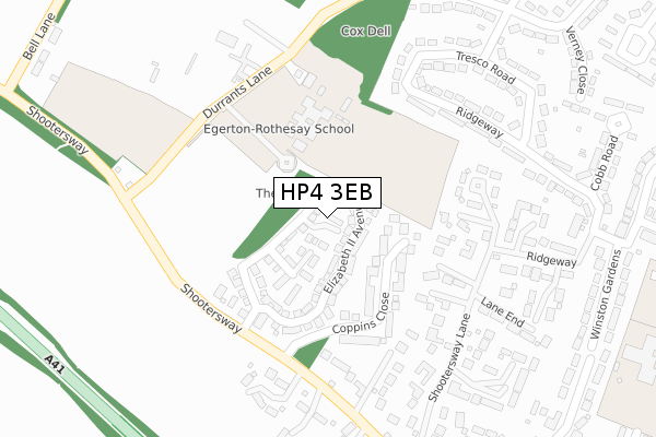
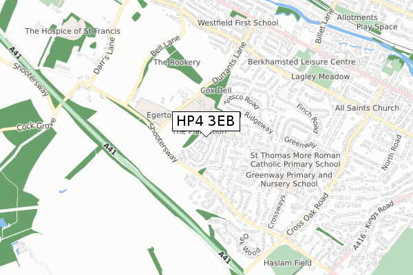
HP4 3EB is located in the Berkhamsted West electoral ward, within the local authority district of Dacorum and the English Parliamentary constituency of South West Hertfordshire. The Sub Integrated Care Board (ICB) Location is NHS Hertfordshire and West Essex ICB - 06N and the police force is Hertfordshire. This postcode has been in use since April 2018.


GetTheData
Source: OS Open Zoomstack (Ordnance Survey)
Licence: Open Government Licence (requires attribution)
Attribution: Contains OS data © Crown copyright and database right 2025
Source: Open Postcode Geo
Licence: Open Government Licence (requires attribution)
Attribution: Contains OS data © Crown copyright and database right 2025; Contains Royal Mail data © Royal Mail copyright and database right 2025; Source: Office for National Statistics licensed under the Open Government Licence v.3.0
| Easting | 497526 |
| Northing | 207794 |
| Latitude | 51.760356 |
| Longitude | -0.588304 |
GetTheData
Source: Open Postcode Geo
Licence: Open Government Licence
| Country | England |
| Postcode District | HP4 |
➜ See where HP4 is on a map ➜ Where is Berkhamsted? | |
GetTheData
Source: Land Registry Price Paid Data
Licence: Open Government Licence
| Ward | Berkhamsted West |
| Constituency | South West Hertfordshire |
GetTheData
Source: ONS Postcode Database
Licence: Open Government Licence
2022 17 NOV £615,000 |
2019 22 NOV £585,000 |
2018 15 JUN £525,000 |
2018 13 APR £590,000 |
7, CHARLOTTE CLOSE, BERKHAMSTED, HP4 3EB 2018 3 APR £580,000 |
GetTheData
Source: HM Land Registry Price Paid Data
Licence: Contains HM Land Registry data © Crown copyright and database right 2025. This data is licensed under the Open Government Licence v3.0.
| Ridgeway | Shootersway | 332m |
| Marlin Close (Bourne Road) | Shootersway | 354m |
| Ridgeway | Shootersway | 412m |
| Orchard Avenue | Shootersway | 474m |
| Marlin Close (Bourne Road) | Shootersway | 514m |
| Berkhamsted Station | 1.8km |
| Tring Station | 5.1km |
GetTheData
Source: NaPTAN
Licence: Open Government Licence
| Percentage of properties with Next Generation Access | 100.0% |
| Percentage of properties with Superfast Broadband | 100.0% |
| Percentage of properties with Ultrafast Broadband | 100.0% |
| Percentage of properties with Full Fibre Broadband | 0.0% |
Superfast Broadband is between 30Mbps and 300Mbps
Ultrafast Broadband is > 300Mbps
| Median download speed | 18.1Mbps |
| Average download speed | 17.0Mbps |
| Maximum download speed | 29.30Mbps |
| Median upload speed | 5.9Mbps |
| Average upload speed | 4.8Mbps |
| Maximum upload speed | 7.72Mbps |
| Percentage of properties unable to receive 2Mbps | 0.0% |
| Percentage of properties unable to receive 5Mbps | 0.0% |
| Percentage of properties unable to receive 10Mbps | 0.0% |
| Percentage of properties unable to receive 30Mbps | 0.0% |
GetTheData
Source: Ofcom
Licence: Ofcom Terms of Use (requires attribution)
GetTheData
Source: ONS Postcode Database
Licence: Open Government Licence


➜ Get more ratings from the Food Standards Agency
GetTheData
Source: Food Standards Agency
Licence: FSA terms & conditions
| Last Collection | |||
|---|---|---|---|
| Location | Mon-Fri | Sat | Distance |
| Tresco Road | 17:15 | 10:45 | 342m |
| Durrants Road | 17:15 | 10:45 | 573m |
| Westfield Road | 17:15 | 11:00 | 664m |
GetTheData
Source: Dracos
Licence: Creative Commons Attribution-ShareAlike
The below table lists the International Territorial Level (ITL) codes (formerly Nomenclature of Territorial Units for Statistics (NUTS) codes) and Local Administrative Units (LAU) codes for HP4 3EB:
| ITL 1 Code | Name |
|---|---|
| TLH | East |
| ITL 2 Code | Name |
| TLH2 | Bedfordshire and Hertfordshire |
| ITL 3 Code | Name |
| TLH23 | Hertfordshire CC |
| LAU 1 Code | Name |
| E07000096 | Dacorum |
GetTheData
Source: ONS Postcode Directory
Licence: Open Government Licence
The below table lists the Census Output Area (OA), Lower Layer Super Output Area (LSOA), and Middle Layer Super Output Area (MSOA) for HP4 3EB:
| Code | Name | |
|---|---|---|
| OA | E00118727 | |
| LSOA | E01023371 | Dacorum 012C |
| MSOA | E02004867 | Dacorum 012 |
GetTheData
Source: ONS Postcode Directory
Licence: Open Government Licence
| HP4 3NZ | Coppins Close | 146m |
| HP4 3NR | Chalet Close | 220m |
| HP4 3NN | Shootersway | 245m |
| HP4 3LD | Ridgeway | 248m |
| HP4 3NT | Crossfields Close | 250m |
| HP4 3LA | Tresco Road | 279m |
| HP4 3NP | Shootersway Lane | 280m |
| HP4 3TR | Woodcock Hill | 285m |
| HP4 3NU | Torwood Close | 287m |
| HP4 3AR | Blegberry Gardens | 295m |
GetTheData
Source: Open Postcode Geo; Land Registry Price Paid Data
Licence: Open Government Licence