HP3 8DB maps, stats, and open data
- Home
- Postcode
- HP
- HP3
- HP3 8
HP3 8DB is located in the Nash Mills electoral ward, within the local authority district of Dacorum and the English Parliamentary constituency of Hemel Hempstead. The Sub Integrated Care Board (ICB) Location is NHS Hertfordshire and West Essex ICB - 06N and the police force is Hertfordshire. This postcode has been in use since May 2018.
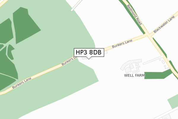
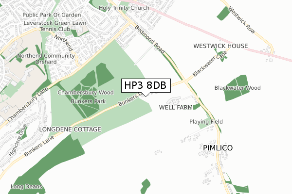
HP3 8DB maps


Source: OS Open Zoomstack (Ordnance Survey)
Licence: Open Government Licence (requires attribution)
Attribution: Contains OS data © Crown copyright and database right 2025
Source: Open Postcode GeoLicence: Open Government Licence (requires attribution)
Attribution: Contains OS data © Crown copyright and database right 2025; Contains Royal Mail data © Royal Mail copyright and database right 2025; Source: Office for National Statistics licensed under the Open Government Licence v.3.0
HP3 8DB geodata
| Easting | 508723 |
| Northing | 205733 |
| Latitude | 51.739772 |
| Longitude | -0.426777 |
Where is HP3 8DB?
| Country | England |
| Postcode District | HP3 |
Politics
| Ward | Nash Mills |
|---|
| Constituency | Hemel Hempstead |
|---|
Transport
Nearest bus stops to HP3 8DB
| Bunkers Lane (Bedmond Road) | Pimlico | 336m |
| Bunkers Lane (Bedmond Road) | Pimlico | 373m |
| Chambersbury Lane (Bedmond Road) | Leverstock Green | 584m |
| Chambersbury Lane (Bedmond Road) | Leverstock Green | 598m |
| Greenacres (Hemel Hempstead Road) | Leverstock Green | 712m |
Nearest railway stations to HP3 8DB
| Apsley Station | 2.6km |
| Kings Langley Station | 3.8km |
| Hemel Hempstead Station | 4.4km |
Broadband
Broadband access in HP3 8DB (2020 data)
| Percentage of properties with Next Generation Access | 100.0% |
| Percentage of properties with Superfast Broadband | 0.0% |
| Percentage of properties with Ultrafast Broadband | 0.0% |
| Percentage of properties with Full Fibre Broadband | 0.0% |
Superfast Broadband is between 30Mbps and 300Mbps
Ultrafast Broadband is > 300Mbps
Broadband limitations in HP3 8DB (2020 data)
| Percentage of properties unable to receive 2Mbps | 0.0% |
| Percentage of properties unable to receive 5Mbps | 0.0% |
| Percentage of properties unable to receive 10Mbps | 0.0% |
| Percentage of properties unable to receive 30Mbps | 100.0% |
Deprivation
27.1% of English postcodes are less deprived than
HP3 8DB:
Food Standards Agency
Three nearest food hygiene ratings to HP3 8DB (metres)
Sibleys Orchard
Leverstock Green Cricket Club
Leverstock Cricket Club
719m
Woodfield School
➜ Get more ratings from the Food Standards Agency
Nearest post box to HP3 8DB
| | Last Collection | |
|---|
| Location | Mon-Fri | Sat | Distance |
|---|
| Greenacres | 18:30 | 12:00 | 728m |
| Horseshoes | 17:15 | 12:00 | 744m |
| Pimlico Village | 17:00 | 08:00 | 873m |
HP3 8DB ITL and HP3 8DB LAU
The below table lists the International Territorial Level (ITL) codes (formerly Nomenclature of Territorial Units for Statistics (NUTS) codes) and Local Administrative Units (LAU) codes for HP3 8DB:
| ITL 1 Code | Name |
|---|
| TLH | East |
| ITL 2 Code | Name |
|---|
| TLH2 | Bedfordshire and Hertfordshire |
| ITL 3 Code | Name |
|---|
| TLH23 | Hertfordshire CC |
| LAU 1 Code | Name |
|---|
| E07000096 | Dacorum |
HP3 8DB census areas
The below table lists the Census Output Area (OA), Lower Layer Super Output Area (LSOA), and Middle Layer Super Output Area (MSOA) for HP3 8DB:
| Code | Name |
|---|
| OA | E00118943 | |
|---|
| LSOA | E01023415 | Dacorum 020F |
|---|
| MSOA | E02004875 | Dacorum 020 |
|---|
Nearest postcodes to HP3 8DB


