HP23 5FW maps, stats, and open data
- Home
- Postcode
- HP
- HP23
- HP23 5
HP23 5FW is located in the Aldbury and Wigginton electoral ward, within the local authority district of Dacorum and the English Parliamentary constituency of South West Hertfordshire. The Sub Integrated Care Board (ICB) Location is NHS Hertfordshire and West Essex ICB - 06N and the police force is Hertfordshire. This postcode has been in use since July 2019.
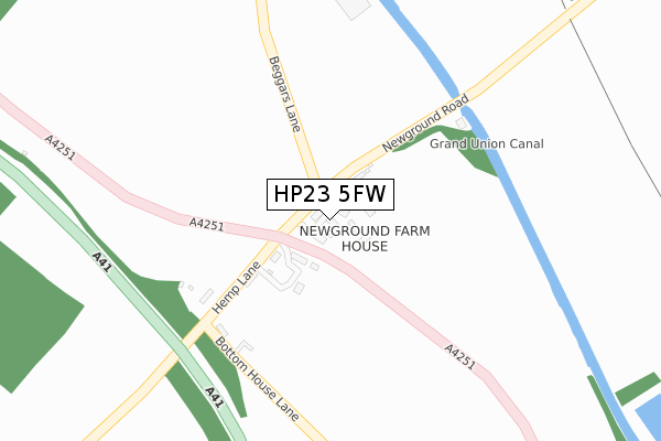
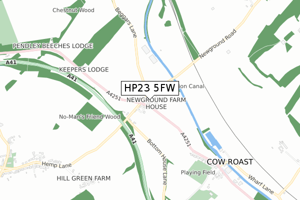
HP23 5FW maps


Source: OS Open Zoomstack (Ordnance Survey)
Licence: Open Government Licence (requires attribution)
Attribution: Contains OS data © Crown copyright and database right 2025
Source: Open Postcode GeoLicence: Open Government Licence (requires attribution)
Attribution: Contains OS data © Crown copyright and database right 2025; Contains Royal Mail data © Royal Mail copyright and database right 2025; Source: Office for National Statistics licensed under the Open Government Licence v.3.0
HP23 5FW geodata
| Easting | 495218 |
| Northing | 210843 |
| Latitude | 51.788159 |
| Longitude | -0.620899 |
Where is HP23 5FW?
| Country | England |
| Postcode District | HP23 |
Politics
| Ward | Aldbury And Wigginton |
|---|
| Constituency | South West Hertfordshire |
|---|
Transport
Nearest bus stops to HP23 5FW
| Newground Road (A4251) | Wigginton | 50m |
| Newground Road (A4251) | Wigginton | 56m |
| Keepers Lodge (A4251) | Wigginton | 443m |
| Keepers Lodge (A4251) | Wigginton | 576m |
| The Cow Roast Inn (Tring Road) | Cow Roast | 741m |
Nearest railway stations to HP23 5FW
| Tring Station | 1.4km |
| Berkhamsted Station | 4.9km |
Broadband
Broadband access in HP23 5FW (2020 data)
| Percentage of properties with Next Generation Access | 100.0% |
| Percentage of properties with Superfast Broadband | 100.0% |
| Percentage of properties with Ultrafast Broadband | 100.0% |
| Percentage of properties with Full Fibre Broadband | 100.0% |
Superfast Broadband is between 30Mbps and 300Mbps
Ultrafast Broadband is > 300Mbps
Broadband limitations in HP23 5FW (2020 data)
| Percentage of properties unable to receive 2Mbps | 0.0% |
| Percentage of properties unable to receive 5Mbps | 0.0% |
| Percentage of properties unable to receive 10Mbps | 0.0% |
| Percentage of properties unable to receive 30Mbps | 0.0% |
Deprivation
14.5% of English postcodes are less deprived than
HP23 5FW:
Food Standards Agency
Three nearest food hygiene ratings to HP23 5FW (metres)
Berkhamsted & Hemel Hempstead Sports & Hockey Club
Berkhamsted Hockey Club
654m
Londis Esso ST Filling Ltd
Northchurch Service Station
993m
Planet Coffee
Coffee Kiosk Tring Railway Station
1,389m
➜ Get more ratings from the Food Standards Agency
Nearest post box to HP23 5FW
| | Last Collection | |
|---|
| Location | Mon-Fri | Sat | Distance |
|---|
| New Ground | 16:00 | 07:00 | 43m |
| Cow Roast | 16:00 | 07:00 | 678m |
| Tring Station | 17:00 | 09:15 | 1,395m |
HP23 5FW ITL and HP23 5FW LAU
The below table lists the International Territorial Level (ITL) codes (formerly Nomenclature of Territorial Units for Statistics (NUTS) codes) and Local Administrative Units (LAU) codes for HP23 5FW:
| ITL 1 Code | Name |
|---|
| TLH | East |
| ITL 2 Code | Name |
|---|
| TLH2 | Bedfordshire and Hertfordshire |
| ITL 3 Code | Name |
|---|
| TLH23 | Hertfordshire CC |
| LAU 1 Code | Name |
|---|
| E07000096 | Dacorum |
HP23 5FW census areas
The below table lists the Census Output Area (OA), Lower Layer Super Output Area (LSOA), and Middle Layer Super Output Area (MSOA) for HP23 5FW:
| Code | Name |
|---|
| OA | E00118644 | |
|---|
| LSOA | E01023352 | Dacorum 004A |
|---|
| MSOA | E02004859 | Dacorum 004 |
|---|
Nearest postcodes to HP23 5FW


