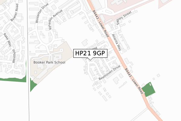
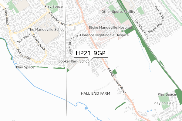
HP21 9GP is located in the Wendover, Halton and Stoke Mandeville electoral ward, within the unitary authority of Buckinghamshire and the English Parliamentary constituency of Aylesbury. The Sub Integrated Care Board (ICB) Location is NHS Buckinghamshire, Oxfordshire and Berkshire West ICB - 14Y and the police force is Thames Valley. This postcode has been in use since July 2018.


GetTheData
Source: OS Open Zoomstack (Ordnance Survey)
Licence: Open Government Licence (requires attribution)
Attribution: Contains OS data © Crown copyright and database right 2025
Source: Open Postcode Geo
Licence: Open Government Licence (requires attribution)
Attribution: Contains OS data © Crown copyright and database right 2025; Contains Royal Mail data © Royal Mail copyright and database right 2025; Source: Office for National Statistics licensed under the Open Government Licence v.3.0
| Easting | 482502 |
| Northing | 211286 |
| Latitude | 51.794157 |
| Longitude | -0.805106 |
GetTheData
Source: Open Postcode Geo
Licence: Open Government Licence
| Country | England |
| Postcode District | HP21 |
➜ See where HP21 is on a map ➜ Where is Aylesbury? | |
GetTheData
Source: Land Registry Price Paid Data
Licence: Open Government Licence
| Ward | Wendover, Halton And Stoke Mandeville |
| Constituency | Aylesbury |
GetTheData
Source: ONS Postcode Database
Licence: Open Government Licence
2025 6 MAR £450,000 |
2023 9 AUG £500,000 |
2023 7 AUG £725,000 |
2022 17 JUN £585,000 |
2021 7 SEP £360,500 |
74, LENNON WAY, AYLESBURY, HP21 9GP 2021 23 FEB £460,000 |
51, LENNON WAY, AYLESBURY, HP21 9GP 2020 24 FEB £485,000 |
49, LENNON WAY, AYLESBURY, HP21 9GP 2019 20 DEC £500,000 |
2, LENNON WAY, AYLESBURY, HP21 9GP 2019 20 DEC £380,000 |
70, LENNON WAY, AYLESBURY, HP21 9GP 2019 28 NOV £495,000 |
GetTheData
Source: HM Land Registry Price Paid Data
Licence: Contains HM Land Registry data © Crown copyright and database right 2025. This data is licensed under the Open Government Licence v3.0.
| Ambulance Station (Mandeville Road) | Aylesbury | 176m |
| Ambulance Station (Mandeville Road) | Aylesbury | 213m |
| Ranch House (Lower Road) | Stoke Mandeville | 256m |
| Kynaston Avenue | Aylesbury | 279m |
| Ambulance Station Roundabout (Service Road) | Aylesbury | 305m |
| Stoke Mandeville Station | 1.6km |
| Aylesbury Station | 2.3km |
| Little Kimble Station | 4.7km |
GetTheData
Source: NaPTAN
Licence: Open Government Licence
| Percentage of properties with Next Generation Access | 100.0% |
| Percentage of properties with Superfast Broadband | 100.0% |
| Percentage of properties with Ultrafast Broadband | 100.0% |
| Percentage of properties with Full Fibre Broadband | 100.0% |
Superfast Broadband is between 30Mbps and 300Mbps
Ultrafast Broadband is > 300Mbps
| Percentage of properties unable to receive 2Mbps | 0.0% |
| Percentage of properties unable to receive 5Mbps | 0.0% |
| Percentage of properties unable to receive 10Mbps | 0.0% |
| Percentage of properties unable to receive 30Mbps | 0.0% |
GetTheData
Source: Ofcom
Licence: Ofcom Terms of Use (requires attribution)
GetTheData
Source: ONS Postcode Database
Licence: Open Government Licence


➜ Get more ratings from the Food Standards Agency
GetTheData
Source: Food Standards Agency
Licence: FSA terms & conditions
| Last Collection | |||
|---|---|---|---|
| Location | Mon-Fri | Sat | Distance |
| Kynaston Ave | 17:15 | 12:00 | 391m |
| Richards Close | 17:00 | 12:00 | 683m |
| Manderville Road | 17:15 | 12:00 | 724m |
GetTheData
Source: Dracos
Licence: Creative Commons Attribution-ShareAlike
The below table lists the International Territorial Level (ITL) codes (formerly Nomenclature of Territorial Units for Statistics (NUTS) codes) and Local Administrative Units (LAU) codes for HP21 9GP:
| ITL 1 Code | Name |
|---|---|
| TLJ | South East (England) |
| ITL 2 Code | Name |
| TLJ1 | Berkshire, Buckinghamshire and Oxfordshire |
| ITL 3 Code | Name |
| TLJ13 | Buckinghamshire |
| LAU 1 Code | Name |
| E06000060 | Buckinghamshire |
GetTheData
Source: ONS Postcode Directory
Licence: Open Government Licence
The below table lists the Census Output Area (OA), Lower Layer Super Output Area (LSOA), and Middle Layer Super Output Area (MSOA) for HP21 9GP:
| Code | Name | |
|---|---|---|
| OA | E00088990 | |
| LSOA | E01017631 | Aylesbury Vale 021E |
| MSOA | E02003672 | Aylesbury Vale 021 |
GetTheData
Source: ONS Postcode Directory
Licence: Open Government Licence
| HP21 9DR | Lower Road | 190m |
| HP21 9DZ | Bradenham Walk | 212m |
| HP21 9EF | Claydon Path | 254m |
| HP21 9DT | Roblin Close | 298m |
| HP21 9DS | Kynaston Avenue | 302m |
| HP21 9EE | Mentmore Green | 324m |
| HP21 9EG | Wotton Path | 345m |
| HP21 9EQ | Chequers Court | 347m |
| HP21 9EA | Stoke Farm Lane | 370m |
| HP21 9BD | Winterton Drive | 381m |
GetTheData
Source: Open Postcode Geo; Land Registry Price Paid Data
Licence: Open Government Licence