HP2 7BX maps, stats, and open data
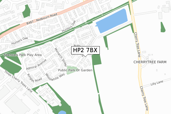
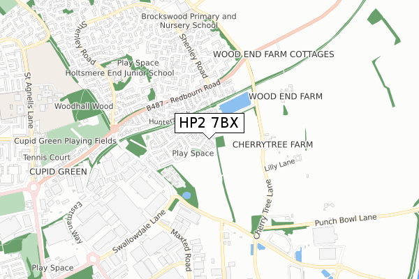
HP2 7BX is located in the Woodhall Farm electoral ward, within the local authority district of Dacorum and the English Parliamentary constituency of Hemel Hempstead. The Sub Integrated Care Board (ICB) Location is NHS Hertfordshire and West Essex ICB - 06N and the police force is Hertfordshire. This postcode has been in use since January 2018.
HP2 7BX maps


Licence: Open Government Licence (requires attribution)
Attribution: Contains OS data © Crown copyright and database right 2025
Source: Open Postcode Geo
Licence: Open Government Licence (requires attribution)
Attribution: Contains OS data © Crown copyright and database right 2025; Contains Royal Mail data © Royal Mail copyright and database right 2025; Source: Office for National Statistics licensed under the Open Government Licence v.3.0
HP2 7BX geodata
| Easting | 508170 |
| Northing | 209439 |
| Latitude | 51.773188 |
| Longitude | -0.433630 |
Where is HP2 7BX?
| Country | England |
| Postcode District | HP2 |
Politics
| Ward | Woodhall Farm |
|---|---|
| Constituency | Hemel Hempstead |
House Prices
Sales of detached houses in HP2 7BX
2020 5 JUN £440,000 |
2020 31 MAR £420,000 |
37, BURGUNDY DRIVE, HEMEL HEMPSTEAD, HP2 7BX 2018 29 JUN £534,950 |
53, BURGUNDY DRIVE, HEMEL HEMPSTEAD, HP2 7BX 2018 29 MAR £449,950 |
47, BURGUNDY DRIVE, HEMEL HEMPSTEAD, HP2 7BX 2018 29 MAR £449,950 |
45, BURGUNDY DRIVE, HEMEL HEMPSTEAD, HP2 7BX 2018 29 MAR £589,950 |
51, BURGUNDY DRIVE, HEMEL HEMPSTEAD, HP2 7BX 2018 29 MAR £449,950 |
2018 16 MAR £389,950 |
73, BURGUNDY DRIVE, HEMEL HEMPSTEAD, HP2 7BX 2018 26 FEB £449,950 |
23, BURGUNDY DRIVE, HEMEL HEMPSTEAD, HP2 7BX 2018 26 JAN £389,950 |
➜ Hemel Hempstead house prices
Licence: Contains HM Land Registry data © Crown copyright and database right 2025. This data is licensed under the Open Government Licence v3.0.
Transport
Nearest bus stops to HP2 7BX
| Half Moon Meadow (Redbourn Road) | Cupid Green | 287m |
| Half Moon Meadow (Redbourn Road) | Cupid Green | 330m |
| Steria (Three Cherrytrees Lane) | Maylands Business Park | 421m |
| Cuffley Court (Shenley Road) | Cupid Green | 466m |
| Cuffley Court (Shenley Road) | Cupid Green | 485m |
Nearest railway stations to HP2 7BX
| Apsley Station | 5km |
| Hemel Hempstead Station | 5.2km |
Broadband
Broadband access in HP2 7BX (2020 data)
| Percentage of properties with Next Generation Access | 97.5% |
| Percentage of properties with Superfast Broadband | 97.5% |
| Percentage of properties with Ultrafast Broadband | 97.5% |
| Percentage of properties with Full Fibre Broadband | 0.0% |
Superfast Broadband is between 30Mbps and 300Mbps
Ultrafast Broadband is > 300Mbps
Broadband speed in HP2 7BX (2019 data)
Download
| Median download speed | 100.0Mbps |
| Average download speed | 126.5Mbps |
| Maximum download speed | 350.00Mbps |
Upload
| Median upload speed | 0.8Mbps |
| Average upload speed | 0.7Mbps |
| Maximum upload speed | 0.78Mbps |
Broadband limitations in HP2 7BX (2020 data)
| Percentage of properties unable to receive 2Mbps | 0.0% |
| Percentage of properties unable to receive 5Mbps | 2.5% |
| Percentage of properties unable to receive 10Mbps | 2.5% |
| Percentage of properties unable to receive 30Mbps | 2.5% |
Deprivation
65.2% of English postcodes are less deprived than HP2 7BX:Food Standards Agency
Three nearest food hygiene ratings to HP2 7BX (metres)


➜ Get more ratings from the Food Standards Agency
Nearest post box to HP2 7BX
| Last Collection | |||
|---|---|---|---|
| Location | Mon-Fri | Sat | Distance |
| Maylands Avenue | 18:30 | 594m | |
| Redbourne Road | 17:15 | 12:00 | 733m |
| Woodhall Farm P.o. | 17:15 | 12:00 | 819m |
HP2 7BX ITL and HP2 7BX LAU
The below table lists the International Territorial Level (ITL) codes (formerly Nomenclature of Territorial Units for Statistics (NUTS) codes) and Local Administrative Units (LAU) codes for HP2 7BX:
| ITL 1 Code | Name |
|---|---|
| TLH | East |
| ITL 2 Code | Name |
| TLH2 | Bedfordshire and Hertfordshire |
| ITL 3 Code | Name |
| TLH23 | Hertfordshire CC |
| LAU 1 Code | Name |
| E07000096 | Dacorum |
HP2 7BX census areas
The below table lists the Census Output Area (OA), Lower Layer Super Output Area (LSOA), and Middle Layer Super Output Area (MSOA) for HP2 7BX:
| Code | Name | |
|---|---|---|
| OA | E00118609 | |
| LSOA | E01023346 | Dacorum 013B |
| MSOA | E02004868 | Dacorum 013 |
Nearest postcodes to HP2 7BX
| HP2 7SZ | Hunters Oak | 214m |
| HP2 7SD | Half Moon Meadow | 248m |
| HP2 7SB | Lower Emms | 250m |
| HP2 7SX | Hunters Oak | 260m |
| HP2 7SY | Hunters Oak | 266m |
| HP2 7SA | Birch Leys | 267m |
| HP2 7RL | Brockswood Drive | 293m |
| HP2 7SG | Crackley Meadow | 298m |
| HP2 7SQ | Crackley Meadow | 323m |
| HP2 7LQ | Cleves Road | 333m |