HP2 4BF maps, stats, and open data
- Home
- Postcode
- HP
- HP2
- HP2 4
HP2 4BF is located in the Adeyfield East electoral ward, within the local authority district of Dacorum and the English Parliamentary constituency of Hemel Hempstead. The Sub Integrated Care Board (ICB) Location is NHS Hertfordshire and West Essex ICB - 06N and the police force is Hertfordshire. This postcode has been in use since January 2019.
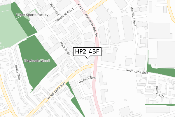
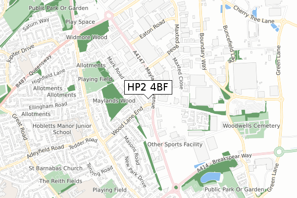
HP2 4BF maps


Source: OS Open Zoomstack (Ordnance Survey)
Licence: Open Government Licence (requires attribution)
Attribution: Contains OS data © Crown copyright and database right 2025
Source: Open Postcode GeoLicence: Open Government Licence (requires attribution)
Attribution: Contains OS data © Crown copyright and database right 2025; Contains Royal Mail data © Royal Mail copyright and database right 2025; Source: Office for National Statistics licensed under the Open Government Licence v.3.0
HP2 4BF geodata
| Easting | 507809 |
| Northing | 208022 |
| Latitude | 51.760522 |
| Longitude | -0.439299 |
Where is HP2 4BF?
| Country | England |
| Postcode District | HP2 |
Politics
| Ward | Adeyfield East |
|---|
| Constituency | Hemel Hempstead |
|---|
Transport
Nearest bus stops to HP2 4BF
| Maylands Avenue (Wood Lane End) | Maylands Business Park | 50m |
| Wood Lane End North (Maylands Avenue) | Maylands Business Park | 62m |
| Wood Lane End South (Maylands Avenue) | Maylands Business Park | 96m |
| Wood Lane End South (Maylands Avenue) | Maylands Business Park | 101m |
| Cleveland Road (Maylands Avenue) | Maylands Business Park | 344m |
Nearest railway stations to HP2 4BF
| Apsley Station | 3.5km |
| Hemel Hempstead Station | 4.1km |
Broadband
Broadband access in HP2 4BF (2020 data)
| Percentage of properties with Next Generation Access | 100.0% |
| Percentage of properties with Superfast Broadband | 100.0% |
| Percentage of properties with Ultrafast Broadband | 100.0% |
| Percentage of properties with Full Fibre Broadband | 100.0% |
Superfast Broadband is between 30Mbps and 300Mbps
Ultrafast Broadband is > 300Mbps
Broadband limitations in HP2 4BF (2020 data)
| Percentage of properties unable to receive 2Mbps | 0.0% |
| Percentage of properties unable to receive 5Mbps | 0.0% |
| Percentage of properties unable to receive 10Mbps | 0.0% |
| Percentage of properties unable to receive 30Mbps | 0.0% |
Deprivation
65.2% of English postcodes are less deprived than
HP2 4BF:
Food Standards Agency
Three nearest food hygiene ratings to HP2 4BF (metres)
Windmill Sandwich Bar
One Stop Stores Ltd
Vapemans
➜ Get more ratings from the Food Standards Agency
Nearest post box to HP2 4BF
| | Last Collection | |
|---|
| Location | Mon-Fri | Sat | Distance |
|---|
| Maylands Avenue | 17:30 | 12:00 | 45m |
| Cleveland Road | 17:30 | 12:00 | 276m |
| Cleveland Road | 18:30 | | 294m |
HP2 4BF ITL and HP2 4BF LAU
The below table lists the International Territorial Level (ITL) codes (formerly Nomenclature of Territorial Units for Statistics (NUTS) codes) and Local Administrative Units (LAU) codes for HP2 4BF:
| ITL 1 Code | Name |
|---|
| TLH | East |
| ITL 2 Code | Name |
|---|
| TLH2 | Bedfordshire and Hertfordshire |
| ITL 3 Code | Name |
|---|
| TLH23 | Hertfordshire CC |
| LAU 1 Code | Name |
|---|
| E07000096 | Dacorum |
HP2 4BF census areas
The below table lists the Census Output Area (OA), Lower Layer Super Output Area (LSOA), and Middle Layer Super Output Area (MSOA) for HP2 4BF:
| Code | Name |
|---|
| OA | E00118612 | |
|---|
| LSOA | E01023346 | Dacorum 013B |
|---|
| MSOA | E02004868 | Dacorum 013 |
|---|
Nearest postcodes to HP2 4BF


