HP16 9EQ maps, stats, and open data
HP16 9EQ is located in the Ridgeway East electoral ward, within the unitary authority of Buckinghamshire and the English Parliamentary constituency of Aylesbury. The Sub Integrated Care Board (ICB) Location is NHS Buckinghamshire, Oxfordshire and Berkshire West ICB - 14Y and the police force is Thames Valley. This postcode has been in use since September 2019.
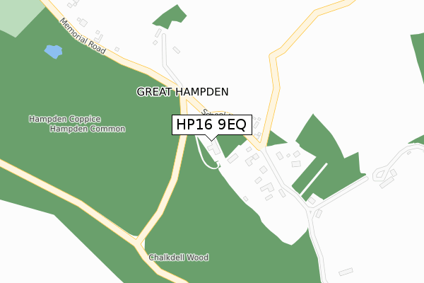
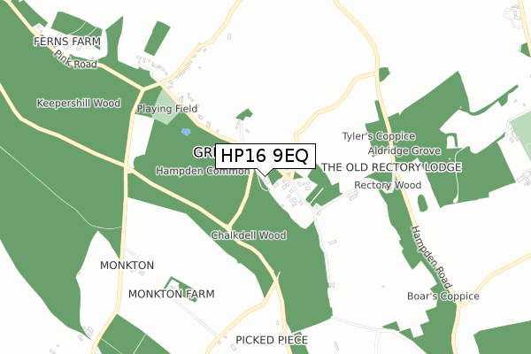
HP16 9EQ maps


Licence: Open Government Licence (requires attribution)
Attribution: Contains OS data © Crown copyright and database right 2025
Source: Open Postcode Geo
Licence: Open Government Licence (requires attribution)
Attribution: Contains OS data © Crown copyright and database right 2025; Contains Royal Mail data © Royal Mail copyright and database right 2025; Source: Office for National Statistics licensed under the Open Government Licence v.3.0
HP16 9EQ geodata
| Easting | 485030 |
| Northing | 201089 |
| Latitude | 51.702116 |
| Longitude | -0.770950 |
Where is HP16 9EQ?
| Country | England |
| Postcode District | HP16 |
Politics
| Ward | Ridgeway East |
|---|---|
| Constituency | Aylesbury |
Transport
Nearest bus stops to HP16 9EQ
| The Hampden Arms Ph (Hampden Road) | Great Hampden | 631m |
| The Hampden Arms Ph (Great Hampden Road) | Great Hampden | 635m |
| Denner Farm (Bryant's Bottom Road) | Bryant's Bottom | 766m |
| Denner Farm (Bryant's Bottom Road) | Bryant's Bottom | 775m |
| Monkton Farm (Hampden Road) | Speen | 848m |
Nearest railway stations to HP16 9EQ
| Great Missenden Station | 4.3km |
| Saunderton Station | 4.8km |
| Monks Risborough Station | 5.5km |
Deprivation
9.1% of English postcodes are less deprived than HP16 9EQ:Food Standards Agency
Three nearest food hygiene ratings to HP16 9EQ (metres)


➜ Get more ratings from the Food Standards Agency
Nearest post box to HP16 9EQ
| Last Collection | |||
|---|---|---|---|
| Location | Mon-Fri | Sat | Distance |
| Hampden Row | 16:50 | 11:15 | 617m |
| Bryants Bottom | 17:00 | 10:45 | 1,413m |
| Speen P.o. | 16:00 | 09:30 | 1,564m |
HP16 9EQ ITL and HP16 9EQ LAU
The below table lists the International Territorial Level (ITL) codes (formerly Nomenclature of Territorial Units for Statistics (NUTS) codes) and Local Administrative Units (LAU) codes for HP16 9EQ:
| ITL 1 Code | Name |
|---|---|
| TLJ | South East (England) |
| ITL 2 Code | Name |
| TLJ1 | Berkshire, Buckinghamshire and Oxfordshire |
| ITL 3 Code | Name |
| TLJ13 | Buckinghamshire |
| LAU 1 Code | Name |
| E06000060 | Buckinghamshire |
HP16 9EQ census areas
The below table lists the Census Output Area (OA), Lower Layer Super Output Area (LSOA), and Middle Layer Super Output Area (MSOA) for HP16 9EQ:
| Code | Name | |
|---|---|---|
| OA | E00090241 | |
| LSOA | E01017888 | Wycombe 002D |
| MSOA | E02003697 | Wycombe 002 |
Nearest postcodes to HP16 9EQ
| HP16 9RJ | Great Hampden | 181m |
| HP16 9RL | Great Hampden | 420m |
| HP16 9RF | Great Hampden | 511m |
| HP16 9RQ | Great Hampden | 629m |
| HP16 9RG | Great Hampden | 821m |
| HP16 0JU | Bryants Bottom | 1177m |
| HP27 0SZ | Coleheath Bottom | 1234m |
| HP16 9RA | Briary Cottages | 1241m |
| HP27 0RX | Cornerways | 1299m |
| HP27 0RY | Woodview Drive | 1312m |