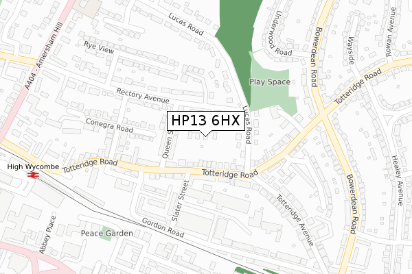
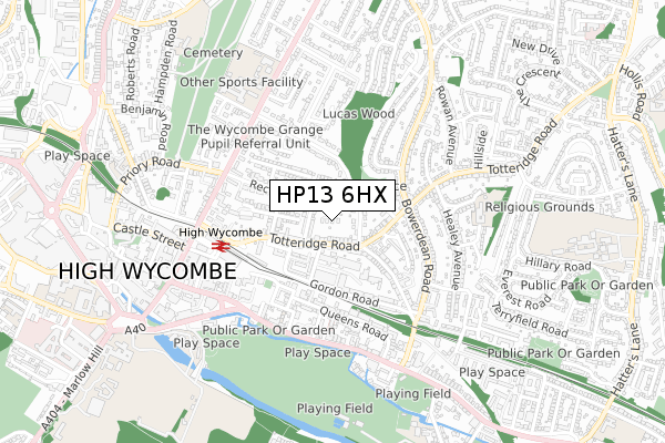
HP13 6HX is located in the Terriers and Amersham Hill electoral ward, within the unitary authority of Buckinghamshire and the English Parliamentary constituency of Wycombe. The Sub Integrated Care Board (ICB) Location is NHS Buckinghamshire, Oxfordshire and Berkshire West ICB - 14Y and the police force is Thames Valley. This postcode has been in use since April 2019.


GetTheData
Source: OS Open Zoomstack (Ordnance Survey)
Licence: Open Government Licence (requires attribution)
Attribution: Contains OS data © Crown copyright and database right 2025
Source: Open Postcode Geo
Licence: Open Government Licence (requires attribution)
Attribution: Contains OS data © Crown copyright and database right 2025; Contains Royal Mail data © Royal Mail copyright and database right 2025; Source: Office for National Statistics licensed under the Open Government Licence v.3.0
| Easting | 487352 |
| Northing | 193142 |
| Latitude | 51.630323 |
| Longitude | -0.739345 |
GetTheData
Source: Open Postcode Geo
Licence: Open Government Licence
| Country | England |
| Postcode District | HP13 |
➜ See where HP13 is on a map ➜ Where is High Wycombe? | |
GetTheData
Source: Land Registry Price Paid Data
Licence: Open Government Licence
| Ward | Terriers And Amersham Hill |
| Constituency | Wycombe |
GetTheData
Source: ONS Postcode Database
Licence: Open Government Licence
2, SOUTH VIEW, HIGH WYCOMBE, HP13 6HX 2021 12 AUG £1,150,000 |
2021 8 JAN £1,100,000 |
3, SOUTH VIEW, HIGH WYCOMBE, HP13 6HX 2021 6 JAN £1,100,000 |
4, SOUTH VIEW, HIGH WYCOMBE, HP13 6HX 2019 13 SEP £1,100,000 |
GetTheData
Source: HM Land Registry Price Paid Data
Licence: Contains HM Land Registry data © Crown copyright and database right 2025. This data is licensed under the Open Government Licence v3.0.
| Lucas Road (Totteridge Road) | High Wycombe | 109m |
| Lucas Road (Totteridge Road) | High Wycombe | 131m |
| Duke Street (Totteridge Road) | High Wycombe | 188m |
| Duke Street (Totteridge Road) | High Wycombe | 224m |
| Bowerdean Crossroads (Totteridge Road) | High Wycombe | 264m |
| High Wycombe Station | 0.4km |
GetTheData
Source: NaPTAN
Licence: Open Government Licence
| Percentage of properties with Next Generation Access | 100.0% |
| Percentage of properties with Superfast Broadband | 100.0% |
| Percentage of properties with Ultrafast Broadband | 0.0% |
| Percentage of properties with Full Fibre Broadband | 0.0% |
Superfast Broadband is between 30Mbps and 300Mbps
Ultrafast Broadband is > 300Mbps
| Percentage of properties unable to receive 2Mbps | 0.0% |
| Percentage of properties unable to receive 5Mbps | 0.0% |
| Percentage of properties unable to receive 10Mbps | 0.0% |
| Percentage of properties unable to receive 30Mbps | 0.0% |
GetTheData
Source: Ofcom
Licence: Ofcom Terms of Use (requires attribution)
GetTheData
Source: ONS Postcode Database
Licence: Open Government Licence


➜ Get more ratings from the Food Standards Agency
GetTheData
Source: Food Standards Agency
Licence: FSA terms & conditions
| Last Collection | |||
|---|---|---|---|
| Location | Mon-Fri | Sat | Distance |
| Hatters Lane | 16:30 | 12:00 | 18m |
| North Town P.o. | 17:00 | 12:00 | 210m |
| Subway | 16:15 | 12:00 | 317m |
GetTheData
Source: Dracos
Licence: Creative Commons Attribution-ShareAlike
The below table lists the International Territorial Level (ITL) codes (formerly Nomenclature of Territorial Units for Statistics (NUTS) codes) and Local Administrative Units (LAU) codes for HP13 6HX:
| ITL 1 Code | Name |
|---|---|
| TLJ | South East (England) |
| ITL 2 Code | Name |
| TLJ1 | Berkshire, Buckinghamshire and Oxfordshire |
| ITL 3 Code | Name |
| TLJ13 | Buckinghamshire |
| LAU 1 Code | Name |
| E06000060 | Buckinghamshire |
GetTheData
Source: ONS Postcode Directory
Licence: Open Government Licence
The below table lists the Census Output Area (OA), Lower Layer Super Output Area (LSOA), and Middle Layer Super Output Area (MSOA) for HP13 6HX:
| Code | Name | |
|---|---|---|
| OA | E00090392 | |
| LSOA | E01017919 | Wycombe 010D |
| MSOA | E02003705 | Wycombe 010 |
GetTheData
Source: ONS Postcode Directory
Licence: Open Government Licence
| HP13 6EY | Totteridge Road | 68m |
| HP13 6HA | West View Cottages | 96m |
| HP13 6EZ | Queen Street | 100m |
| HP13 6EX | Totteridge Road | 104m |
| HP13 6ES | Slater Street | 115m |
| HP13 6HP | Lucas Road | 126m |
| HP13 6HB | Totteridge Road | 129m |
| HP13 6EA | Conegra Road | 158m |
| HP13 6HF | Rectory Close | 166m |
| HP13 6HQ | St Marks Close | 174m |
GetTheData
Source: Open Postcode Geo; Land Registry Price Paid Data
Licence: Open Government Licence