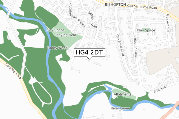
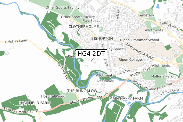
HG4 2DT is located in the Ripon Ure Bank & Spa electoral ward, within the unitary authority of North Yorkshire and the English Parliamentary constituency of Skipton and Ripon. The Sub Integrated Care Board (ICB) Location is NHS Humber and North Yorkshire ICB - 42D and the police force is North Yorkshire. This postcode has been in use since October 2018.


GetTheData
Source: OS Open Zoomstack (Ordnance Survey)
Licence: Open Government Licence (requires attribution)
Attribution: Contains OS data © Crown copyright and database right 2025
Source: Open Postcode Geo
Licence: Open Government Licence (requires attribution)
Attribution: Contains OS data © Crown copyright and database right 2025; Contains Royal Mail data © Royal Mail copyright and database right 2025; Source: Office for National Statistics licensed under the Open Government Licence v.3.0
| Easting | 429649 |
| Northing | 471247 |
| Latitude | 54.136230 |
| Longitude | -1.547717 |
GetTheData
Source: Open Postcode Geo
Licence: Open Government Licence
| Country | England |
| Postcode District | HG4 |
➜ See where HG4 is on a map ➜ Where is Ripon? | |
GetTheData
Source: Land Registry Price Paid Data
Licence: Open Government Licence
| Ward | Ripon Ure Bank & Spa |
| Constituency | Skipton And Ripon |
GetTheData
Source: ONS Postcode Database
Licence: Open Government Licence
44, BISHOPTON PLACE, RIPON, HG4 2DT 2024 15 OCT £640,000 |
2, BISHOPTON PLACE, RIPON, HG4 2DT 2024 15 JAN £612,995 |
3, BISHOPTON PLACE, RIPON, HG4 2DT 2024 8 JAN £649,995 |
5, BISHOPTON PLACE, RIPON, HG4 2DT 2023 31 OCT £593,995 |
4, BISHOPTON PLACE, RIPON, HG4 2DT 2023 23 OCT £603,995 |
42, BISHOPTON PLACE, RIPON, HG4 2DT 2023 6 OCT £643,995 |
6, BISHOPTON PLACE, RIPON, HG4 2DT 2023 27 SEP £640,000 |
43, BISHOPTON PLACE, RIPON, HG4 2DT 2023 19 SEP £641,995 |
41, BISHOPTON PLACE, RIPON, HG4 2DT 2023 25 AUG £638,995 |
36, BISHOPTON PLACE, RIPON, HG4 2DT 2023 25 AUG £633,995 |
GetTheData
Source: HM Land Registry Price Paid Data
Licence: Contains HM Land Registry data © Crown copyright and database right 2025. This data is licensed under the Open Government Licence v3.0.
| Lark Lane (Clotherholme Road) | Bishopton | 472m |
| River Laver Caravan Park (Studley Road) | Bishopton | 484m |
| Ripon School (Clotherholme Road) | Bishopton | 615m |
| Ripon Schools (Clotherholme Road) | Bishopton | 621m |
| Lark Lane (Little Harries Lane) | Bishopton | 898m |
GetTheData
Source: NaPTAN
Licence: Open Government Licence
| Percentage of properties with Next Generation Access | 100.0% |
| Percentage of properties with Superfast Broadband | 100.0% |
| Percentage of properties with Ultrafast Broadband | 75.0% |
| Percentage of properties with Full Fibre Broadband | 75.0% |
Superfast Broadband is between 30Mbps and 300Mbps
Ultrafast Broadband is > 300Mbps
| Percentage of properties unable to receive 2Mbps | 0.0% |
| Percentage of properties unable to receive 5Mbps | 0.0% |
| Percentage of properties unable to receive 10Mbps | 0.0% |
| Percentage of properties unable to receive 30Mbps | 0.0% |
GetTheData
Source: Ofcom
Licence: Ofcom Terms of Use (requires attribution)
GetTheData
Source: ONS Postcode Database
Licence: Open Government Licence


➜ Get more ratings from the Food Standards Agency
GetTheData
Source: Food Standards Agency
Licence: FSA terms & conditions
| Last Collection | |||
|---|---|---|---|
| Location | Mon-Fri | Sat | Distance |
| Lark Lane P.o. | 17:30 | 12:15 | 481m |
| Bondgate P.o. | 18:15 | 12:00 | 1,868m |
| Studley Royal | 16:00 | 10:15 | 2,130m |
GetTheData
Source: Dracos
Licence: Creative Commons Attribution-ShareAlike
The below table lists the International Territorial Level (ITL) codes (formerly Nomenclature of Territorial Units for Statistics (NUTS) codes) and Local Administrative Units (LAU) codes for HG4 2DT:
| ITL 1 Code | Name |
|---|---|
| TLE | Yorkshire and The Humber |
| ITL 2 Code | Name |
| TLE2 | North Yorkshire |
| ITL 3 Code | Name |
| TLE22 | North Yorkshire CC |
| LAU 1 Code | Name |
| E07000165 | Harrogate |
GetTheData
Source: ONS Postcode Directory
Licence: Open Government Licence
The below table lists the Census Output Area (OA), Lower Layer Super Output Area (LSOA), and Middle Layer Super Output Area (MSOA) for HG4 2DT:
| Code | Name | |
|---|---|---|
| OA | E00141141 | |
| LSOA | E01027712 | Harrogate 002A |
| MSOA | E02005762 | Harrogate 002 |
GetTheData
Source: ONS Postcode Directory
Licence: Open Government Licence
| HG4 2EJ | Ash Bank Avenue | 185m |
| HG4 2EL | Ash Bank Road | 185m |
| HG4 2TY | Bellman Walk | 187m |
| HG4 2QP | Ash Bank Road | 227m |
| HG4 2TX | Doublegates Walk | 233m |
| HG4 2TP | Doublegates Avenue | 253m |
| HG4 2TZ | Cornbell Gate | 256m |
| HG4 2EH | Ash Bank Close | 265m |
| HG4 2QN | Bishopton Lane | 271m |
| HG4 2TU | Doublegates Close | 280m |
GetTheData
Source: Open Postcode Geo; Land Registry Price Paid Data
Licence: Open Government Licence