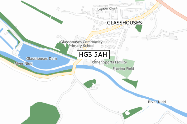
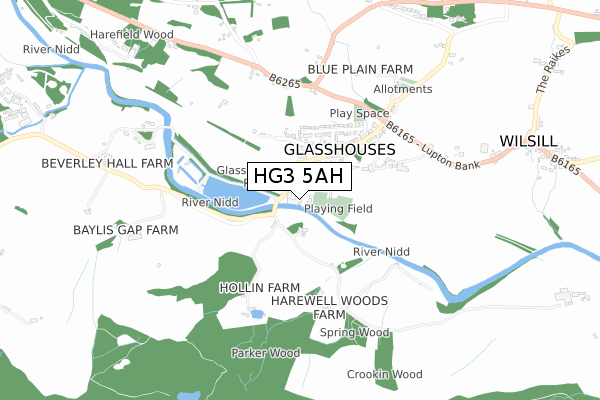
HG3 5AH is located in the Pateley Bridge & Nidderdale electoral ward, within the unitary authority of North Yorkshire and the English Parliamentary constituency of Skipton and Ripon. The Sub Integrated Care Board (ICB) Location is NHS Humber and North Yorkshire ICB - 42D and the police force is North Yorkshire. This postcode has been in use since November 2022.


GetTheData
Source: OS Open Zoomstack (Ordnance Survey)
Licence: Open Government Licence (requires attribution)
Attribution: Contains OS data © Crown copyright and database right 2025
Source: Open Postcode Geo
Licence: Open Government Licence (requires attribution)
Attribution: Contains OS data © Crown copyright and database right 2025; Contains Royal Mail data © Royal Mail copyright and database right 2025; Source: Office for National Statistics licensed under the Open Government Licence v.3.0
| Easting | 417213 |
| Northing | 464359 |
| Latitude | 54.074889 |
| Longitude | -1.738438 |
GetTheData
Source: Open Postcode Geo
Licence: Open Government Licence
| Country | England |
| Postcode District | HG3 |
➜ See where HG3 is on a map ➜ Where is Glasshouses? | |
GetTheData
Source: Land Registry Price Paid Data
Licence: Open Government Licence
| Ward | Pateley Bridge & Nidderdale |
| Constituency | Skipton And Ripon |
GetTheData
Source: ONS Postcode Database
Licence: Open Government Licence
| Lupton Bank Top (B6265) | Glasshouses | 488m |
| Glasshouses Lane End (Lupton Bank) | Glasshouses | 488m |
| Lupton Bank Top (B6265) | Glasshouses | 490m |
| Glasshouses Lane End (Lupton Bank) | Glasshouses | 496m |
| Blazefield House Farm (B6265) | Blazefield | 998m |
GetTheData
Source: NaPTAN
Licence: Open Government Licence
GetTheData
Source: ONS Postcode Database
Licence: Open Government Licence


➜ Get more ratings from the Food Standards Agency
GetTheData
Source: Food Standards Agency
Licence: FSA terms & conditions
| Last Collection | |||
|---|---|---|---|
| Location | Mon-Fri | Sat | Distance |
| Pateley Bridge P.o. | 17:00 | 10:45 | 1,880m |
| Bridghouse Gate | 16:00 | 12:45 | 1,897m |
| Strawberry Hill | 16:00 | 10:45 | 2,391m |
GetTheData
Source: Dracos
Licence: Creative Commons Attribution-ShareAlike
The below table lists the International Territorial Level (ITL) codes (formerly Nomenclature of Territorial Units for Statistics (NUTS) codes) and Local Administrative Units (LAU) codes for HG3 5AH:
| ITL 1 Code | Name |
|---|---|
| TLE | Yorkshire and The Humber |
| ITL 2 Code | Name |
| TLE2 | North Yorkshire |
| ITL 3 Code | Name |
| TLE22 | North Yorkshire CC |
| LAU 1 Code | Name |
| E07000165 | Harrogate |
GetTheData
Source: ONS Postcode Directory
Licence: Open Government Licence
The below table lists the Census Output Area (OA), Lower Layer Super Output Area (LSOA), and Middle Layer Super Output Area (MSOA) for HG3 5AH:
| Code | Name | |
|---|---|---|
| OA | E00141080 | |
| LSOA | E01027701 | Harrogate 006C |
| MSOA | E02005766 | Harrogate 006 |
GetTheData
Source: ONS Postcode Directory
Licence: Open Government Licence
| HG3 5QH | 109m | |
| HG3 5QL | Fir Grove Terrace | 134m |
| HG3 5QG | Low Fold | 148m |
| HG3 5DY | Harewell Close | 151m |
| HG3 5QN | Albert Terrace | 154m |
| HG3 5QS | West Riding Terrace | 222m |
| HG3 5QP | Guyscliffe View | 241m |
| HG3 5QT | Chapel Terrace | 250m |
| HG3 5QU | Cliff View Terrace | 260m |
| HG3 5QX | Lupton Close | 296m |
GetTheData
Source: Open Postcode Geo; Land Registry Price Paid Data
Licence: Open Government Licence