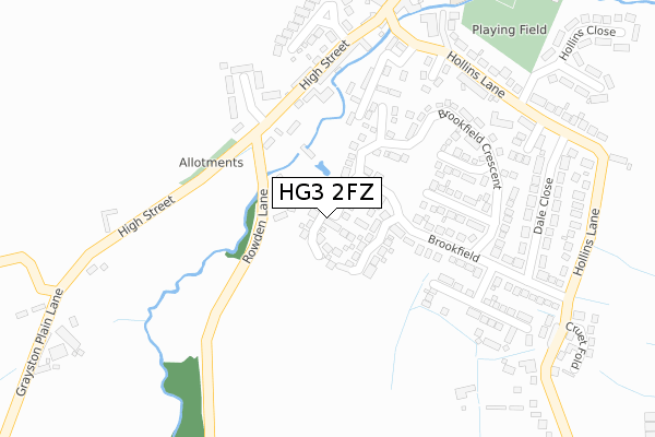
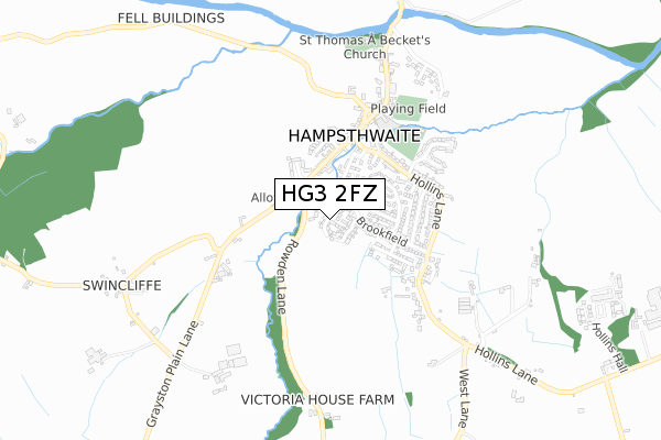
HG3 2FZ is located in the Killinghall, Hampsthwaite & Saltergate electoral ward, within the unitary authority of North Yorkshire and the English Parliamentary constituency of Harrogate and Knaresborough. The Sub Integrated Care Board (ICB) Location is NHS Humber and North Yorkshire ICB - 42D and the police force is North Yorkshire. This postcode has been in use since January 2018.


GetTheData
Source: OS Open Zoomstack (Ordnance Survey)
Licence: Open Government Licence (requires attribution)
Attribution: Contains OS data © Crown copyright and database right 2025
Source: Open Postcode Geo
Licence: Open Government Licence (requires attribution)
Attribution: Contains OS data © Crown copyright and database right 2025; Contains Royal Mail data © Royal Mail copyright and database right 2025; Source: Office for National Statistics licensed under the Open Government Licence v.3.0
| Easting | 425834 |
| Northing | 458368 |
| Latitude | 54.020689 |
| Longitude | -1.607197 |
GetTheData
Source: Open Postcode Geo
Licence: Open Government Licence
| Country | England |
| Postcode District | HG3 |
➜ See where HG3 is on a map ➜ Where is Hampsthwaite? | |
GetTheData
Source: Land Registry Price Paid Data
Licence: Open Government Licence
| Ward | Killinghall, Hampsthwaite & Saltergate |
| Constituency | Harrogate And Knaresborough |
GetTheData
Source: ONS Postcode Database
Licence: Open Government Licence
2021 16 JUN £480,000 |
29, BROOKFIELD FOLD, HAMPSTHWAITE, HARROGATE, HG3 2FZ 2019 27 SEP £569,995 |
3, BROOKFIELD FOLD, HAMPSTHWAITE, HARROGATE, HG3 2FZ 2019 27 SEP £439,995 |
2019 23 AUG £489,995 |
31, BROOKFIELD FOLD, HAMPSTHWAITE, HARROGATE, HG3 2FZ 2019 6 JUN £699,995 |
5, BROOKFIELD FOLD, HAMPSTHWAITE, HARROGATE, HG3 2FZ 2019 17 MAY £499,995 |
24, BROOKFIELD FOLD, HAMPSTHWAITE, HARROGATE, HG3 2FZ 2019 26 APR £702,995 |
20, BROOKFIELD FOLD, HAMPSTHWAITE, HARROGATE, HG3 2FZ 2019 12 APR £589,995 |
22, BROOKFIELD FOLD, HAMPSTHWAITE, HARROGATE, HG3 2FZ 2019 29 MAR £599,995 |
27, BROOKFIELD FOLD, HAMPSTHWAITE, HARROGATE, HG3 2FZ 2018 5 OCT £539,995 |
GetTheData
Source: HM Land Registry Price Paid Data
Licence: Contains HM Land Registry data © Crown copyright and database right 2025. This data is licensed under the Open Government Licence v3.0.
| Finden Gardens (Lund Lane) | Hampsthwaite | 285m |
| Memorial Hall (Lund Lane) | Hampsthwaite | 300m |
| Hollins Close (Brookfield Cresent) | Hampsthwaite | 304m |
| Brookfield (Hollins Lane) | Hampsthwaite | 357m |
| Dale Close | Hampsthwaite | 364m |
| Harrogate Station | 5.5km |
GetTheData
Source: NaPTAN
Licence: Open Government Licence
| Percentage of properties with Next Generation Access | 100.0% |
| Percentage of properties with Superfast Broadband | 100.0% |
| Percentage of properties with Ultrafast Broadband | 0.0% |
| Percentage of properties with Full Fibre Broadband | 0.0% |
Superfast Broadband is between 30Mbps and 300Mbps
Ultrafast Broadband is > 300Mbps
| Median download speed | 39.1Mbps |
| Average download speed | 31.5Mbps |
| Maximum download speed | 54.68Mbps |
| Median upload speed | 7.6Mbps |
| Average upload speed | 6.2Mbps |
| Maximum upload speed | 9.95Mbps |
| Percentage of properties unable to receive 2Mbps | 0.0% |
| Percentage of properties unable to receive 5Mbps | 0.0% |
| Percentage of properties unable to receive 10Mbps | 0.0% |
| Percentage of properties unable to receive 30Mbps | 0.0% |
GetTheData
Source: Ofcom
Licence: Ofcom Terms of Use (requires attribution)
GetTheData
Source: ONS Postcode Database
Licence: Open Government Licence


➜ Get more ratings from the Food Standards Agency
GetTheData
Source: Food Standards Agency
Licence: FSA terms & conditions
| Last Collection | |||
|---|---|---|---|
| Location | Mon-Fri | Sat | Distance |
| Kettlesing | 16:45 | 11:00 | 285m |
| Bell Bank | 16:45 | 11:00 | 733m |
| Clint Bank | 16:30 | 11:15 | 1,487m |
GetTheData
Source: Dracos
Licence: Creative Commons Attribution-ShareAlike
The below table lists the International Territorial Level (ITL) codes (formerly Nomenclature of Territorial Units for Statistics (NUTS) codes) and Local Administrative Units (LAU) codes for HG3 2FZ:
| ITL 1 Code | Name |
|---|---|
| TLE | Yorkshire and The Humber |
| ITL 2 Code | Name |
| TLE2 | North Yorkshire |
| ITL 3 Code | Name |
| TLE22 | North Yorkshire CC |
| LAU 1 Code | Name |
| E07000165 | Harrogate |
GetTheData
Source: ONS Postcode Directory
Licence: Open Government Licence
The below table lists the Census Output Area (OA), Lower Layer Super Output Area (LSOA), and Middle Layer Super Output Area (MSOA) for HG3 2FZ:
| Code | Name | |
|---|---|---|
| OA | E00140885 | |
| LSOA | E01027664 | Harrogate 008B |
| MSOA | E02005768 | Harrogate 008 |
GetTheData
Source: ONS Postcode Directory
Licence: Open Government Licence
| HG3 2ER | Rowden Lane | 93m |
| HG3 2EF | Brookfield | 161m |
| HG3 2ED | Brookfield Way | 161m |
| HG3 2EA | Brookfield Close | 182m |
| HG3 2EE | Brookfield Crescent | 194m |
| HG3 2EN | Finden Gardens | 203m |
| HG3 2EP | High Street | 235m |
| HG3 2EB | Brookfield Garth | 240m |
| HG3 2EL | Finden Gardens | 253m |
| HG3 2ES | Peckfield Close | 261m |
GetTheData
Source: Open Postcode Geo; Land Registry Price Paid Data
Licence: Open Government Licence