Property/Postcode Data Search:
HD9 7UD maps, stats, and open data
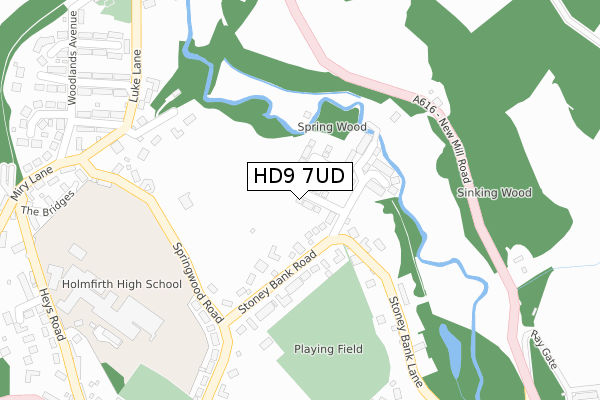
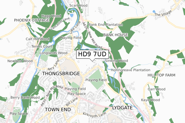
HD9 7UD is located in the Holme Valley South electoral ward, within the metropolitan district of Kirklees and the English Parliamentary constituency of Colne Valley. The Sub Integrated Care Board (ICB) Location is NHS West Yorkshire ICB - X2C4Y and the police force is West Yorkshire. This postcode has been in use since June 2019.
HD9 7UD maps


Source: OS Open Zoomstack (Ordnance Survey)
Licence: Open Government Licence (requires attribution)
Attribution: Contains OS data © Crown copyright and database right 2025
Source: Open Postcode Geo
Licence: Open Government Licence (requires attribution)
Attribution: Contains OS data © Crown copyright and database right 2025; Contains Royal Mail data © Royal Mail copyright and database right 2025; Source: Office for National Statistics licensed under the Open Government Licence v.3.0
Licence: Open Government Licence (requires attribution)
Attribution: Contains OS data © Crown copyright and database right 2025
Source: Open Postcode Geo
Licence: Open Government Licence (requires attribution)
Attribution: Contains OS data © Crown copyright and database right 2025; Contains Royal Mail data © Royal Mail copyright and database right 2025; Source: Office for National Statistics licensed under the Open Government Licence v.3.0
HD9 7UD geodata
| Easting | 415559 |
| Northing | 409777 |
| Latitude | 53.584369 |
| Longitude | -1.766452 |
Where is HD9 7UD?
| Country | England |
| Postcode District | HD9 |
Politics
| Ward | Holme Valley South |
|---|---|
| Constituency | Colne Valley |
House Prices
Sales of detached houses in HD9 7UD
2, STONEY BANK CHASE, THONGSBRIDGE, HOLMFIRTH, HD9 7UD 2022 21 JAN £432,950 |
17, STONEY BANK CHASE, THONGSBRIDGE, HOLMFIRTH, HD9 7UD 2021 29 SEP £359,950 |
15, STONEY BANK CHASE, THONGSBRIDGE, HOLMFIRTH, HD9 7UD 2021 17 SEP £381,950 |
9, STONEY BANK CHASE, THONGSBRIDGE, HOLMFIRTH, HD9 7UD 2021 10 SEP £324,950 |
11, STONEY BANK CHASE, THONGSBRIDGE, HOLMFIRTH, HD9 7UD 2021 10 SEP £324,950 |
45, STONEY BANK CHASE, THONGSBRIDGE, HOLMFIRTH, HD9 7UD 2021 26 MAR £314,950 |
35, STONEY BANK CHASE, THONGSBRIDGE, HOLMFIRTH, HD9 7UD 2020 18 DEC £319,950 |
41, STONEY BANK CHASE, THONGSBRIDGE, HOLMFIRTH, HD9 7UD 2020 18 DEC £384,950 |
37, STONEY BANK CHASE, THONGSBRIDGE, HOLMFIRTH, HD9 7UD 2020 4 DEC £379,950 |
40, STONEY BANK CHASE, THONGSBRIDGE, HOLMFIRTH, HD9 7UD 2020 26 OCT £314,950 |
Source: HM Land Registry Price Paid Data
Licence: Contains HM Land Registry data © Crown copyright and database right 2025. This data is licensed under the Open Government Licence v3.0.
Licence: Contains HM Land Registry data © Crown copyright and database right 2025. This data is licensed under the Open Government Licence v3.0.
Transport
Nearest bus stops to HD9 7UD
| Springwood Road | Thongsbridge | 253m |
| New Mill Road Sinking Wood (New Mill Road) | Thongsbridge | 266m |
| New Mill Road Sinking Wood (New Mill Road) | Thongsbridge | 276m |
| Springwood Road | Thongsbridge | 280m |
| Luke Lane Elm Ave (Luke Lane) | Thongsbridge | 315m |
Nearest railway stations to HD9 7UD
| Brockholes Station | 1.4km |
| Honley Station | 2.8km |
| Stocksmoor Station | 3.1km |
Deprivation
11.4% of English postcodes are less deprived than HD9 7UD:Food Standards Agency
Three nearest food hygiene ratings to HD9 7UD (metres)
Woodland Fisheries

72 Springwood Road
275m
Hey Days Nursery

Holmfirth High School
374m
Holmfirth High School

Heys Road
374m
➜ Get more ratings from the Food Standards Agency
Nearest post box to HD9 7UD
| Last Collection | |||
|---|---|---|---|
| Location | Mon-Fri | Sat | Distance |
| Thongsbridge Station | 17:15 | 12:00 | 462m |
| Sycamore | 17:00 | 12:00 | 526m |
| Scar End | 17:00 | 12:00 | 597m |
HD9 7UD ITL and HD9 7UD LAU
The below table lists the International Territorial Level (ITL) codes (formerly Nomenclature of Territorial Units for Statistics (NUTS) codes) and Local Administrative Units (LAU) codes for HD9 7UD:
| ITL 1 Code | Name |
|---|---|
| TLE | Yorkshire and The Humber |
| ITL 2 Code | Name |
| TLE4 | West Yorkshire |
| ITL 3 Code | Name |
| TLE44 | Calderdale and Kirklees |
| LAU 1 Code | Name |
| E08000034 | Kirklees |
HD9 7UD census areas
The below table lists the Census Output Area (OA), Lower Layer Super Output Area (LSOA), and Middle Layer Super Output Area (MSOA) for HD9 7UD:
| Code | Name | |
|---|---|---|
| OA | E00056342 | |
| LSOA | E01011189 | Kirklees 059G |
| MSOA | E02002329 | Kirklees 059 |
Nearest postcodes to HD9 7UD
| HD9 7LW | Stoney Bank Lane | 129m |
| HD9 7SL | Stoneybank Road | 139m |
| HD9 7LS | Old Mill Lane | 153m |
| HD9 7LZ | Stoney Bank Lane | 183m |
| HD9 7TH | Morefield Bank | 262m |
| HD9 7SN | Springwood Road | 275m |
| HD9 7SZ | Luke Lane | 307m |
| HD9 7SJ | Springwood Road | 314m |
| HD9 7SR | Larch Avenue | 368m |
| HD9 7ST | Elm Avenue | 388m |