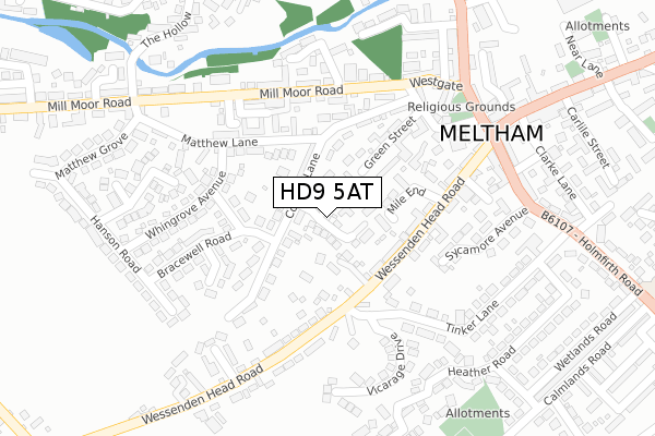
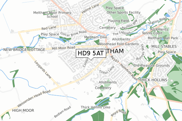
HD9 5AT is located in the Holme Valley North electoral ward, within the metropolitan district of Kirklees and the English Parliamentary constituency of Colne Valley. The Sub Integrated Care Board (ICB) Location is NHS West Yorkshire ICB - X2C4Y and the police force is West Yorkshire. This postcode has been in use since September 2018.


GetTheData
Source: OS Open Zoomstack (Ordnance Survey)
Licence: Open Government Licence (requires attribution)
Attribution: Contains OS data © Crown copyright and database right 2025
Source: Open Postcode Geo
Licence: Open Government Licence (requires attribution)
Attribution: Contains OS data © Crown copyright and database right 2025; Contains Royal Mail data © Royal Mail copyright and database right 2025; Source: Office for National Statistics licensed under the Open Government Licence v.3.0
| Easting | 409735 |
| Northing | 410466 |
| Latitude | 53.590700 |
| Longitude | -1.854402 |
GetTheData
Source: Open Postcode Geo
Licence: Open Government Licence
| Country | England |
| Postcode District | HD9 |
➜ See where HD9 is on a map ➜ Where is Meltham? | |
GetTheData
Source: Land Registry Price Paid Data
Licence: Open Government Licence
| Ward | Holme Valley North |
| Constituency | Colne Valley |
GetTheData
Source: ONS Postcode Database
Licence: Open Government Licence
2024 18 OCT £440,000 |
2024 28 JUN £425,000 |
2021 6 APR £400,000 |
20, MELTHAM GRANGE, MELTHAM, HOLMFIRTH, HD9 5AT 2020 12 JUN £350,000 |
11, MELTHAM GRANGE, MELTHAM, HOLMFIRTH, HD9 5AT 2020 22 MAY £315,000 |
2020 7 APR £310,000 |
15, MELTHAM GRANGE, MELTHAM, HOLMFIRTH, HD9 5AT 2020 20 MAR £310,000 |
7, MELTHAM GRANGE, MELTHAM, HOLMFIRTH, HD9 5AT 2020 7 FEB £340,000 |
2020 31 JAN £365,000 |
1, MELTHAM GRANGE, MELTHAM, HOLMFIRTH, HD9 5AT 2019 1 NOV £310,000 |
GetTheData
Source: HM Land Registry Price Paid Data
Licence: Contains HM Land Registry data © Crown copyright and database right 2025. This data is licensed under the Open Government Licence v3.0.
| Matthew Lane Colders Ln (Matthew Lane) | Meltham | 148m |
| Colders Drive | Meltham | 150m |
| Wessenden Head Road | Meltham | 165m |
| Colders Lane | Meltham | 169m |
| Whingrove Avenue | Meltham | 174m |
| Slaithwaite Station | 4.1km |
| Honley Station | 5.2km |
| Berry Brow Station | 5.3km |
GetTheData
Source: NaPTAN
Licence: Open Government Licence
| Percentage of properties with Next Generation Access | 100.0% |
| Percentage of properties with Superfast Broadband | 100.0% |
| Percentage of properties with Ultrafast Broadband | 0.0% |
| Percentage of properties with Full Fibre Broadband | 0.0% |
Superfast Broadband is between 30Mbps and 300Mbps
Ultrafast Broadband is > 300Mbps
| Median download speed | 40.0Mbps |
| Average download speed | 38.5Mbps |
| Maximum download speed | 51.04Mbps |
| Median upload speed | 10.0Mbps |
| Average upload speed | 8.8Mbps |
| Maximum upload speed | 12.76Mbps |
| Percentage of properties unable to receive 2Mbps | 0.0% |
| Percentage of properties unable to receive 5Mbps | 0.0% |
| Percentage of properties unable to receive 10Mbps | 0.0% |
| Percentage of properties unable to receive 30Mbps | 0.0% |
GetTheData
Source: Ofcom
Licence: Ofcom Terms of Use (requires attribution)
GetTheData
Source: ONS Postcode Database
Licence: Open Government Licence


➜ Get more ratings from the Food Standards Agency
GetTheData
Source: Food Standards Agency
Licence: FSA terms & conditions
| Last Collection | |||
|---|---|---|---|
| Location | Mon-Fri | Sat | Distance |
| Meltham P.o. Box | 17:30 | 11:15 | 276m |
| Scarr Green Close Meltham | 17:00 | 10:15 | 614m |
| 40 Red Lane, Meltham | 17:00 | 10:15 | 618m |
GetTheData
Source: Dracos
Licence: Creative Commons Attribution-ShareAlike
The below table lists the International Territorial Level (ITL) codes (formerly Nomenclature of Territorial Units for Statistics (NUTS) codes) and Local Administrative Units (LAU) codes for HD9 5AT:
| ITL 1 Code | Name |
|---|---|
| TLE | Yorkshire and The Humber |
| ITL 2 Code | Name |
| TLE4 | West Yorkshire |
| ITL 3 Code | Name |
| TLE44 | Calderdale and Kirklees |
| LAU 1 Code | Name |
| E08000034 | Kirklees |
GetTheData
Source: ONS Postcode Directory
Licence: Open Government Licence
The below table lists the Census Output Area (OA), Lower Layer Super Output Area (LSOA), and Middle Layer Super Output Area (MSOA) for HD9 5AT:
| Code | Name | |
|---|---|---|
| OA | E00056306 | |
| LSOA | E01011168 | Kirklees 055A |
| MSOA | E02002325 | Kirklees 055 |
GetTheData
Source: ONS Postcode Directory
Licence: Open Government Licence
| HD9 5JL | Colders Lane | 73m |
| HD9 4HU | Mile End | 96m |
| HD9 5JH | Colders Green | 97m |
| HD9 5JP | Colders Drive | 126m |
| HD9 4EU | Wessenden Head Road | 143m |
| HD9 5NP | Green Street | 165m |
| HD9 5JJ | Colders Lane | 168m |
| HD9 4ET | Wessenden Head Road | 168m |
| HD9 5JS | Matthew Lane | 179m |
| HD9 5JN | Popley Butts | 179m |
GetTheData
Source: Open Postcode Geo; Land Registry Price Paid Data
Licence: Open Government Licence