HD8 0ZH maps, stats, and open data
HD8 0ZH is located in the Kirkburton electoral ward, within the metropolitan district of Kirklees and the English Parliamentary constituency of Dewsbury. The Sub Integrated Care Board (ICB) Location is NHS West Yorkshire ICB - X2C4Y and the police force is West Yorkshire. This postcode has been in use since May 2018.
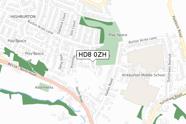
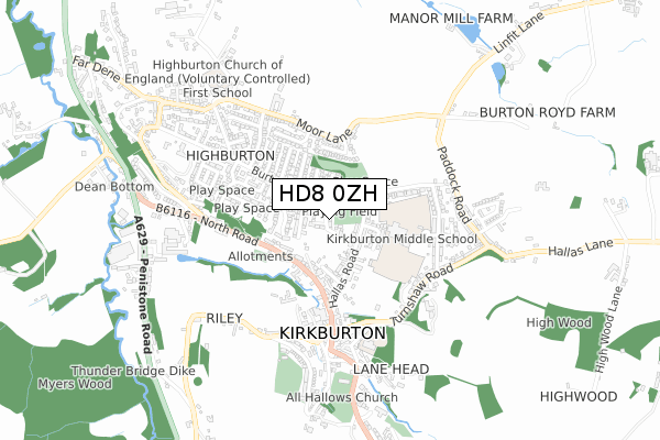
HD8 0ZH maps


Licence: Open Government Licence (requires attribution)
Attribution: Contains OS data © Crown copyright and database right 2025
Source: Open Postcode Geo
Licence: Open Government Licence (requires attribution)
Attribution: Contains OS data © Crown copyright and database right 2025; Contains Royal Mail data © Royal Mail copyright and database right 2025; Source: Office for National Statistics licensed under the Open Government Licence v.3.0
HD8 0ZH geodata
| Easting | 419749 |
| Northing | 413109 |
| Latitude | 53.614177 |
| Longitude | -1.702954 |
Where is HD8 0ZH?
| Country | England |
| Postcode District | HD8 |
Politics
| Ward | Kirkburton |
|---|---|
| Constituency | Dewsbury |
House Prices
Sales of detached houses in HD8 0ZH
2025 3 JUN £395,000 |
2025 3 MAR £450,000 |
2023 16 AUG £435,000 |
2021 17 FEB £340,000 |
31, FOXGLOVE DRIVE, KIRKBURTON, HUDDERSFIELD, HD8 0ZH 2019 24 MAY £364,950 |
24, FOXGLOVE DRIVE, KIRKBURTON, HUDDERSFIELD, HD8 0ZH 2019 22 FEB £365,950 |
39, FOXGLOVE DRIVE, KIRKBURTON, HUDDERSFIELD, HD8 0ZH 2019 8 FEB £338,950 |
37, FOXGLOVE DRIVE, KIRKBURTON, HUDDERSFIELD, HD8 0ZH 2019 1 FEB £281,950 |
41, FOXGLOVE DRIVE, KIRKBURTON, HUDDERSFIELD, HD8 0ZH 2019 25 JAN £354,950 |
35, FOXGLOVE DRIVE, KIRKBURTON, HUDDERSFIELD, HD8 0ZH 2018 21 DEC £281,950 |
Licence: Contains HM Land Registry data © Crown copyright and database right 2025. This data is licensed under the Open Government Licence v3.0.
Transport
Nearest bus stops to HD8 0ZH
| North Road Liberal Club (North Road) | Kirkburton | 208m |
| North Road Liberal Club (North Road) | Kirkburton | 218m |
| Moor Lane Cotswold Mews (Moor Lane) | Highburton | 332m |
| Moor Lane Cotswold Mews (Moor Lane) | Highburton | 338m |
| North Rd Hallas Road (North Road) | Kirkburton | 340m |
Nearest railway stations to HD8 0ZH
| Stocksmoor Station | 2.6km |
| Shepley Station | 2.8km |
| Brockholes Station | 4.8km |
Broadband
Broadband access in HD8 0ZH (2020 data)
| Percentage of properties with Next Generation Access | 100.0% |
| Percentage of properties with Superfast Broadband | 100.0% |
| Percentage of properties with Ultrafast Broadband | 100.0% |
| Percentage of properties with Full Fibre Broadband | 100.0% |
Superfast Broadband is between 30Mbps and 300Mbps
Ultrafast Broadband is > 300Mbps
Broadband limitations in HD8 0ZH (2020 data)
| Percentage of properties unable to receive 2Mbps | 0.0% |
| Percentage of properties unable to receive 5Mbps | 0.0% |
| Percentage of properties unable to receive 10Mbps | 0.0% |
| Percentage of properties unable to receive 30Mbps | 0.0% |
Deprivation
4.2% of English postcodes are less deprived than HD8 0ZH:Food Standards Agency
Three nearest food hygiene ratings to HD8 0ZH (metres)


➜ Get more ratings from the Food Standards Agency
Nearest post box to HD8 0ZH
| Last Collection | |||
|---|---|---|---|
| Location | Mon-Fri | Sat | Distance |
| Kirkburton P.o. Box | 17:15 | 12:00 | 494m |
| North Road | 17:30 | 12:00 | 522m |
| Harry Bower | 16:00 | 12:00 | 568m |
HD8 0ZH ITL and HD8 0ZH LAU
The below table lists the International Territorial Level (ITL) codes (formerly Nomenclature of Territorial Units for Statistics (NUTS) codes) and Local Administrative Units (LAU) codes for HD8 0ZH:
| ITL 1 Code | Name |
|---|---|
| TLE | Yorkshire and The Humber |
| ITL 2 Code | Name |
| TLE4 | West Yorkshire |
| ITL 3 Code | Name |
| TLE44 | Calderdale and Kirklees |
| LAU 1 Code | Name |
| E08000034 | Kirklees |
HD8 0ZH census areas
The below table lists the Census Output Area (OA), Lower Layer Super Output Area (LSOA), and Middle Layer Super Output Area (MSOA) for HD8 0ZH:
| Code | Name | |
|---|---|---|
| OA | E00056379 | |
| LSOA | E01011196 | Kirklees 051C |
| MSOA | E02002321 | Kirklees 051 |
Nearest postcodes to HD8 0ZH
| HD8 0QE | North Road | 140m |
| HD8 0QQ | Hallas Road | 141m |
| HD8 0US | Ashford Court | 144m |
| HD8 0TD | Sycamore Court | 149m |
| HD8 0QF | Hallas Road | 182m |
| HD8 0XH | Gregory Drive | 185m |
| HD8 0ZF | Orchard Close | 193m |
| HD8 0XJ | Dene Park | 203m |
| HD8 0TB | Elm Court | 209m |
| HD8 0QA | Little Hallas | 216m |