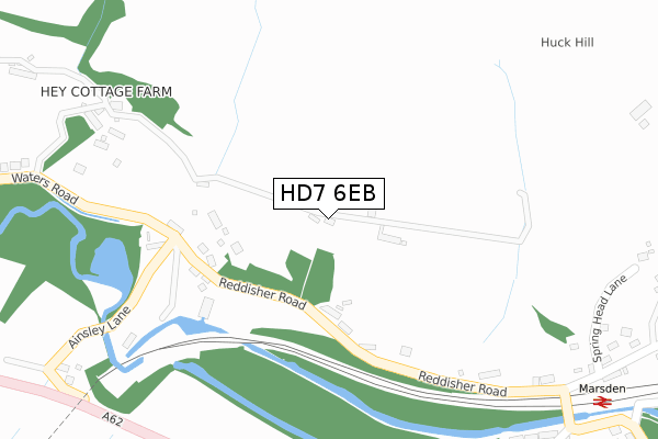
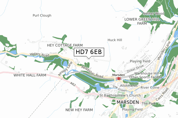
HD7 6EB is located in the Colne Valley electoral ward, within the metropolitan district of Kirklees and the English Parliamentary constituency of Colne Valley. The Sub Integrated Care Board (ICB) Location is NHS West Yorkshire ICB - X2C4Y and the police force is West Yorkshire. This postcode has been in use since February 2020.


GetTheData
Source: OS Open Zoomstack (Ordnance Survey)
Licence: Open Government Licence (requires attribution)
Attribution: Contains OS data © Crown copyright and database right 2025
Source: Open Postcode Geo
Licence: Open Government Licence (requires attribution)
Attribution: Contains OS data © Crown copyright and database right 2025; Contains Royal Mail data © Royal Mail copyright and database right 2025; Source: Office for National Statistics licensed under the Open Government Licence v.3.0
| Easting | 404266 |
| Northing | 412120 |
| Latitude | 53.605638 |
| Longitude | -1.937001 |
GetTheData
Source: Open Postcode Geo
Licence: Open Government Licence
| Country | England |
| Postcode District | HD7 |
➜ See where HD7 is on a map | |
GetTheData
Source: Land Registry Price Paid Data
Licence: Open Government Licence
| Ward | Colne Valley |
| Constituency | Colne Valley |
GetTheData
Source: ONS Postcode Database
Licence: Open Government Licence
| Waters Road | Marsden | 243m |
| Reddisher Rd Rough Lee Farm (Reddisher Road) | Marsden | 271m |
| Reddisher Rd Rough Lee Farm (Reddisher Road) | Marsden | 292m |
| Waters Road | Marsden | 384m |
| Waters Road | Marsden | 386m |
| Marsden Station | 0.5km |
| Slaithwaite Station | 4.2km |
GetTheData
Source: NaPTAN
Licence: Open Government Licence
GetTheData
Source: ONS Postcode Database
Licence: Open Government Licence


➜ Get more ratings from the Food Standards Agency
GetTheData
Source: Food Standards Agency
Licence: FSA terms & conditions
| Last Collection | |||
|---|---|---|---|
| Location | Mon-Fri | Sat | Distance |
| Ottiwells | 17:00 | 12:00 | 490m |
| 2 Peel Street | 17:15 | 12:00 | 801m |
| Smithy Holme | 17:15 | 12:00 | 1,016m |
GetTheData
Source: Dracos
Licence: Creative Commons Attribution-ShareAlike
The below table lists the International Territorial Level (ITL) codes (formerly Nomenclature of Territorial Units for Statistics (NUTS) codes) and Local Administrative Units (LAU) codes for HD7 6EB:
| ITL 1 Code | Name |
|---|---|
| TLE | Yorkshire and The Humber |
| ITL 2 Code | Name |
| TLE4 | West Yorkshire |
| ITL 3 Code | Name |
| TLE44 | Calderdale and Kirklees |
| LAU 1 Code | Name |
| E08000034 | Kirklees |
GetTheData
Source: ONS Postcode Directory
Licence: Open Government Licence
The below table lists the Census Output Area (OA), Lower Layer Super Output Area (LSOA), and Middle Layer Super Output Area (MSOA) for HD7 6EB:
| Code | Name | |
|---|---|---|
| OA | E00055785 | |
| LSOA | E01011075 | Kirklees 052C |
| MSOA | E02002322 | Kirklees 052 |
GetTheData
Source: ONS Postcode Directory
Licence: Open Government Licence
| HD7 6NF | Reddisher Road | 172m |
| HD7 6NQ | Waterfall Cottages | 252m |
| HD7 6DS | Glen Royd Manchester Road | 443m |
| HD7 6DZ | High Lea | 468m |
| HD7 6AX | Osborne Terrace | 492m |
| HD7 6DR | Warrington Terrace | 496m |
| HD7 6EQ | Millwright Close | 514m |
| HD7 6DP | Manchester Road | 522m |
| HD7 6DN | Clough Lea | 530m |
| HD7 6EA | Rectory Close | 555m |
GetTheData
Source: Open Postcode Geo; Land Registry Price Paid Data
Licence: Open Government Licence