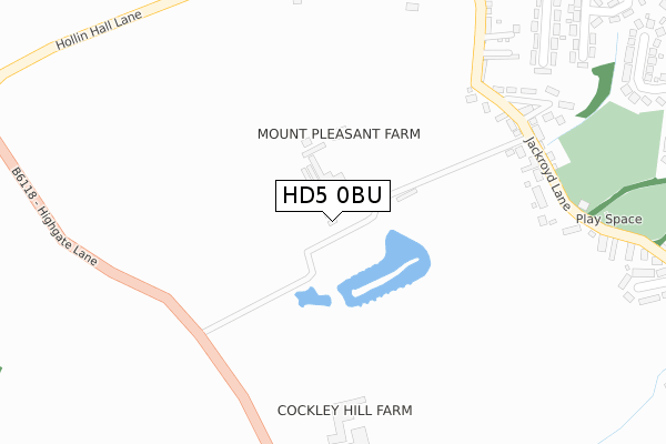
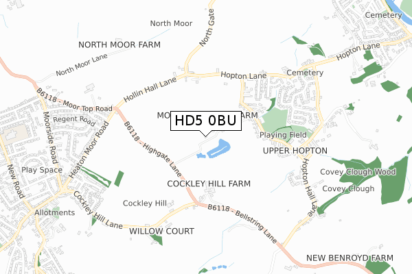
HD5 0BU is located in the Mirfield electoral ward, within the metropolitan district of Kirklees and the English Parliamentary constituency of Dewsbury. The Sub Integrated Care Board (ICB) Location is NHS West Yorkshire ICB - X2C4Y and the police force is West Yorkshire. This postcode has been in use since April 2019.


GetTheData
Source: OS Open Zoomstack (Ordnance Survey)
Licence: Open Government Licence (requires attribution)
Attribution: Contains OS data © Crown copyright and database right 2025
Source: Open Postcode Geo
Licence: Open Government Licence (requires attribution)
Attribution: Contains OS data © Crown copyright and database right 2025; Contains Royal Mail data © Royal Mail copyright and database right 2025; Source: Office for National Statistics licensed under the Open Government Licence v.3.0
| Easting | 419085 |
| Northing | 418488 |
| Latitude | 53.662548 |
| Longitude | -1.712663 |
GetTheData
Source: Open Postcode Geo
Licence: Open Government Licence
| Country | England |
| Postcode District | HD5 |
➜ See where HD5 is on a map | |
GetTheData
Source: Land Registry Price Paid Data
Licence: Open Government Licence
| Ward | Mirfield |
| Constituency | Dewsbury |
GetTheData
Source: ONS Postcode Database
Licence: Open Government Licence
| Jackroyd Lane Cricket Club (Jackroyd Lane) | Upper Hopton | 313m |
| Jackroyd Lane Cricket Club (Jackroyd Lane) | Upper Hopton | 339m |
| Highgate Lane Cockley Hill Ln (Highgate Lane) | Upper Hopton | 393m |
| Highgate Lane Cockley Hill Ln (Highgate Lane) | Upper Hopton | 400m |
| Hopton Lane Hopton Ave (Hopton Lane) | Upper Hopton | 460m |
| Mirfield Station | 1.7km |
| Deighton Station | 2.7km |
| Ravensthorpe Station | 4km |
GetTheData
Source: NaPTAN
Licence: Open Government Licence
| Percentage of properties with Next Generation Access | 100.0% |
| Percentage of properties with Superfast Broadband | 100.0% |
| Percentage of properties with Ultrafast Broadband | 0.0% |
| Percentage of properties with Full Fibre Broadband | 0.0% |
Superfast Broadband is between 30Mbps and 300Mbps
Ultrafast Broadband is > 300Mbps
| Percentage of properties unable to receive 2Mbps | 0.0% |
| Percentage of properties unable to receive 5Mbps | 0.0% |
| Percentage of properties unable to receive 10Mbps | 0.0% |
| Percentage of properties unable to receive 30Mbps | 0.0% |
GetTheData
Source: Ofcom
Licence: Ofcom Terms of Use (requires attribution)
GetTheData
Source: ONS Postcode Database
Licence: Open Government Licence


➜ Get more ratings from the Food Standards Agency
GetTheData
Source: Food Standards Agency
Licence: FSA terms & conditions
| Last Collection | |||
|---|---|---|---|
| Location | Mon-Fri | Sat | Distance |
| Hopton P.o. | 16:00 | 10:30 | 319m |
| Hopton Lane/Jackroyd Lane | 16:00 | 10:30 | 448m |
| Hilltop Cres | 16:00 | 10:30 | 497m |
GetTheData
Source: Dracos
Licence: Creative Commons Attribution-ShareAlike
The below table lists the International Territorial Level (ITL) codes (formerly Nomenclature of Territorial Units for Statistics (NUTS) codes) and Local Administrative Units (LAU) codes for HD5 0BU:
| ITL 1 Code | Name |
|---|---|
| TLE | Yorkshire and The Humber |
| ITL 2 Code | Name |
| TLE4 | West Yorkshire |
| ITL 3 Code | Name |
| TLE44 | Calderdale and Kirklees |
| LAU 1 Code | Name |
| E08000034 | Kirklees |
GetTheData
Source: ONS Postcode Directory
Licence: Open Government Licence
The below table lists the Census Output Area (OA), Lower Layer Super Output Area (LSOA), and Middle Layer Super Output Area (MSOA) for HD5 0BU:
| Code | Name | |
|---|---|---|
| OA | E00056541 | |
| LSOA | E01011214 | Kirklees 026C |
| MSOA | E02002296 | Kirklees 026 |
GetTheData
Source: ONS Postcode Directory
Licence: Open Government Licence
| WF14 8EH | Jackroyd Lane | 56m |
| WF14 8HX | Jackroyd Lane | 304m |
| WF14 8HY | Jackroyd Lane | 349m |
| HD5 0PE | Cockley Hill Lane | 361m |
| WF14 8HU | Jackroyd Lane | 378m |
| WF14 8EJ | Hopton Lane | 401m |
| WF14 8JW | Hopton Avenue | 419m |
| WF14 8ET | Northgate | 431m |
| WF14 8JN | Hopton Lane | 450m |
| WF14 8HT | Hill Top Crescent | 481m |
GetTheData
Source: Open Postcode Geo; Land Registry Price Paid Data
Licence: Open Government Licence