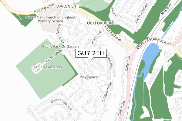
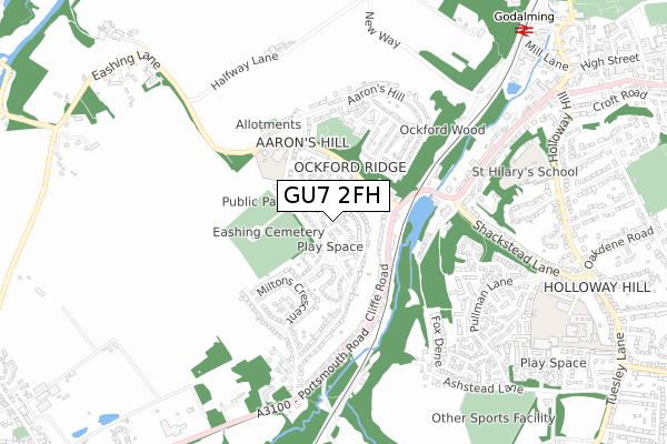
GU7 2FH is located in the Godalming Central & Ockford electoral ward, within the local authority district of Waverley and the English Parliamentary constituency of South West Surrey. The Sub Integrated Care Board (ICB) Location is NHS Surrey Heartlands ICB - 92A and the police force is Surrey. This postcode has been in use since April 2020.


GetTheData
Source: OS Open Zoomstack (Ordnance Survey)
Licence: Open Government Licence (requires attribution)
Attribution: Contains OS data © Crown copyright and database right 2025
Source: Open Postcode Geo
Licence: Open Government Licence (requires attribution)
Attribution: Contains OS data © Crown copyright and database right 2025; Contains Royal Mail data © Royal Mail copyright and database right 2025; Source: Office for National Statistics licensed under the Open Government Licence v.3.0
| Easting | 495925 |
| Northing | 143178 |
| Latitude | 51.179794 |
| Longitude | -0.629017 |
GetTheData
Source: Open Postcode Geo
Licence: Open Government Licence
| Country | England |
| Postcode District | GU7 |
➜ See where GU7 is on a map ➜ Where is Godalming? | |
GetTheData
Source: Land Registry Price Paid Data
Licence: Open Government Licence
| Ward | Godalming Central & Ockford |
| Constituency | South West Surrey |
GetTheData
Source: ONS Postcode Database
Licence: Open Government Licence
| Eashing Lane Estate (Ockford Ridge) | Ockford Ridge | 122m |
| Ockford Ridge (Franklyn Road) | Ockford Ridge | 173m |
| Ockford Ridge (Franklyn Road) | Ockford Ridge | 183m |
| Eashing Lane (Portsmouth Road) | Godalming | 207m |
| Eashing Lane | Godalming | 237m |
| Godalming Station | 1km |
| Milford (Surrey) Station | 1.9km |
| Farncombe Station | 2.6km |
GetTheData
Source: NaPTAN
Licence: Open Government Licence
GetTheData
Source: ONS Postcode Database
Licence: Open Government Licence


➜ Get more ratings from the Food Standards Agency
GetTheData
Source: Food Standards Agency
Licence: FSA terms & conditions
| Last Collection | |||
|---|---|---|---|
| Location | Mon-Fri | Sat | Distance |
| Ockford Ridge Post Office | 17:15 | 12:00 | 143m |
| Eashing Lane | 17:00 | 12:00 | 216m |
| Miltons Crescent | 17:15 | 12:00 | 400m |
GetTheData
Source: Dracos
Licence: Creative Commons Attribution-ShareAlike
The below table lists the International Territorial Level (ITL) codes (formerly Nomenclature of Territorial Units for Statistics (NUTS) codes) and Local Administrative Units (LAU) codes for GU7 2FH:
| ITL 1 Code | Name |
|---|---|
| TLJ | South East (England) |
| ITL 2 Code | Name |
| TLJ2 | Surrey, East and West Sussex |
| ITL 3 Code | Name |
| TLJ25 | West Surrey |
| LAU 1 Code | Name |
| E07000216 | Waverley |
GetTheData
Source: ONS Postcode Directory
Licence: Open Government Licence
The below table lists the Census Output Area (OA), Lower Layer Super Output Area (LSOA), and Middle Layer Super Output Area (MSOA) for GU7 2FH:
| Code | Name | |
|---|---|---|
| OA | E00157613 | |
| LSOA | E01030915 | Waverley 010B |
| MSOA | E02006448 | Waverley 010 |
GetTheData
Source: ONS Postcode Directory
Licence: Open Government Licence
| GU7 2NL | Ockford Ridge | 38m |
| GU7 2NH | Coopers Rise | 79m |
| GU7 2NP | Ockford Ridge | 101m |
| GU7 2NJ | Coopers Rise | 105m |
| GU7 2NQ | Ockford Ridge | 108m |
| GU7 2NW | Quarry Hill | 146m |
| GU7 2JY | Cliffe Rise | 155m |
| GU7 2NR | Ockford Ridge | 159m |
| GU7 2NN | Ockford Ridge | 180m |
| GU7 2JZ | Eashing Lane | 188m |
GetTheData
Source: Open Postcode Geo; Land Registry Price Paid Data
Licence: Open Government Licence