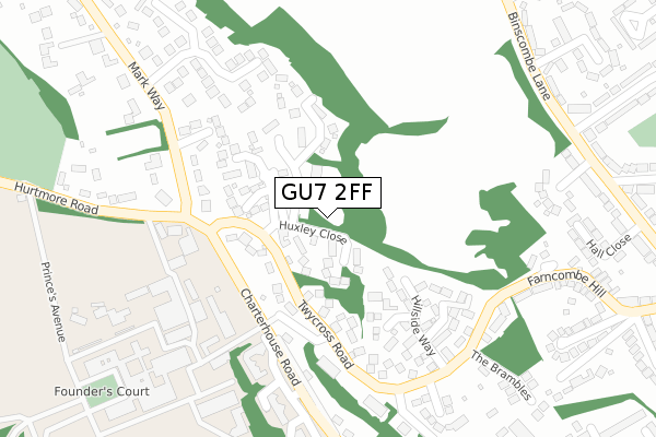
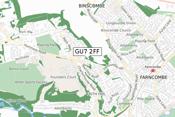
GU7 2FF is located in the Godalming Binscombe & Charterhouse electoral ward, within the local authority district of Waverley and the English Parliamentary constituency of South West Surrey. The Sub Integrated Care Board (ICB) Location is NHS Surrey Heartlands ICB - 92A and the police force is Surrey. This postcode has been in use since November 2019.


GetTheData
Source: OS Open Zoomstack (Ordnance Survey)
Licence: Open Government Licence (requires attribution)
Attribution: Contains OS data © Crown copyright and database right 2025
Source: Open Postcode Geo
Licence: Open Government Licence (requires attribution)
Attribution: Contains OS data © Crown copyright and database right 2025; Contains Royal Mail data © Royal Mail copyright and database right 2025; Source: Office for National Statistics licensed under the Open Government Licence v.3.0
| Easting | 496666 |
| Northing | 145340 |
| Latitude | 51.199105 |
| Longitude | -0.617838 |
GetTheData
Source: Open Postcode Geo
Licence: Open Government Licence
| Country | England |
| Postcode District | GU7 |
➜ See where GU7 is on a map ➜ Where is Farncombe? | |
GetTheData
Source: Land Registry Price Paid Data
Licence: Open Government Licence
| Ward | Godalming Binscombe & Charterhouse |
| Constituency | South West Surrey |
GetTheData
Source: ONS Postcode Database
Licence: Open Government Licence
| Chapel Fields (Charterhouse Road) | Farncombe | 217m |
| Charterhouse School (Hurtmore Road) | Charterhouse | 271m |
| Charterhouse School (Hurtmore Road) | Charterhouse | 275m |
| Chapel Fields (Charterhouse Road) | Farncombe | 324m |
| Shops (Binscombe Lane) | Binscombe | 365m |
| Farncombe Station | 1km |
| Godalming Station | 1.4km |
| Shalford (Surrey) Station | 3.9km |
GetTheData
Source: NaPTAN
Licence: Open Government Licence
GetTheData
Source: ONS Postcode Database
Licence: Open Government Licence


➜ Get more ratings from the Food Standards Agency
GetTheData
Source: Food Standards Agency
Licence: FSA terms & conditions
| Last Collection | |||
|---|---|---|---|
| Location | Mon-Fri | Sat | Distance |
| Charterhouse Bridge | 17:00 | 12:00 | 210m |
| Mark Way | 17:00 | 12:00 | 249m |
| Tilthams Green | 16:00 | 12:00 | 267m |
GetTheData
Source: Dracos
Licence: Creative Commons Attribution-ShareAlike
The below table lists the International Territorial Level (ITL) codes (formerly Nomenclature of Territorial Units for Statistics (NUTS) codes) and Local Administrative Units (LAU) codes for GU7 2FF:
| ITL 1 Code | Name |
|---|---|
| TLJ | South East (England) |
| ITL 2 Code | Name |
| TLJ2 | Surrey, East and West Sussex |
| ITL 3 Code | Name |
| TLJ25 | West Surrey |
| LAU 1 Code | Name |
| E07000216 | Waverley |
GetTheData
Source: ONS Postcode Directory
Licence: Open Government Licence
The below table lists the Census Output Area (OA), Lower Layer Super Output Area (LSOA), and Middle Layer Super Output Area (MSOA) for GU7 2FF:
| Code | Name | |
|---|---|---|
| OA | E00157628 | |
| LSOA | E01030919 | Waverley 007D |
| MSOA | E02006445 | Waverley 007 |
GetTheData
Source: ONS Postcode Directory
Licence: Open Government Licence
| GU7 2AP | Guildway Houses | 92m |
| GU7 2AS | Huxley Close | 106m |
| GU7 2QR | Brackenlea | 127m |
| GU7 2HH | Twycross Road | 127m |
| GU7 2QS | Markenhorn | 128m |
| GU7 2AR | Mcalmont Ridge | 131m |
| GU7 2QU | Sellars Hill | 179m |
| GU7 2BU | Applegarth | 186m |
| GU7 2HW | Davies Close | 206m |
| GU7 2HN | Hillside Way | 238m |
GetTheData
Source: Open Postcode Geo; Land Registry Price Paid Data
Licence: Open Government Licence