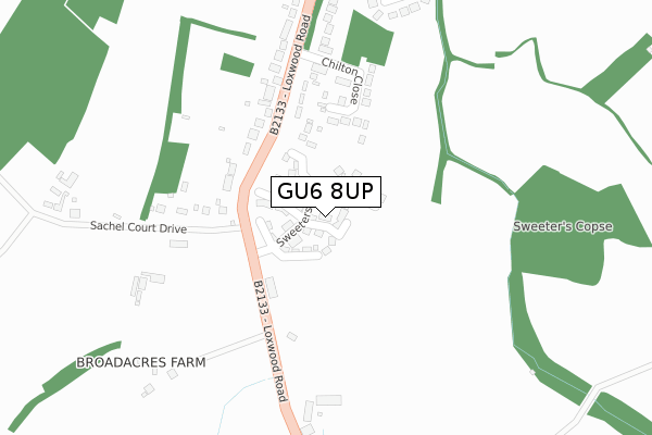
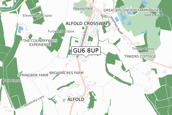
GU6 8UP is located in the Alfold, Dunsfold & Hascombe electoral ward, within the local authority district of Waverley and the English Parliamentary constituency of Guildford. The Sub Integrated Care Board (ICB) Location is NHS Surrey Heartlands ICB - 92A and the police force is Surrey. This postcode has been in use since April 2019.


GetTheData
Source: OS Open Zoomstack (Ordnance Survey)
Licence: Open Government Licence (requires attribution)
Attribution: Contains OS data © Crown copyright and database right 2025
Source: Open Postcode Geo
Licence: Open Government Licence (requires attribution)
Attribution: Contains OS data © Crown copyright and database right 2025; Contains Royal Mail data © Royal Mail copyright and database right 2025; Source: Office for National Statistics licensed under the Open Government Licence v.3.0
| Easting | 503958 |
| Northing | 134562 |
| Latitude | 51.100942 |
| Longitude | -0.516614 |
GetTheData
Source: Open Postcode Geo
Licence: Open Government Licence
| Country | England |
| Postcode District | GU6 |
➜ See where GU6 is on a map | |
GetTheData
Source: Land Registry Price Paid Data
Licence: Open Government Licence
| Ward | Alfold, Dunsfold & Hascombe |
| Constituency | Guildford |
GetTheData
Source: ONS Postcode Database
Licence: Open Government Licence
| Chiltern Close (Loxwood Road) | Alfold | 324m |
| Chiltern Close (Loxwood Road) | Alfold | 335m |
| Clappers Meadow (Loxwood Road) | Alfold Crossways | 426m |
| Clappers Meadow (Loxwood Road) | Alfold Crossways | 475m |
| Rosemary Lane (Loxwood Road) | Alfold | 580m |
GetTheData
Source: NaPTAN
Licence: Open Government Licence
GetTheData
Source: ONS Postcode Database
Licence: Open Government Licence


➜ Get more ratings from the Food Standards Agency
GetTheData
Source: Food Standards Agency
Licence: FSA terms & conditions
| Last Collection | |||
|---|---|---|---|
| Location | Mon-Fri | Sat | Distance |
| Alfold Post Office | 16:15 | 10:30 | 538m |
| Alfold Crossways | 16:15 | 09:45 | 757m |
| Whitelea | 16:45 | 07:15 | 908m |
GetTheData
Source: Dracos
Licence: Creative Commons Attribution-ShareAlike
The below table lists the International Territorial Level (ITL) codes (formerly Nomenclature of Territorial Units for Statistics (NUTS) codes) and Local Administrative Units (LAU) codes for GU6 8UP:
| ITL 1 Code | Name |
|---|---|
| TLJ | South East (England) |
| ITL 2 Code | Name |
| TLJ2 | Surrey, East and West Sussex |
| ITL 3 Code | Name |
| TLJ25 | West Surrey |
| LAU 1 Code | Name |
| E07000216 | Waverley |
GetTheData
Source: ONS Postcode Directory
Licence: Open Government Licence
The below table lists the Census Output Area (OA), Lower Layer Super Output Area (LSOA), and Middle Layer Super Output Area (MSOA) for GU6 8UP:
| Code | Name | |
|---|---|---|
| OA | E00157365 | |
| LSOA | E01030862 | Waverley 015A |
| MSOA | E02006453 | Waverley 015 |
GetTheData
Source: ONS Postcode Directory
Licence: Open Government Licence
| GU6 8HB | Chilton Close | 215m |
| GU6 8HR | Sachel Court Drive | 248m |
| GU6 8HL | Loxwood Road | 254m |
| GU6 8HN | Loxwood Road | 276m |
| GU6 8HP | Loxwood Road | 405m |
| GU6 8HJ | Clappers Meadow | 432m |
| GU6 8HH | Clappers Meadow | 444m |
| GU6 8HW | Loxwood Road | 457m |
| GU6 8ER | Loxwood Road | 540m |
| GU6 8EA | Glebelands Meadow | 544m |
GetTheData
Source: Open Postcode Geo; Land Registry Price Paid Data
Licence: Open Government Licence