GU6 7FS maps, stats, and open data
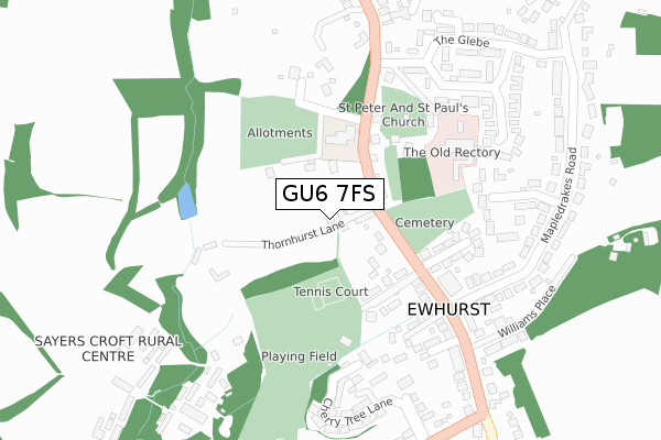
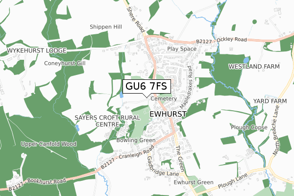
GU6 7FS is located in the Ewhurst & Ellens Green electoral ward, within the local authority district of Waverley and the English Parliamentary constituency of Guildford. The Sub Integrated Care Board (ICB) Location is NHS Surrey Heartlands ICB - 92A and the police force is Surrey. This postcode has been in use since August 2017.
GU6 7FS maps


Licence: Open Government Licence (requires attribution)
Attribution: Contains OS data © Crown copyright and database right 2025
Source: Open Postcode Geo
Licence: Open Government Licence (requires attribution)
Attribution: Contains OS data © Crown copyright and database right 2025; Contains Royal Mail data © Royal Mail copyright and database right 2025; Source: Office for National Statistics licensed under the Open Government Licence v.3.0
GU6 7FS geodata
| Easting | 509021 |
| Northing | 140323 |
| Latitude | 51.151787 |
| Longitude | -0.442590 |
Where is GU6 7FS?
| Country | England |
| Postcode District | GU6 |
Politics
| Ward | Ewhurst & Ellens Green |
|---|---|
| Constituency | Guildford |
House Prices
Sales of detached houses in GU6 7FS
THE BARN, THORNHURST BROOK FARM, THORNHURST LANE, EWHURST, CRANLEIGH, GU6 7FS 2022 6 JAN £1,150,000 |
THE STABLES, THORNHURST BROOK FARM, THORNHURST LANE, EWHURST, CRANLEIGH, GU6 7FS 2021 17 DEC £866,000 |
Licence: Contains HM Land Registry data © Crown copyright and database right 2025. This data is licensed under the Open Government Licence v3.0.
Transport
Nearest bus stops to GU6 7FS
| The Glebe (The Street) | Ewhurst | 146m |
| The Glebe (The Street) | Ewhurst | 238m |
| Post Office (The Green) | Ewhurst | 277m |
| Post Office (The Green) | Ewhurst | 301m |
| Gadbridge Lane (Cranleigh Road) | Ewhurst | 437m |
Broadband
Broadband access in GU6 7FS (2020 data)
| Percentage of properties with Next Generation Access | 100.0% |
| Percentage of properties with Superfast Broadband | 100.0% |
| Percentage of properties with Ultrafast Broadband | 0.0% |
| Percentage of properties with Full Fibre Broadband | 0.0% |
Superfast Broadband is between 30Mbps and 300Mbps
Ultrafast Broadband is > 300Mbps
Broadband speed in GU6 7FS (2019 data)
Download
| Median download speed | 38.1Mbps |
| Average download speed | 38.2Mbps |
| Maximum download speed | 39.99Mbps |
Upload
| Median upload speed | 9.7Mbps |
| Average upload speed | 9.5Mbps |
| Maximum upload speed | 14.19Mbps |
Broadband limitations in GU6 7FS (2020 data)
| Percentage of properties unable to receive 2Mbps | 0.0% |
| Percentage of properties unable to receive 5Mbps | 0.0% |
| Percentage of properties unable to receive 10Mbps | 0.0% |
| Percentage of properties unable to receive 30Mbps | 0.0% |
Deprivation
15.5% of English postcodes are less deprived than GU6 7FS:Food Standards Agency
Three nearest food hygiene ratings to GU6 7FS (metres)


➜ Get more ratings from the Food Standards Agency
Nearest post box to GU6 7FS
| Last Collection | |||
|---|---|---|---|
| Location | Mon-Fri | Sat | Distance |
| Ewhurst Post Office | 17:15 | 09:15 | 279m |
| Ewhurst Village | 17:00 | 08:45 | 477m |
| Cranleigh Road | 17:15 | 10:15 | 494m |
GU6 7FS ITL and GU6 7FS LAU
The below table lists the International Territorial Level (ITL) codes (formerly Nomenclature of Territorial Units for Statistics (NUTS) codes) and Local Administrative Units (LAU) codes for GU6 7FS:
| ITL 1 Code | Name |
|---|---|
| TLJ | South East (England) |
| ITL 2 Code | Name |
| TLJ2 | Surrey, East and West Sussex |
| ITL 3 Code | Name |
| TLJ25 | West Surrey |
| LAU 1 Code | Name |
| E07000216 | Waverley |
GU6 7FS census areas
The below table lists the Census Output Area (OA), Lower Layer Super Output Area (LSOA), and Middle Layer Super Output Area (MSOA) for GU6 7FS:
| Code | Name | |
|---|---|---|
| OA | E00157456 | |
| LSOA | E01030880 | Waverley 015E |
| MSOA | E02006453 | Waverley 015 |
Nearest postcodes to GU6 7FS
| GU6 7RE | The Street | 77m |
| GU6 7RD | Broomers Lane | 127m |
| GU6 7PX | The Street | 138m |
| GU6 7RA | The Street | 163m |
| GU6 7RF | Mount Close | 198m |
| GU6 7QY | The Street | 226m |
| GU6 7RY | Old Bakery Court | 250m |
| GU6 7RG | Mapledrakes Road | 266m |
| GU6 7PU | Rectory Close | 277m |
| GU6 7QR | Mapledrakes Close | 286m |