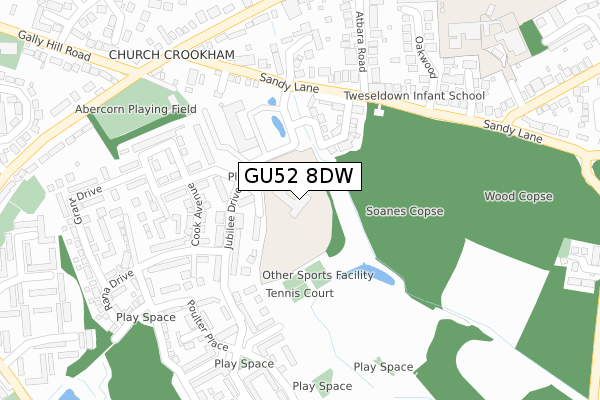
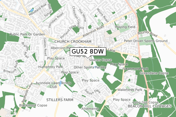
GU52 8DW is located in the Crookham West and Ewshot electoral ward, within the local authority district of Hart and the English Parliamentary constituency of North East Hampshire. The Sub Integrated Care Board (ICB) Location is NHS Frimley ICB - D4U1Y and the police force is Hampshire. This postcode has been in use since February 2020.


GetTheData
Source: OS Open Zoomstack (Ordnance Survey)
Licence: Open Government Licence (requires attribution)
Attribution: Contains OS data © Crown copyright and database right 2025
Source: Open Postcode Geo
Licence: Open Government Licence (requires attribution)
Attribution: Contains OS data © Crown copyright and database right 2025; Contains Royal Mail data © Royal Mail copyright and database right 2025; Source: Office for National Statistics licensed under the Open Government Licence v.3.0
| Easting | 481269 |
| Northing | 151553 |
| Latitude | 51.257357 |
| Longitude | -0.836748 |
GetTheData
Source: Open Postcode Geo
Licence: Open Government Licence
| Country | England |
| Postcode District | GU52 |
➜ See where GU52 is on a map ➜ Where is Fleet? | |
GetTheData
Source: Land Registry Price Paid Data
Licence: Open Government Licence
| Ward | Crookham West And Ewshot |
| Constituency | North East Hampshire |
GetTheData
Source: ONS Postcode Database
Licence: Open Government Licence
| Atbara Road (Sandy Lane) | Church Crookham | 199m |
| Atbara Road (Sandy Lane) | Church Crookham | 215m |
| Manor Court (Sandy Lane) | Church Crookham | 242m |
| Manor Court (Sandy Lane) | Church Crookham | 247m |
| Gally Hill Road (Aldershot Road) | Church Crookham | 363m |
| Fleet Station | 3.7km |
| Winchfield Station | 5.8km |
GetTheData
Source: NaPTAN
Licence: Open Government Licence
GetTheData
Source: ONS Postcode Database
Licence: Open Government Licence


➜ Get more ratings from the Food Standards Agency
GetTheData
Source: Food Standards Agency
Licence: FSA terms & conditions
| Last Collection | |||
|---|---|---|---|
| Location | Mon-Fri | Sat | Distance |
| Copse Corner | 17:00 | 11:30 | 304m |
| Tesco/Esso Service Station | 17:15 | 12:15 | 1,007m |
| Florence Road | 17:30 | 12:30 | 1,064m |
GetTheData
Source: Dracos
Licence: Creative Commons Attribution-ShareAlike
The below table lists the International Territorial Level (ITL) codes (formerly Nomenclature of Territorial Units for Statistics (NUTS) codes) and Local Administrative Units (LAU) codes for GU52 8DW:
| ITL 1 Code | Name |
|---|---|
| TLJ | South East (England) |
| ITL 2 Code | Name |
| TLJ3 | Hampshire and Isle of Wight |
| ITL 3 Code | Name |
| TLJ37 | North Hampshire |
| LAU 1 Code | Name |
| E07000089 | Hart |
GetTheData
Source: ONS Postcode Directory
Licence: Open Government Licence
The below table lists the Census Output Area (OA), Lower Layer Super Output Area (LSOA), and Middle Layer Super Output Area (MSOA) for GU52 8DW:
| Code | Name | |
|---|---|---|
| OA | E00116147 | |
| LSOA | E01022857 | Hart 010E |
| MSOA | E02004760 | Hart 010 |
GetTheData
Source: ONS Postcode Directory
Licence: Open Government Licence
| GU52 8AB | Everest Walk | 82m |
| GU52 8LL | Nepal Gardens | 148m |
| GU52 8AG | Cook Avenue | 166m |
| GU52 8AN | Jubilee Drive | 185m |
| GU52 8AH | Jubilee Drive | 191m |
| GU52 8AE | Walker Close | 194m |
| GU52 8BS | Sandy Lane | 222m |
| GU52 8LD | Sandy Lane | 222m |
| GU52 8LA | Sandy Lane | 233m |
| GU52 8AF | Macintyre Place | 235m |
GetTheData
Source: Open Postcode Geo; Land Registry Price Paid Data
Licence: Open Government Licence