GU51 2AA maps, stats, and open data
- Home
- Postcode
- GU
- GU51
- GU51 2
GU51 2AA is located in the Fleet East electoral ward, within the local authority district of Hart and the English Parliamentary constituency of North East Hampshire. The Sub Integrated Care Board (ICB) Location is NHS Frimley ICB - D4U1Y and the police force is Hampshire. This postcode has been in use since January 2018.
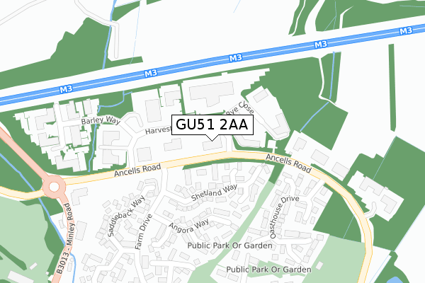
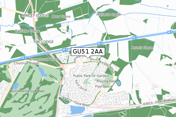
GU51 2AA maps


Source: OS Open Zoomstack (Ordnance Survey)
Licence: Open Government Licence (requires attribution)
Attribution: Contains OS data © Crown copyright and database right 2025
Source: Open Postcode GeoLicence: Open Government Licence (requires attribution)
Attribution: Contains OS data © Crown copyright and database right 2025; Contains Royal Mail data © Royal Mail copyright and database right 2025; Source: Office for National Statistics licensed under the Open Government Licence v.3.0
GU51 2AA geodata
| Easting | 481979 |
| Northing | 156103 |
| Latitude | 51.298161 |
| Longitude | -0.825535 |
Where is GU51 2AA?
| Country | England |
| Postcode District | GU51 |
Politics
| Ward | Fleet East |
|---|
| Constituency | North East Hampshire |
|---|
Transport
Nearest bus stops to GU51 2AA
| Harvest Crescent (Ancells Road) | Ancells Farm | 258m |
| Harvest Crescent (Ancells Road) | Ancells Farm | 262m |
| Angora Way (Farm Drive) | Ancells Farm | 269m |
| Angora Way (Farm Drive) | Ancells Farm | 271m |
| Tamworth Drive (Farm Drive) | Ancells Farm | 343m |
Nearest railway stations to GU51 2AA
| Fleet Station | 0.9km |
| Farnborough (Main) Station | 4.9km |
| Blackwater Station | 5km |
Broadband
Broadband access in GU51 2AA (2020 data)
| Percentage of properties with Next Generation Access | 100.0% |
| Percentage of properties with Superfast Broadband | 100.0% |
| Percentage of properties with Ultrafast Broadband | 0.0% |
| Percentage of properties with Full Fibre Broadband | 0.0% |
Superfast Broadband is between 30Mbps and 300Mbps
Ultrafast Broadband is > 300Mbps
Broadband speed in GU51 2AA (2019 data)
Download
| Median download speed | 47.0Mbps |
| Average download speed | 41.0Mbps |
| Maximum download speed | 80.00Mbps |
Upload
| Median upload speed | 9.9Mbps |
| Average upload speed | 9.1Mbps |
| Maximum upload speed | 20.00Mbps |
Broadband limitations in GU51 2AA (2020 data)
| Percentage of properties unable to receive 2Mbps | 0.0% |
| Percentage of properties unable to receive 5Mbps | 0.0% |
| Percentage of properties unable to receive 10Mbps | 0.0% |
| Percentage of properties unable to receive 30Mbps | 0.0% |
Deprivation
3.3% of English postcodes are less deprived than
GU51 2AA:
Food Standards Agency
Three nearest food hygiene ratings to GU51 2AA (metres)
Baxterstorey - Keysight Fleet 5156
New Era Chinese Takeaway
Ancells Farm Pre-School
Ancells Farm Community Centre
372m
➜ Get more ratings from the Food Standards Agency
Nearest post box to GU51 2AA
| | Last Collection | |
|---|
| Location | Mon-Fri | Sat | Distance |
|---|
| Ancells Park | 18:45 | | 67m |
| Ancells Farm Post Office | 18:00 | 12:45 | 395m |
| Royal Mail Delivery Office | 18:45 | 11:45 | 1,113m |
GU51 2AA ITL and GU51 2AA LAU
The below table lists the International Territorial Level (ITL) codes (formerly Nomenclature of Territorial Units for Statistics (NUTS) codes) and Local Administrative Units (LAU) codes for GU51 2AA:
| ITL 1 Code | Name |
|---|
| TLJ | South East (England) |
| ITL 2 Code | Name |
|---|
| TLJ3 | Hampshire and Isle of Wight |
| ITL 3 Code | Name |
|---|
| TLJ37 | North Hampshire |
| LAU 1 Code | Name |
|---|
| E07000089 | Hart |
GU51 2AA census areas
The below table lists the Census Output Area (OA), Lower Layer Super Output Area (LSOA), and Middle Layer Super Output Area (MSOA) for GU51 2AA:
| Code | Name |
|---|
| OA | E00116197 | |
|---|
| LSOA | E01022867 | Hart 005D |
|---|
| MSOA | E02004755 | Hart 005 |
|---|
Nearest postcodes to GU51 2AA


