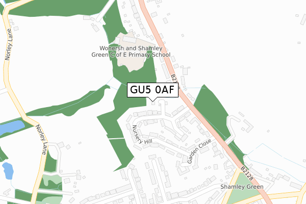
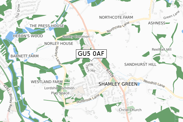
GU5 0AF is located in the Bramley & Wonersh electoral ward, within the local authority district of Waverley and the English Parliamentary constituency of Guildford. The Sub Integrated Care Board (ICB) Location is NHS Surrey Heartlands ICB - 92A and the police force is Surrey. This postcode has been in use since March 2018.


GetTheData
Source: OS Open Zoomstack (Ordnance Survey)
Licence: Open Government Licence (requires attribution)
Attribution: Contains OS data © Crown copyright and database right 2025
Source: Open Postcode Geo
Licence: Open Government Licence (requires attribution)
Attribution: Contains OS data © Crown copyright and database right 2025; Contains Royal Mail data © Royal Mail copyright and database right 2025; Source: Office for National Statistics licensed under the Open Government Licence v.3.0
| Easting | 502839 |
| Northing | 144116 |
| Latitude | 51.187026 |
| Longitude | -0.529866 |
GetTheData
Source: Open Postcode Geo
Licence: Open Government Licence
| Country | England |
| Postcode District | GU5 |
➜ See where GU5 is on a map ➜ Where is Shamley Green? | |
GetTheData
Source: Land Registry Price Paid Data
Licence: Open Government Licence
| Ward | Bramley & Wonersh |
| Constituency | Guildford |
GetTheData
Source: ONS Postcode Database
Licence: Open Government Licence
| Nursery Hill (Guildford Road) | Shamley Green | 135m |
| Nursery Hill (Guildford Road) | Shamley Green | 169m |
| Wonersh And Shamley Green School (Guildford Road) | Shamley Green | 200m |
| Wonersh And Shamley Green School (Guildford Road) | Shamley Green | 200m |
| Lords Hill Turning (Cranleigh Road) | Shamley Green | 439m |
| Chilworth Station | 3.2km |
| Shalford (Surrey) Station | 4km |
GetTheData
Source: NaPTAN
Licence: Open Government Licence
| Percentage of properties with Next Generation Access | 100.0% |
| Percentage of properties with Superfast Broadband | 100.0% |
| Percentage of properties with Ultrafast Broadband | 0.0% |
| Percentage of properties with Full Fibre Broadband | 0.0% |
Superfast Broadband is between 30Mbps and 300Mbps
Ultrafast Broadband is > 300Mbps
| Percentage of properties unable to receive 2Mbps | 0.0% |
| Percentage of properties unable to receive 5Mbps | 0.0% |
| Percentage of properties unable to receive 10Mbps | 0.0% |
| Percentage of properties unable to receive 30Mbps | 0.0% |
GetTheData
Source: Ofcom
Licence: Ofcom Terms of Use (requires attribution)
GetTheData
Source: ONS Postcode Database
Licence: Open Government Licence


➜ Get more ratings from the Food Standards Agency
GetTheData
Source: Food Standards Agency
Licence: FSA terms & conditions
| Last Collection | |||
|---|---|---|---|
| Location | Mon-Fri | Sat | Distance |
| Shamley Green Post Office | 17:00 | 11:30 | 483m |
| Lords Hill | 17:00 | 09:30 | 492m |
| East End | 16:45 | 08:00 | 868m |
GetTheData
Source: Dracos
Licence: Creative Commons Attribution-ShareAlike
The below table lists the International Territorial Level (ITL) codes (formerly Nomenclature of Territorial Units for Statistics (NUTS) codes) and Local Administrative Units (LAU) codes for GU5 0AF:
| ITL 1 Code | Name |
|---|---|
| TLJ | South East (England) |
| ITL 2 Code | Name |
| TLJ2 | Surrey, East and West Sussex |
| ITL 3 Code | Name |
| TLJ25 | West Surrey |
| LAU 1 Code | Name |
| E07000216 | Waverley |
GetTheData
Source: ONS Postcode Directory
Licence: Open Government Licence
The below table lists the Census Output Area (OA), Lower Layer Super Output Area (LSOA), and Middle Layer Super Output Area (MSOA) for GU5 0AF:
| Code | Name | |
|---|---|---|
| OA | E00157733 | |
| LSOA | E01030940 | Waverley 008D |
| MSOA | E02006446 | Waverley 008 |
GetTheData
Source: ONS Postcode Directory
Licence: Open Government Licence
| GU5 0UL | Nursery Hill | 103m |
| GU5 0UN | Nursery Hill | 140m |
| GU5 0RS | Guildford Road | 156m |
| GU5 0RT | Guildford Road | 212m |
| GU5 0UW | Garden Close | 215m |
| GU5 0UR | Sweet Water Close | 223m |
| GU5 0UJ | The Green | 247m |
| GU5 0UX | Stonards Brow | 249m |
| GU5 0UP | Sweetwater Lane | 315m |
| GU5 0UY | Stonards Brow | 346m |
GetTheData
Source: Open Postcode Geo; Land Registry Price Paid Data
Licence: Open Government Licence