GU46 7AP maps, stats, and open data
- Home
- Postcode
- GU
- GU46
- GU46 7
GU46 7AP is located in the Yateley East electoral ward, within the local authority district of Hart and the English Parliamentary constituency of North East Hampshire. The Sub Integrated Care Board (ICB) Location is NHS Frimley ICB - D4U1Y and the police force is Hampshire. This postcode has been in use since January 2018.
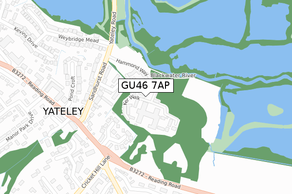
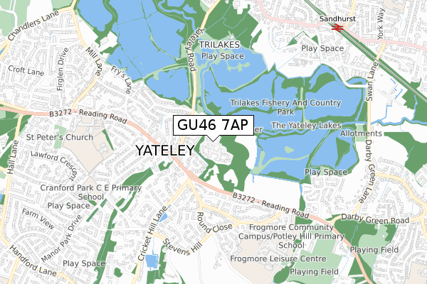
GU46 7AP maps


Source: OS Open Zoomstack (Ordnance Survey)
Licence: Open Government Licence (requires attribution)
Attribution: Contains OS data © Crown copyright and database right 2025
Source: Open Postcode GeoLicence: Open Government Licence (requires attribution)
Attribution: Contains OS data © Crown copyright and database right 2025; Contains Royal Mail data © Royal Mail copyright and database right 2025; Source: Office for National Statistics licensed under the Open Government Licence v.3.0
GU46 7AP geodata
| Easting | 482672 |
| Northing | 160844 |
| Latitude | 51.340682 |
| Longitude | -0.814499 |
Where is GU46 7AP?
| Country | England |
| Postcode District | GU46 |
Politics
| Ward | Yateley East |
|---|
| Constituency | North East Hampshire |
|---|
Transport
Nearest bus stops to GU46 7AP
| Lodge Grove (Reading Road) | Yateley | 226m |
| Potley Hill Roundabout (Reading Road) | Yateley | 256m |
| Fiske Court (Potley Hill Road) | Yateley | 294m |
| Manor Park (Reading Road) | Yateley | 304m |
| Fiske Court (Potley Hill Road) | Yateley | 304m |
Nearest railway stations to GU46 7AP
| Sandhurst Station | 1km |
| Blackwater Station | 2.8km |
| Crowthorne Station | 2.9km |
Broadband
Broadband access in GU46 7AP (2020 data)
| Percentage of properties with Next Generation Access | 100.0% |
| Percentage of properties with Superfast Broadband | 100.0% |
| Percentage of properties with Ultrafast Broadband | 100.0% |
| Percentage of properties with Full Fibre Broadband | 100.0% |
Superfast Broadband is between 30Mbps and 300Mbps
Ultrafast Broadband is > 300Mbps
Broadband limitations in GU46 7AP (2020 data)
| Percentage of properties unable to receive 2Mbps | 0.0% |
| Percentage of properties unable to receive 5Mbps | 0.0% |
| Percentage of properties unable to receive 10Mbps | 0.0% |
| Percentage of properties unable to receive 30Mbps | 0.0% |
Deprivation
6.9% of English postcodes are less deprived than
GU46 7AP:
Food Standards Agency
Three nearest food hygiene ratings to GU46 7AP (metres)
The Royal Oak
Rice Restaurant
News Letter
➜ Get more ratings from the Food Standards Agency
Nearest post box to GU46 7AP
| | Last Collection | |
|---|
| Location | Mon-Fri | Sat | Distance |
|---|
| The Parade Post Office | 17:00 | 12:30 | 300m |
| Round Close | 16:15 | 11:30 | 391m |
| Fiske Court | 16:15 | 11:30 | 429m |
GU46 7AP ITL and GU46 7AP LAU
The below table lists the International Territorial Level (ITL) codes (formerly Nomenclature of Territorial Units for Statistics (NUTS) codes) and Local Administrative Units (LAU) codes for GU46 7AP:
| ITL 1 Code | Name |
|---|
| TLJ | South East (England) |
| ITL 2 Code | Name |
|---|
| TLJ3 | Hampshire and Isle of Wight |
| ITL 3 Code | Name |
|---|
| TLJ37 | North Hampshire |
| LAU 1 Code | Name |
|---|
| E07000089 | Hart |
GU46 7AP census areas
The below table lists the Census Output Area (OA), Lower Layer Super Output Area (LSOA), and Middle Layer Super Output Area (MSOA) for GU46 7AP:
| Code | Name |
|---|
| OA | E00116322 | |
|---|
| LSOA | E01022891 | Hart 001B |
|---|
| MSOA | E02004751 | Hart 001 |
|---|
Nearest postcodes to GU46 7AP


