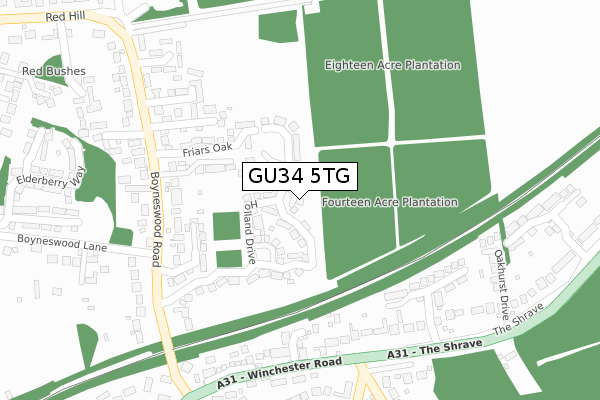
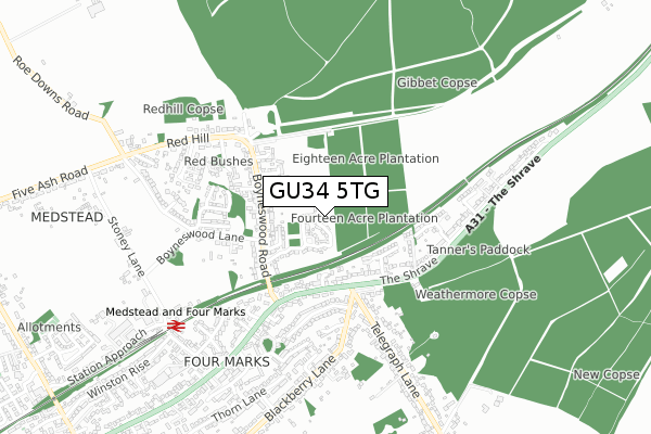
GU34 5TG is located in the Four Marks & Medstead electoral ward, within the local authority district of East Hampshire and the English Parliamentary constituency of East Hampshire. The Sub Integrated Care Board (ICB) Location is NHS Hampshire and Isle of Wight ICB - D9Y0V and the police force is Hampshire. This postcode has been in use since March 2019.


GetTheData
Source: OS Open Zoomstack (Ordnance Survey)
Licence: Open Government Licence (requires attribution)
Attribution: Contains OS data © Crown copyright and database right 2025
Source: Open Postcode Geo
Licence: Open Government Licence (requires attribution)
Attribution: Contains OS data © Crown copyright and database right 2025; Contains Royal Mail data © Royal Mail copyright and database right 2025; Source: Office for National Statistics licensed under the Open Government Licence v.3.0
| Easting | 467457 |
| Northing | 135748 |
| Latitude | 51.117056 |
| Longitude | -1.037613 |
GetTheData
Source: Open Postcode Geo
Licence: Open Government Licence
| Country | England |
| Postcode District | GU34 |
➜ See where GU34 is on a map | |
GetTheData
Source: Land Registry Price Paid Data
Licence: Open Government Licence
| Ward | Four Marks & Medstead |
| Constituency | East Hampshire |
GetTheData
Source: ONS Postcode Database
Licence: Open Government Licence
| Telegraph Lane (Winchester Road) | Four Marks | 282m |
| Telegraph Lane (Winchester Road) | Four Marks | 283m |
| Hazel Road (Winchester Road) | Four Marks | 557m |
| The Shrave (A31 Winchester Road) | Four Marks | 650m |
| The Shrave (A31 Winchester Road) | Four Marks | 654m |
| Medstead & Four Marks (Mid Hants Railway) | Four Marks | 689m |
| Alton Station | 6.3km |
GetTheData
Source: NaPTAN
Licence: Open Government Licence
| Percentage of properties with Next Generation Access | 100.0% |
| Percentage of properties with Superfast Broadband | 100.0% |
| Percentage of properties with Ultrafast Broadband | 100.0% |
| Percentage of properties with Full Fibre Broadband | 100.0% |
Superfast Broadband is between 30Mbps and 300Mbps
Ultrafast Broadband is > 300Mbps
| Percentage of properties unable to receive 2Mbps | 0.0% |
| Percentage of properties unable to receive 5Mbps | 0.0% |
| Percentage of properties unable to receive 10Mbps | 0.0% |
| Percentage of properties unable to receive 30Mbps | 0.0% |
GetTheData
Source: Ofcom
Licence: Ofcom Terms of Use (requires attribution)
GetTheData
Source: ONS Postcode Database
Licence: Open Government Licence


➜ Get more ratings from the Food Standards Agency
GetTheData
Source: Food Standards Agency
Licence: FSA terms & conditions
| Last Collection | |||
|---|---|---|---|
| Location | Mon-Fri | Sat | Distance |
| Boyneswood Road | 16:15 | 07:15 | 267m |
| Four Marks Post Office | 17:00 | 11:30 | 704m |
| Five Ash Road | 16:00 | 08:00 | 851m |
GetTheData
Source: Dracos
Licence: Creative Commons Attribution-ShareAlike
The below table lists the International Territorial Level (ITL) codes (formerly Nomenclature of Territorial Units for Statistics (NUTS) codes) and Local Administrative Units (LAU) codes for GU34 5TG:
| ITL 1 Code | Name |
|---|---|
| TLJ | South East (England) |
| ITL 2 Code | Name |
| TLJ3 | Hampshire and Isle of Wight |
| ITL 3 Code | Name |
| TLJ36 | Central Hampshire |
| LAU 1 Code | Name |
| E07000085 | East Hampshire |
GetTheData
Source: ONS Postcode Directory
Licence: Open Government Licence
The below table lists the Census Output Area (OA), Lower Layer Super Output Area (LSOA), and Middle Layer Super Output Area (MSOA) for GU34 5TG:
| Code | Name | |
|---|---|---|
| OA | E00114873 | |
| LSOA | E01022594 | East Hampshire 007C |
| MSOA | E02004703 | East Hampshire 007 |
GetTheData
Source: ONS Postcode Directory
Licence: Open Government Licence
| GU34 5EU | Friars Oak | 166m |
| GU34 5FT | Watercress Way | 172m |
| GU34 5EA | Boyneswood Road | 217m |
| GU34 5FS | Watercress Way | 219m |
| GU34 5FJ | Thornybush Gardens | 221m |
| GU34 5BF | Chawton End Close | 254m |
| GU34 5FX | Handyside Place | 279m |
| GU34 5FY | Charters Close | 298m |
| GU34 5HD | Winchester Road | 307m |
| GU34 5EB | Boyneswood Close | 310m |
GetTheData
Source: Open Postcode Geo; Land Registry Price Paid Data
Licence: Open Government Licence