GU34 5QL maps, stats, and open data
GU34 5QL is located in the Four Marks & Medstead electoral ward, within the local authority district of East Hampshire and the English Parliamentary constituency of East Hampshire. The Sub Integrated Care Board (ICB) Location is NHS Hampshire and Isle of Wight ICB - D9Y0V and the police force is Hampshire. This postcode has been in use since July 2018.
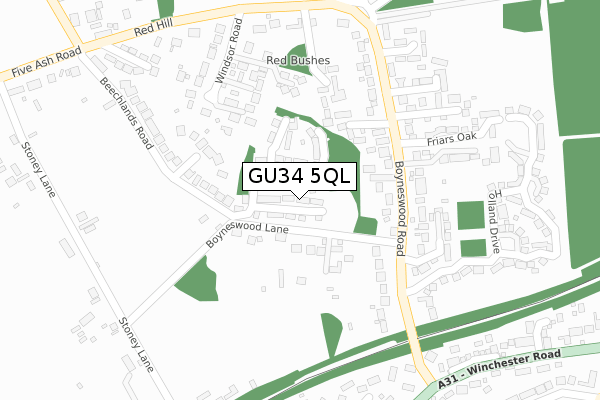
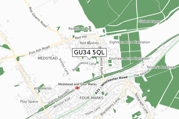
GU34 5QL maps


Licence: Open Government Licence (requires attribution)
Attribution: Contains OS data © Crown copyright and database right 2025
Source: Open Postcode Geo
Licence: Open Government Licence (requires attribution)
Attribution: Contains OS data © Crown copyright and database right 2025; Contains Royal Mail data © Royal Mail copyright and database right 2025; Source: Office for National Statistics licensed under the Open Government Licence v.3.0
GU34 5QL geodata
| Easting | 467049 |
| Northing | 135730 |
| Latitude | 51.116942 |
| Longitude | -1.043444 |
Where is GU34 5QL?
| Country | England |
| Postcode District | GU34 |
Politics
| Ward | Four Marks & Medstead |
|---|---|
| Constituency | East Hampshire |
House Prices
Sales of detached houses in GU34 5QL
2025 25 MAR £535,000 |
2022 3 MAY £497,000 |
1, MULBERRY GARDENS, MEDSTEAD, ALTON, GU34 5QL 2019 4 JUN £649,995 |
5, MULBERRY GARDENS, MEDSTEAD, ALTON, GU34 5QL 2018 28 SEP £424,950 |
4, MULBERRY GARDENS, MEDSTEAD, ALTON, GU34 5QL 2018 28 SEP £400,000 |
2018 28 SEP £399,950 |
2018 27 SEP £380,000 |
Licence: Contains HM Land Registry data © Crown copyright and database right 2025. This data is licensed under the Open Government Licence v3.0.
Transport
Nearest bus stops to GU34 5QL
| Hazel Road (Winchester Road) | Four Marks | 461m |
| Telegraph Lane (Winchester Road) | Four Marks | 546m |
| Station Approach (Winchester Road) | Four Marks | 549m |
| Telegraph Lane (Winchester Road) | Four Marks | 582m |
| The Gospel Hall (Winchester Road) | Four Marks | 739m |
Nearest underground/metro/tram to GU34 5QL
| Medstead & Four Marks (Mid Hants Railway) | Four Marks | 412m |
Broadband
Broadband access in GU34 5QL (2020 data)
| Percentage of properties with Next Generation Access | 100.0% |
| Percentage of properties with Superfast Broadband | 100.0% |
| Percentage of properties with Ultrafast Broadband | 100.0% |
| Percentage of properties with Full Fibre Broadband | 100.0% |
Superfast Broadband is between 30Mbps and 300Mbps
Ultrafast Broadband is > 300Mbps
Broadband limitations in GU34 5QL (2020 data)
| Percentage of properties unable to receive 2Mbps | 0.0% |
| Percentage of properties unable to receive 5Mbps | 0.0% |
| Percentage of properties unable to receive 10Mbps | 0.0% |
| Percentage of properties unable to receive 30Mbps | 0.0% |
Deprivation
15.6% of English postcodes are less deprived than GU34 5QL:Food Standards Agency
Three nearest food hygiene ratings to GU34 5QL (metres)


➜ Get more ratings from the Food Standards Agency
Nearest post box to GU34 5QL
| Last Collection | |||
|---|---|---|---|
| Location | Mon-Fri | Sat | Distance |
| Boyneswood Road | 16:15 | 07:15 | 207m |
| Five Ash Road | 16:00 | 08:00 | 476m |
| Four Marks Post Office | 17:00 | 11:30 | 571m |
GU34 5QL ITL and GU34 5QL LAU
The below table lists the International Territorial Level (ITL) codes (formerly Nomenclature of Territorial Units for Statistics (NUTS) codes) and Local Administrative Units (LAU) codes for GU34 5QL:
| ITL 1 Code | Name |
|---|---|
| TLJ | South East (England) |
| ITL 2 Code | Name |
| TLJ3 | Hampshire and Isle of Wight |
| ITL 3 Code | Name |
| TLJ36 | Central Hampshire |
| LAU 1 Code | Name |
| E07000085 | East Hampshire |
GU34 5QL census areas
The below table lists the Census Output Area (OA), Lower Layer Super Output Area (LSOA), and Middle Layer Super Output Area (MSOA) for GU34 5QL:
| Code | Name | |
|---|---|---|
| OA | E00114873 | |
| LSOA | E01022594 | East Hampshire 007C |
| MSOA | E02004703 | East Hampshire 007 |
Nearest postcodes to GU34 5QL
| GU34 5DZ | Boyneswood Lane | 86m |
| GU34 5FQ | Bluebell Gardens | 142m |
| GU34 5FF | Red Bushes Close | 206m |
| GU34 5EA | Boyneswood Road | 211m |
| GU34 5EF | Windsor Road | 226m |
| GU34 5EQ | Beechlands Road | 228m |
| GU34 5DY | Boyneswood Road | 235m |
| GU34 5FS | Watercress Way | 246m |
| GU34 5FT | Watercress Way | 251m |
| GU34 5FJ | Thornybush Gardens | 281m |