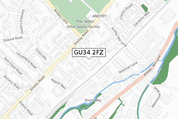
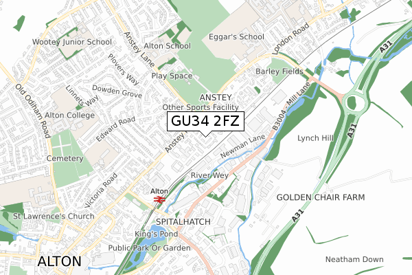
GU34 2FZ is located in the Alton Holybourne electoral ward, within the local authority district of East Hampshire and the English Parliamentary constituency of East Hampshire. The Sub Integrated Care Board (ICB) Location is NHS Hampshire and Isle of Wight ICB - D9Y0V and the police force is Hampshire. This postcode has been in use since January 2018.


GetTheData
Source: OS Open Zoomstack (Ordnance Survey)
Licence: Open Government Licence (requires attribution)
Attribution: Contains OS data © Crown copyright and database right 2025
Source: Open Postcode Geo
Licence: Open Government Licence (requires attribution)
Attribution: Contains OS data © Crown copyright and database right 2025; Contains Royal Mail data © Royal Mail copyright and database right 2025; Source: Office for National Statistics licensed under the Open Government Licence v.3.0
| Easting | 472622 |
| Northing | 140067 |
| Latitude | 51.155257 |
| Longitude | -0.962964 |
GetTheData
Source: Open Postcode Geo
Licence: Open Government Licence
| Country | England |
| Postcode District | GU34 |
➜ See where GU34 is on a map ➜ Where is Alton? | |
GetTheData
Source: Land Registry Price Paid Data
Licence: Open Government Licence
| Ward | Alton Holybourne |
| Constituency | East Hampshire |
GetTheData
Source: ONS Postcode Database
Licence: Open Government Licence
2025 17 JAN £560,000 |
2024 6 DEC £490,000 |
2023 11 OCT £580,000 |
2022 11 NOV £650,000 |
2022 26 AUG £580,000 |
2022 30 JUN £477,000 |
2022 14 APR £450,000 |
2019 28 JUN £389,000 |
77, GOSWELL SQUARE, ALTON, GU34 2FZ 2019 30 MAY £507,000 |
75, GOSWELL SQUARE, ALTON, GU34 2FZ 2019 3 MAY £505,500 |
GetTheData
Source: HM Land Registry Price Paid Data
Licence: Contains HM Land Registry data © Crown copyright and database right 2025. This data is licensed under the Open Government Licence v3.0.
| Anstey Lane (Anstey Road) | Holybourne | 106m |
| Anstey Lane | Holybourne | 161m |
| Health Centre (Anstey Road) | Holybourne | 213m |
| Edward Road | Holybourne | 240m |
| Rowan Industrial Park (Mill Lane) | Alton | 275m |
| Alton (Mid-hants Railway) | Alton | 457m |
| Alton Station | 0.5km |
GetTheData
Source: NaPTAN
Licence: Open Government Licence
| Percentage of properties with Next Generation Access | 100.0% |
| Percentage of properties with Superfast Broadband | 100.0% |
| Percentage of properties with Ultrafast Broadband | 65.1% |
| Percentage of properties with Full Fibre Broadband | 0.0% |
Superfast Broadband is between 30Mbps and 300Mbps
Ultrafast Broadband is > 300Mbps
| Median download speed | 20.8Mbps |
| Average download speed | 32.7Mbps |
| Maximum download speed | 80.00Mbps |
| Median upload speed | 1.2Mbps |
| Average upload speed | 5.2Mbps |
| Maximum upload speed | 20.00Mbps |
| Percentage of properties unable to receive 2Mbps | 0.0% |
| Percentage of properties unable to receive 5Mbps | 0.0% |
| Percentage of properties unable to receive 10Mbps | 0.0% |
| Percentage of properties unable to receive 30Mbps | 0.0% |
GetTheData
Source: Ofcom
Licence: Ofcom Terms of Use (requires attribution)
GetTheData
Source: ONS Postcode Database
Licence: Open Government Licence


➜ Get more ratings from the Food Standards Agency
GetTheData
Source: Food Standards Agency
Licence: FSA terms & conditions
| Last Collection | |||
|---|---|---|---|
| Location | Mon-Fri | Sat | Distance |
| Newman Lane | 18:30 | 12:00 | 269m |
| Newman Lane Industrial Estate | 18:30 | 12:00 | 273m |
| Southview Rise | 17:15 | 10:45 | 425m |
GetTheData
Source: Dracos
Licence: Creative Commons Attribution-ShareAlike
The below table lists the International Territorial Level (ITL) codes (formerly Nomenclature of Territorial Units for Statistics (NUTS) codes) and Local Administrative Units (LAU) codes for GU34 2FZ:
| ITL 1 Code | Name |
|---|---|
| TLJ | South East (England) |
| ITL 2 Code | Name |
| TLJ3 | Hampshire and Isle of Wight |
| ITL 3 Code | Name |
| TLJ36 | Central Hampshire |
| LAU 1 Code | Name |
| E07000085 | East Hampshire |
GetTheData
Source: ONS Postcode Directory
Licence: Open Government Licence
The below table lists the Census Output Area (OA), Lower Layer Super Output Area (LSOA), and Middle Layer Super Output Area (MSOA) for GU34 2FZ:
| Code | Name | |
|---|---|---|
| OA | E00114764 | |
| LSOA | E01022574 | East Hampshire 002A |
| MSOA | E02004698 | East Hampshire 002 |
GetTheData
Source: ONS Postcode Directory
Licence: Open Government Licence
| GU34 2RG | John Eggars Square | 110m |
| GU34 2QT | Anstey Mill Close | 131m |
| GU34 2RL | Anstey Road | 142m |
| GU34 2RH | Anstey Lane | 167m |
| GU34 2UZ | Adams Way | 181m |
| GU34 2RW | Shipley Close | 189m |
| GU34 2UU | Adams Way | 210m |
| GU34 2UY | Adams Way | 227m |
| GU34 2NA | Anstey Lane | 231m |
| GU34 2QP | Anstey Mill Lane | 240m |
GetTheData
Source: Open Postcode Geo; Land Registry Price Paid Data
Licence: Open Government Licence