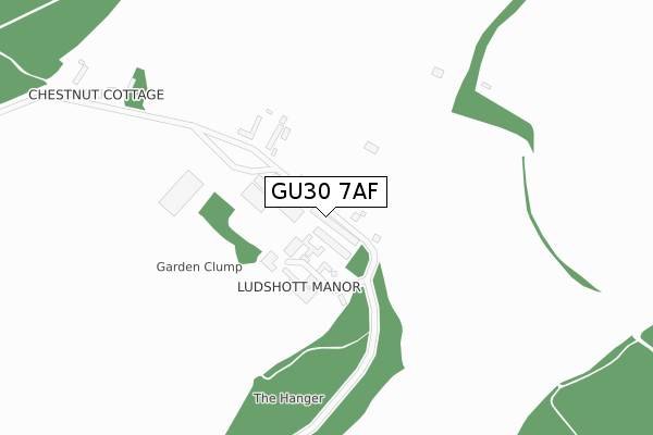
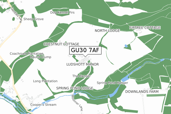
GU30 7AF is located in the Bramshott & Liphook electoral ward, within the local authority district of East Hampshire and the English Parliamentary constituency of East Hampshire. The Sub Integrated Care Board (ICB) Location is NHS Hampshire and Isle of Wight ICB - D9Y0V and the police force is Hampshire. This postcode has been in use since December 2019.


GetTheData
Source: OS Open Zoomstack (Ordnance Survey)
Licence: Open Government Licence (requires attribution)
Attribution: Contains OS data © Crown copyright and database right 2025
Source: Open Postcode Geo
Licence: Open Government Licence (requires attribution)
Attribution: Contains OS data © Crown copyright and database right 2025; Contains Royal Mail data © Royal Mail copyright and database right 2025; Source: Office for National Statistics licensed under the Open Government Licence v.3.0
| Easting | 484295 |
| Northing | 134195 |
| Latitude | 51.100867 |
| Longitude | -0.797460 |
GetTheData
Source: Open Postcode Geo
Licence: Open Government Licence
| Country | England |
| Postcode District | GU30 |
➜ See where GU30 is on a map | |
GetTheData
Source: Land Registry Price Paid Data
Licence: Open Government Licence
| Ward | Bramshott & Liphook |
| Constituency | East Hampshire |
GetTheData
Source: ONS Postcode Database
Licence: Open Government Licence
| Liphook Station | 3.3km |
GetTheData
Source: NaPTAN
Licence: Open Government Licence
GetTheData
Source: ONS Postcode Database
Licence: Open Government Licence


➜ Get more ratings from the Food Standards Agency
GetTheData
Source: Food Standards Agency
Licence: FSA terms & conditions
| Last Collection | |||
|---|---|---|---|
| Location | Mon-Fri | Sat | Distance |
| Bramshott Court | 16:00 | 07:45 | 1,143m |
| Bramshott | 17:00 | 07:30 | 1,268m |
| Bramshott | 17:00 | 10:00 | 1,352m |
GetTheData
Source: Dracos
Licence: Creative Commons Attribution-ShareAlike
The below table lists the International Territorial Level (ITL) codes (formerly Nomenclature of Territorial Units for Statistics (NUTS) codes) and Local Administrative Units (LAU) codes for GU30 7AF:
| ITL 1 Code | Name |
|---|---|
| TLJ | South East (England) |
| ITL 2 Code | Name |
| TLJ3 | Hampshire and Isle of Wight |
| ITL 3 Code | Name |
| TLJ36 | Central Hampshire |
| LAU 1 Code | Name |
| E07000085 | East Hampshire |
GetTheData
Source: ONS Postcode Directory
Licence: Open Government Licence
The below table lists the Census Output Area (OA), Lower Layer Super Output Area (LSOA), and Middle Layer Super Output Area (MSOA) for GU30 7AF:
| Code | Name | |
|---|---|---|
| OA | E00114827 | |
| LSOA | E01022586 | East Hampshire 009D |
| MSOA | E02004705 | East Hampshire 009 |
GetTheData
Source: ONS Postcode Directory
Licence: Open Government Licence
| GU30 7RD | Woolmer Lane | 83m |
| GU30 7RA | Woolmer Lane | 844m |
| GU26 6DU | Ludshott Common | 902m |
| GU30 7RF | Tunbridge Lane | 1064m |
| GU30 7QZ | Rectory Lane | 1086m |
| GU30 7SL | Limes Close | 1146m |
| GU30 7SJ | Rectory Lane | 1159m |
| GU30 7RG | Bramshott Court | 1220m |
| GU30 7SP | Tunbridge Lane | 1274m |
| GU30 7RY | Gentles Lane | 1310m |
GetTheData
Source: Open Postcode Geo; Land Registry Price Paid Data
Licence: Open Government Licence