Property/Postcode Data Search:
GU15 3DG maps, stats, and open data
GU15 3DG is located in the Town electoral ward, within the local authority district of Surrey Heath and the English Parliamentary constituency of Surrey Heath. The Sub Integrated Care Board (ICB) Location is NHS Frimley ICB - D4U1Y and the police force is Surrey. This postcode has been in use since August 2019.
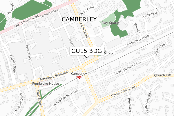
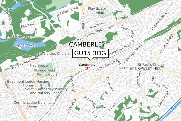
GU15 3DG maps


Source: OS Open Zoomstack (Ordnance Survey)
Licence: Open Government Licence (requires attribution)
Attribution: Contains OS data © Crown copyright and database right 2025
Source: Open Postcode Geo
Licence: Open Government Licence (requires attribution)
Attribution: Contains OS data © Crown copyright and database right 2025; Contains Royal Mail data © Royal Mail copyright and database right 2025; Source: Office for National Statistics licensed under the Open Government Licence v.3.0
Licence: Open Government Licence (requires attribution)
Attribution: Contains OS data © Crown copyright and database right 2025
Source: Open Postcode Geo
Licence: Open Government Licence (requires attribution)
Attribution: Contains OS data © Crown copyright and database right 2025; Contains Royal Mail data © Royal Mail copyright and database right 2025; Source: Office for National Statistics licensed under the Open Government Licence v.3.0
GU15 3DG geodata
| Easting | 487647 |
| Northing | 160555 |
| Latitude | 51.337339 |
| Longitude | -0.743164 |
Where is GU15 3DG?
| Country | England |
| Postcode District | GU15 |
Politics
| Ward | Town |
|---|---|
| Constituency | Surrey Heath |
Transport
Nearest bus stops to GU15 3DG
| Pembroke Broadway | Camberley | 108m |
| Pembroke Broadway | Camberley | 126m |
| Pembroke Broadway | Camberley | 130m |
| Pembroke Broadway | Camberley | 139m |
| Knoll Road | Camberley | 142m |
Nearest railway stations to GU15 3DG
| Camberley Station | 0.1km |
| Blackwater Station | 2.4km |
| Frimley Station | 2.8km |
Deprivation
26.3% of English postcodes are less deprived than GU15 3DG:Food Standards Agency
Three nearest food hygiene ratings to GU15 3DG (metres)
Station Tap / KT / CB / LL / 88th / VM / SC / PA / DM

71-73 High Street
27m
The Claude Du Vall

77 - 81 High Street
28m
Bar-B-Q Pit

75 High Street
30m
➜ Get more ratings from the Food Standards Agency
Nearest post box to GU15 3DG
| Last Collection | |||
|---|---|---|---|
| Location | Mon-Fri | Sat | Distance |
| High Street | 17:45 | 12:30 | 45m |
| Camberley Post Office | 18:45 | 12:30 | 109m |
| Obelisk Way | 17:45 | 12:30 | 243m |
GU15 3DG ITL and GU15 3DG LAU
The below table lists the International Territorial Level (ITL) codes (formerly Nomenclature of Territorial Units for Statistics (NUTS) codes) and Local Administrative Units (LAU) codes for GU15 3DG:
| ITL 1 Code | Name |
|---|---|
| TLJ | South East (England) |
| ITL 2 Code | Name |
| TLJ2 | Surrey, East and West Sussex |
| ITL 3 Code | Name |
| TLJ25 | West Surrey |
| LAU 1 Code | Name |
| E07000214 | Surrey Heath |
GU15 3DG census areas
The below table lists the Census Output Area (OA), Lower Layer Super Output Area (LSOA), and Middle Layer Super Output Area (MSOA) for GU15 3DG:
| Code | Name | |
|---|---|---|
| OA | E00167807 | |
| LSOA | E01030800 | Surrey Heath 005E |
| MSOA | E02006420 | Surrey Heath 005 |
Nearest postcodes to GU15 3DG
| GU15 3SZ | Portesbery Road | 30m |
| GU15 3RB | High Street | 118m |
| GU15 2HP | Upper Gordon Road | 125m |
| GU15 3RS | High Street | 127m |
| GU15 3SY | Knoll Road | 134m |
| GU15 2HE | Upper Gordon Road | 146m |
| GU15 3TA | Portesbery Road | 169m |
| GU15 3SP | Princess Way | 174m |
| GU15 3XD | Pembroke Broadway | 179m |
| GU15 2EH | Upper Gordon Road | 194m |