Property/Postcode Data Search:
GL7 5FF maps, stats, and open data
GL7 5FF is located in the Coln Valley electoral ward, within the local authority district of Cotswold and the English Parliamentary constituency of The Cotswolds. The Sub Integrated Care Board (ICB) Location is NHS Gloucestershire ICB - 11M and the police force is Gloucestershire. This postcode has been in use since November 2018.
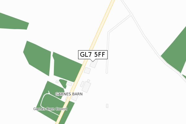
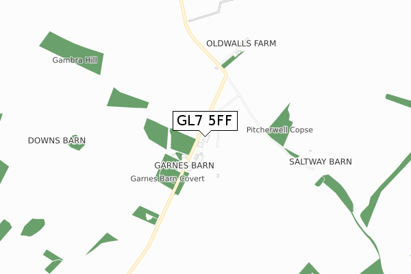
GL7 5FF maps


Source: OS Open Zoomstack (Ordnance Survey)
Licence: Open Government Licence (requires attribution)
Attribution: Contains OS data © Crown copyright and database right 2025
Source: Open Postcode Geo
Licence: Open Government Licence (requires attribution)
Attribution: Contains OS data © Crown copyright and database right 2025; Contains Royal Mail data © Royal Mail copyright and database right 2025; Source: Office for National Statistics licensed under the Open Government Licence v.3.0
Licence: Open Government Licence (requires attribution)
Attribution: Contains OS data © Crown copyright and database right 2025
Source: Open Postcode Geo
Licence: Open Government Licence (requires attribution)
Attribution: Contains OS data © Crown copyright and database right 2025; Contains Royal Mail data © Royal Mail copyright and database right 2025; Source: Office for National Statistics licensed under the Open Government Licence v.3.0
GL7 5FF geodata
| Easting | 411110 |
| Northing | 209404 |
| Latitude | 51.783196 |
| Longitude | -1.840339 |
Where is GL7 5FF?
| Country | England |
| Postcode District | GL7 |
Politics
| Ward | Coln Valley |
|---|---|
| Constituency | The Cotswolds |
Deprivation
39.1% of English postcodes are less deprived than GL7 5FF:Food Standards Agency
Three nearest food hygiene ratings to GL7 5FF (metres)
The Classic Motor Hub

Old Walls
1,533m
➜ Get more ratings from the Food Standards Agency
Nearest post box to GL7 5FF
| Last Collection | |||
|---|---|---|---|
| Location | Mon-Fri | Sat | Distance |
| Calcot | 15:45 | 07:30 | 2,295m |
| Coln Rogers | 15:45 | 08:00 | 2,545m |
| Bibury Court | 16:30 | 09:15 | 2,675m |
GL7 5FF ITL and GL7 5FF LAU
The below table lists the International Territorial Level (ITL) codes (formerly Nomenclature of Territorial Units for Statistics (NUTS) codes) and Local Administrative Units (LAU) codes for GL7 5FF:
| ITL 1 Code | Name |
|---|---|
| TLK | South West (England) |
| ITL 2 Code | Name |
| TLK1 | Gloucestershire, Wiltshire and Bath/Bristol area |
| ITL 3 Code | Name |
| TLK13 | Gloucestershire CC |
| LAU 1 Code | Name |
| E07000079 | Cotswold |
GL7 5FF census areas
The below table lists the Census Output Area (OA), Lower Layer Super Output Area (LSOA), and Middle Layer Super Output Area (MSOA) for GL7 5FF:
| Code | Name | |
|---|---|---|
| OA | E00112686 | |
| LSOA | E01022175 | Cotswold 005A |
| MSOA | E02004619 | Cotswold 005 |
Nearest postcodes to GL7 5FF
| GL7 5NX | Ablington | 1503m |
| GL7 5NU | Ablington | 1780m |
| GL7 5NY | Ablington | 1912m |
| GL7 5ER | 2103m | |
| GL7 5ES | 2174m | |
| GL7 5EW | 2243m | |
| GL54 3JZ | 2293m | |
| GL7 5EN | 2304m | |
| GL54 3LB | 2449m | |
| GL7 5PA | Aldsworth Road | 2455m |