Property/Postcode Data Search:
GL7 5FD maps, stats, and open data
GL7 5FD is located in the The Ampneys & Hampton electoral ward, within the local authority district of Cotswold and the English Parliamentary constituency of The Cotswolds. The Sub Integrated Care Board (ICB) Location is NHS Gloucestershire ICB - 11M and the police force is Gloucestershire. This postcode has been in use since November 2017.
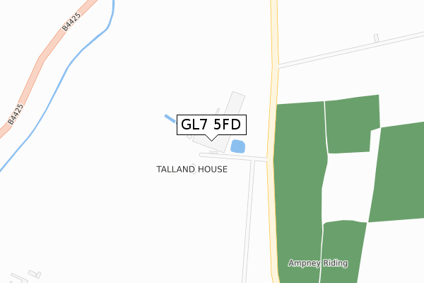
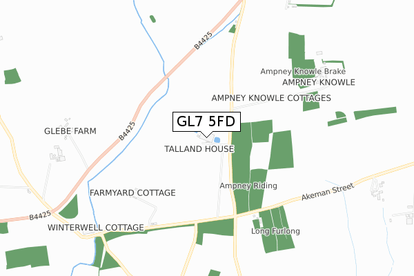
GL7 5FD maps


Source: OS Open Zoomstack (Ordnance Survey)
Licence: Open Government Licence (requires attribution)
Attribution: Contains OS data © Crown copyright and database right 2025
Source: Open Postcode Geo
Licence: Open Government Licence (requires attribution)
Attribution: Contains OS data © Crown copyright and database right 2025; Contains Royal Mail data © Royal Mail copyright and database right 2025; Source: Office for National Statistics licensed under the Open Government Licence v.3.0
Licence: Open Government Licence (requires attribution)
Attribution: Contains OS data © Crown copyright and database right 2025
Source: Open Postcode Geo
Licence: Open Government Licence (requires attribution)
Attribution: Contains OS data © Crown copyright and database right 2025; Contains Royal Mail data © Royal Mail copyright and database right 2025; Source: Office for National Statistics licensed under the Open Government Licence v.3.0
GL7 5FD geodata
| Easting | 407211 |
| Northing | 203990 |
| Latitude | 51.734581 |
| Longitude | -1.896971 |
Where is GL7 5FD?
| Country | England |
| Postcode District | GL7 |
Politics
| Ward | The Ampneys & Hampton |
|---|---|
| Constituency | The Cotswolds |
Transport
Nearest bus stops to GL7 5FD
| Ampneyfield Cottages (Akeman Street Roman Road) | Ampney Crucis | 638m |
| Barnsley House (B4425) | Barnsley | 1,056m |
| Barnsley House (B4425) | Barnsley | 1,068m |
| The Village Pub (B4425) | Barnsley | 1,247m |
| The Village Pub (B4425) | Barnsley | 1,252m |
Deprivation
39.1% of English postcodes are less deprived than GL7 5FD:Food Standards Agency
Three nearest food hygiene ratings to GL7 5FD (metres)
Talland School Of Equitation

Dairy Farm
459m
Caterlink At Ampney Crucis C Of E Primary School

Ampney Crucis C Of E Primary School
1,829m
Deer Park School

Stroud Road
1,917m
➜ Get more ratings from the Food Standards Agency
Nearest post box to GL7 5FD
| Last Collection | |||
|---|---|---|---|
| Location | Mon-Fri | Sat | Distance |
| Cirencester Post Office | 17:30 | 12:30 | 2,702m |
| New Mills | 17:15 | 11:45 | 4,145m |
| Poulton P.o. | 17:30 | 11:30 | 4,162m |
GL7 5FD ITL and GL7 5FD LAU
The below table lists the International Territorial Level (ITL) codes (formerly Nomenclature of Territorial Units for Statistics (NUTS) codes) and Local Administrative Units (LAU) codes for GL7 5FD:
| ITL 1 Code | Name |
|---|---|
| TLK | South West (England) |
| ITL 2 Code | Name |
| TLK1 | Gloucestershire, Wiltshire and Bath/Bristol area |
| ITL 3 Code | Name |
| TLK13 | Gloucestershire CC |
| LAU 1 Code | Name |
| E07000079 | Cotswold |
GL7 5FD census areas
The below table lists the Census Output Area (OA), Lower Layer Super Output Area (LSOA), and Middle Layer Super Output Area (MSOA) for GL7 5FD:
| Code | Name | |
|---|---|---|
| OA | E00112682 | |
| LSOA | E01022175 | Cotswold 005A |
| MSOA | E02004619 | Cotswold 005 |
Nearest postcodes to GL7 5FD
| GL7 5ED | 460m | |
| GL7 5DY | Barnsley Road | 855m |
| GL7 5EE | 1023m | |
| GL7 5EB | 1088m | |
| GL7 5EJ | 1285m | |
| GL7 5EF | 1297m | |
| GL7 5DZ | Sheephouse Lane | 1458m |
| GL7 5DX | Barnsley Road | 1642m |
| GL7 5SA | 1664m | |
| GL7 5HG | Hilcot End | 1667m |