Property/Postcode Data Search:
GL56 0FT maps, stats, and open data
GL56 0FT is located in the Fosseridge electoral ward, within the local authority district of Cotswold and the English Parliamentary constituency of The Cotswolds. The Sub Integrated Care Board (ICB) Location is NHS Gloucestershire ICB - 11M and the police force is Gloucestershire. This postcode has been in use since January 2020.
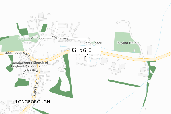
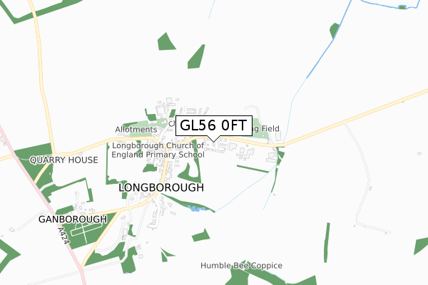
GL56 0FT maps


Source: OS Open Zoomstack (Ordnance Survey)
Licence: Open Government Licence (requires attribution)
Attribution: Contains OS data © Crown copyright and database right 2025
Source: Open Postcode Geo
Licence: Open Government Licence (requires attribution)
Attribution: Contains OS data © Crown copyright and database right 2025; Contains Royal Mail data © Royal Mail copyright and database right 2025; Source: Office for National Statistics licensed under the Open Government Licence v.3.0
Licence: Open Government Licence (requires attribution)
Attribution: Contains OS data © Crown copyright and database right 2025
Source: Open Postcode Geo
Licence: Open Government Licence (requires attribution)
Attribution: Contains OS data © Crown copyright and database right 2025; Contains Royal Mail data © Royal Mail copyright and database right 2025; Source: Office for National Statistics licensed under the Open Government Licence v.3.0
GL56 0FT geodata
| Easting | 418198 |
| Northing | 229617 |
| Latitude | 51.964747 |
| Longitude | -1.736533 |
Where is GL56 0FT?
| Country | England |
| Postcode District | GL56 |
Politics
| Ward | Fosseridge |
|---|---|
| Constituency | The Cotswolds |
Transport
Nearest bus stops to GL56 0FT
| Orchard Rise (High Street) | Longborough | 273m |
| Primary School (High Street) | Longborough | 282m |
| Primary School | Longborough | 291m |
| The Coach & Horses (Ganborough Road) | Longborough | 324m |
| Sussex Lodge (Longborough Road) | Sezincote | 1,505m |
Nearest railway stations to GL56 0FT
| Moreton-in-Marsh Station | 3.9km |
Deprivation
37.7% of English postcodes are less deprived than GL56 0FT:Food Standards Agency
Three nearest food hygiene ratings to GL56 0FT (metres)
Caterlink At Longborough C Of E School

Longborough C Of E School
266m
Sezincote House

Sezincote
1,591m
Holmleigh Dairy

Donnington
1,954m
➜ Get more ratings from the Food Standards Agency
Nearest post box to GL56 0FT
| Last Collection | |||
|---|---|---|---|
| Location | Mon-Fri | Sat | Distance |
| Church Street | 17:00 | 10:45 | 3,500m |
| High Street | 17:00 | 10:45 | 3,643m |
| Police Station | 16:45 | 09:30 | 3,805m |
GL56 0FT ITL and GL56 0FT LAU
The below table lists the International Territorial Level (ITL) codes (formerly Nomenclature of Territorial Units for Statistics (NUTS) codes) and Local Administrative Units (LAU) codes for GL56 0FT:
| ITL 1 Code | Name |
|---|---|
| TLK | South West (England) |
| ITL 2 Code | Name |
| TLK1 | Gloucestershire, Wiltshire and Bath/Bristol area |
| ITL 3 Code | Name |
| TLK13 | Gloucestershire CC |
| LAU 1 Code | Name |
| E07000079 | Cotswold |
GL56 0FT census areas
The below table lists the Census Output Area (OA), Lower Layer Super Output Area (LSOA), and Middle Layer Super Output Area (MSOA) for GL56 0FT:
| Code | Name | |
|---|---|---|
| OA | E00112854 | |
| LSOA | E01022205 | Cotswold 002C |
| MSOA | E02004616 | Cotswold 002 |
Nearest postcodes to GL56 0FT
| GL56 0QH | Charlesway | 87m |
| GL56 0QN | 92m | |
| GL56 0QW | Charlesway | 121m |
| GL56 0QQ | Moreton Road | 184m |
| GL56 0QP | Beanhill | 186m |
| GL56 0QJ | Moreton Road | 218m |
| GL56 0QS | The Folly | 237m |
| GL56 0QR | Chapel Lane | 248m |
| GL56 0QD | School Square | 267m |
| GL56 0QT | Church Street | 293m |