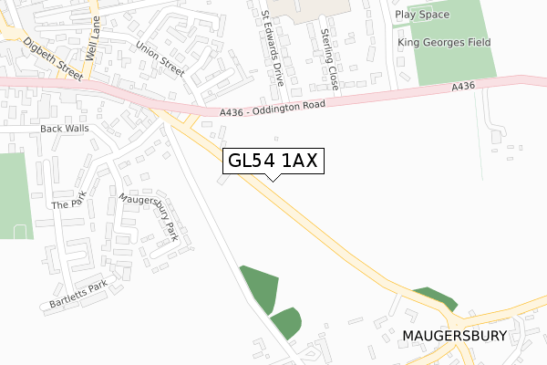
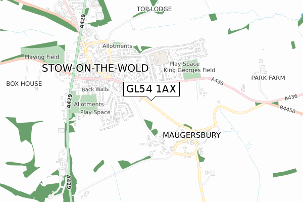
GL54 1AX is located in the Stow electoral ward, within the local authority district of Cotswold and the English Parliamentary constituency of The Cotswolds. The Sub Integrated Care Board (ICB) Location is NHS Gloucestershire ICB - 11M and the police force is Gloucestershire. This postcode has been in use since September 2019.


GetTheData
Source: OS Open Zoomstack (Ordnance Survey)
Licence: Open Government Licence (requires attribution)
Attribution: Contains OS data © Crown copyright and database right 2025
Source: Open Postcode Geo
Licence: Open Government Licence (requires attribution)
Attribution: Contains OS data © Crown copyright and database right 2025; Contains Royal Mail data © Royal Mail copyright and database right 2025; Source: Office for National Statistics licensed under the Open Government Licence v.3.0
| Easting | 419635 |
| Northing | 225496 |
| Latitude | 51.927647 |
| Longitude | -1.715851 |
GetTheData
Source: Open Postcode Geo
Licence: Open Government Licence
| Country | England |
| Postcode District | GL54 |
➜ See where GL54 is on a map ➜ Where is Stow-on-the-Wold? | |
GetTheData
Source: Land Registry Price Paid Data
Licence: Open Government Licence
| Ward | Stow |
| Constituency | The Cotswolds |
GetTheData
Source: ONS Postcode Database
Licence: Open Government Licence
| The Bell Inn (Park Street) | Stow-on-the-wold | 193m |
| The Bell Inn (Oddington Road) | Stow-on-the-wold | 196m |
| King George's Field (Oddington Road) | Stow-on-the-wold | 292m |
| Primary School | Stow-on-the-wold | 314m |
| King George's Field (Oddington Road) | Stow-on-the-wold | 325m |
GetTheData
Source: NaPTAN
Licence: Open Government Licence
GetTheData
Source: ONS Postcode Database
Licence: Open Government Licence


➜ Get more ratings from the Food Standards Agency
GetTheData
Source: Food Standards Agency
Licence: FSA terms & conditions
| Last Collection | |||
|---|---|---|---|
| Location | Mon-Fri | Sat | Distance |
| Police Station | 16:45 | 09:30 | 685m |
| Lower Swell | 16:45 | 09:15 | 2,276m |
| Oddington Top | 16:00 | 09:00 | 2,552m |
GetTheData
Source: Dracos
Licence: Creative Commons Attribution-ShareAlike
The below table lists the International Territorial Level (ITL) codes (formerly Nomenclature of Territorial Units for Statistics (NUTS) codes) and Local Administrative Units (LAU) codes for GL54 1AX:
| ITL 1 Code | Name |
|---|---|
| TLK | South West (England) |
| ITL 2 Code | Name |
| TLK1 | Gloucestershire, Wiltshire and Bath/Bristol area |
| ITL 3 Code | Name |
| TLK13 | Gloucestershire CC |
| LAU 1 Code | Name |
| E07000079 | Cotswold |
GetTheData
Source: ONS Postcode Directory
Licence: Open Government Licence
The below table lists the Census Output Area (OA), Lower Layer Super Output Area (LSOA), and Middle Layer Super Output Area (MSOA) for GL54 1AX:
| Code | Name | |
|---|---|---|
| OA | E00112708 | |
| LSOA | E01022177 | Cotswold 002A |
| MSOA | E02004616 | Cotswold 002 |
GetTheData
Source: ONS Postcode Directory
Licence: Open Government Licence
| GL54 1BY | Mount Pleasant Close | 177m |
| GL54 1AJ | Park Street | 193m |
| GL54 1DU | Maugersbury Park | 213m |
| GL54 1AL | Oddington Road | 226m |
| GL54 1LX | Condurrow Court | 229m |
| GL54 1DT | Lower Park Street | 231m |
| GL54 1AW | St Edwards Drive | 237m |
| GL54 1AH | Lower Park Street | 240m |
| GL54 1AN | Sterling Close | 244m |
| GL54 1BP | Union Street | 251m |
GetTheData
Source: Open Postcode Geo; Land Registry Price Paid Data
Licence: Open Government Licence