Property/Postcode Data Search:
GL53 8DT maps, stats, and open data
GL53 8DT is located in the Charlton Kings electoral ward, within the local authority district of Cheltenham and the English Parliamentary constituency of Cheltenham. The Sub Integrated Care Board (ICB) Location is NHS Gloucestershire ICB - 11M and the police force is Gloucestershire. This postcode has been in use since December 2019.
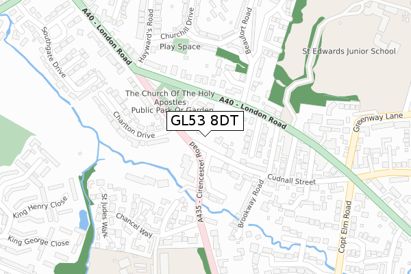
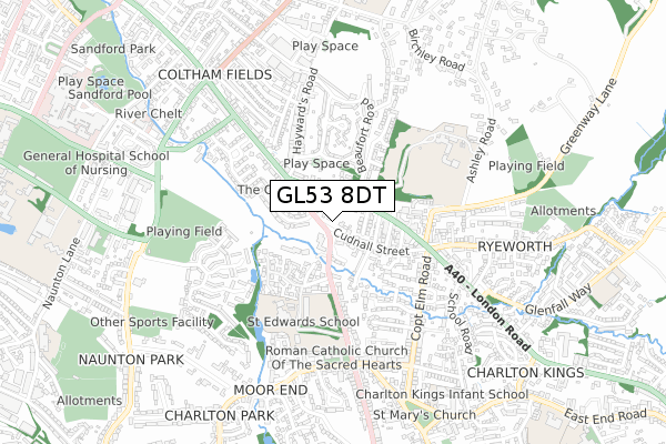
GL53 8DT maps


Source: OS Open Zoomstack (Ordnance Survey)
Licence: Open Government Licence (requires attribution)
Attribution: Contains OS data © Crown copyright and database right 2025
Source: Open Postcode Geo
Licence: Open Government Licence (requires attribution)
Attribution: Contains OS data © Crown copyright and database right 2025; Contains Royal Mail data © Royal Mail copyright and database right 2025; Source: Office for National Statistics licensed under the Open Government Licence v.3.0
Licence: Open Government Licence (requires attribution)
Attribution: Contains OS data © Crown copyright and database right 2025
Source: Open Postcode Geo
Licence: Open Government Licence (requires attribution)
Attribution: Contains OS data © Crown copyright and database right 2025; Contains Royal Mail data © Royal Mail copyright and database right 2025; Source: Office for National Statistics licensed under the Open Government Licence v.3.0
GL53 8DT geodata
| Easting | 396132 |
| Northing | 221155 |
| Latitude | 51.888944 |
| Longitude | -2.057601 |
Where is GL53 8DT?
| Country | England |
| Postcode District | GL53 |
Politics
| Ward | Charlton Kings |
|---|---|
| Constituency | Cheltenham |
House Prices
Sales of detached houses in GL53 8DT
4, BIRCH MEWS, CHARLTON KINGS, CHELTENHAM, GL53 8DT 2021 2 MAR £800,000 |
1, BIRCH MEWS, CHARLTON KINGS, CHELTENHAM, GL53 8DT 2020 4 NOV £950,000 |
3, BIRCH MEWS, CHARLTON KINGS, CHELTENHAM, GL53 8DT 2020 5 OCT £835,000 |
2, BIRCH MEWS, CHARLTON KINGS, CHELTENHAM, GL53 8DT 2020 21 SEP £825,000 |
4, BIRCH MEWS, CHARLTON KINGS, CHELTENHAM, GL53 8DT 2018 26 OCT £1,005,000 |
Source: HM Land Registry Price Paid Data
Licence: Contains HM Land Registry data © Crown copyright and database right 2025. This data is licensed under the Open Government Licence v3.0.
Licence: Contains HM Land Registry data © Crown copyright and database right 2025. This data is licensed under the Open Government Licence v3.0.
Transport
Nearest bus stops to GL53 8DT
| Charlton Court Road (London Road) | Cheltenham | 112m |
| Charlton Court Road (London Road) | Cheltenham | 140m |
| Holy Apostles Church (Cirencester Road) | Charlton Kings | 145m |
| Coronation Flats (Oak Avenue) | Ewens Farm | 236m |
| Six Ways Shops (London Road) | Charlton Kings | 245m |
Nearest railway stations to GL53 8DT
| Cheltenham Spa Station | 3km |
Deprivation
4.7% of English postcodes are less deprived than GL53 8DT:Food Standards Agency
Three nearest food hygiene ratings to GL53 8DT (metres)
Eurest At Spirax Sarco

15 Cirencester Road
74m
The Langton

The Langton Horse
86m
Holy Apostles Church Hall Cafe

The Church Of The Holy Apostle
146m
➜ Get more ratings from the Food Standards Agency
Nearest post box to GL53 8DT
| Last Collection | |||
|---|---|---|---|
| Location | Mon-Fri | Sat | Distance |
| London Road | 17:15 | 12:15 | 287m |
| Six Ways, Charlton Kings | 18:00 | 12:15 | 299m |
| Charlton Church P.o. | 17:30 | 12:00 | 539m |
GL53 8DT ITL and GL53 8DT LAU
The below table lists the International Territorial Level (ITL) codes (formerly Nomenclature of Territorial Units for Statistics (NUTS) codes) and Local Administrative Units (LAU) codes for GL53 8DT:
| ITL 1 Code | Name |
|---|---|
| TLK | South West (England) |
| ITL 2 Code | Name |
| TLK1 | Gloucestershire, Wiltshire and Bath/Bristol area |
| ITL 3 Code | Name |
| TLK13 | Gloucestershire CC |
| LAU 1 Code | Name |
| E07000078 | Cheltenham |
GL53 8DT census areas
The below table lists the Census Output Area (OA), Lower Layer Super Output Area (LSOA), and Middle Layer Super Output Area (MSOA) for GL53 8DT:
| Code | Name | |
|---|---|---|
| OA | E00112367 | |
| LSOA | E01022111 | Cheltenham 012F |
| MSOA | E02004611 | Cheltenham 012 |
Nearest postcodes to GL53 8DT
| GL52 6HD | Langton Gate | 59m |
| GL52 6HT | London Road | 86m |
| GL53 8HS | Cudnall Street | 122m |
| GL53 8HT | Cudnall Street | 135m |
| GL52 6HW | London Road | 137m |
| GL52 6JA | Langton Grove Road | 138m |
| GL52 6JD | Brook Vale | 142m |
| GL53 8HW | Langton Place | 151m |
| GL53 8HE | Brookway Road | 167m |
| GL53 8EP | Cirencester Road | 172m |