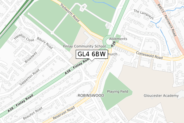
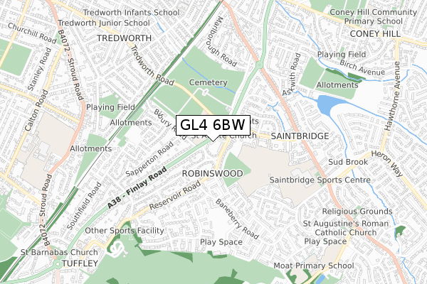
GL4 6BW is located in the Matson, Robinswood and White City electoral ward, within the local authority district of Gloucester and the English Parliamentary constituency of Gloucester. The Sub Integrated Care Board (ICB) Location is NHS Gloucestershire ICB - 11M and the police force is Gloucestershire. This postcode has been in use since June 2018.


GetTheData
Source: OS Open Zoomstack (Ordnance Survey)
Licence: Open Government Licence (requires attribution)
Attribution: Contains OS data © Crown copyright and database right 2025
Source: Open Postcode Geo
Licence: Open Government Licence (requires attribution)
Attribution: Contains OS data © Crown copyright and database right 2025; Contains Royal Mail data © Royal Mail copyright and database right 2025; Source: Office for National Statistics licensed under the Open Government Licence v.3.0
| Easting | 384305 |
| Northing | 216450 |
| Latitude | 51.846431 |
| Longitude | -2.229237 |
GetTheData
Source: Open Postcode Geo
Licence: Open Government Licence
| Country | England |
| Postcode District | GL4 |
➜ See where GL4 is on a map ➜ Where is Gloucester? | |
GetTheData
Source: Land Registry Price Paid Data
Licence: Open Government Licence
| Ward | Matson, Robinswood And White City |
| Constituency | Gloucester |
GetTheData
Source: ONS Postcode Database
Licence: Open Government Licence
| St Aldate Church (Finlay Road) | White City | 35m |
| St Aldate Church (Finlay Road) | White City | 43m |
| St Aldate Church Hall (Reservoir Road) | Robinswood | 65m |
| St Aldate Church Hall (Reservoir Road) | Robinswood | 79m |
| Sapperton Road (Bibury Road) | White City | 121m |
| Gloucester Station | 2.2km |
GetTheData
Source: NaPTAN
Licence: Open Government Licence
| Percentage of properties with Next Generation Access | 100.0% |
| Percentage of properties with Superfast Broadband | 100.0% |
| Percentage of properties with Ultrafast Broadband | 100.0% |
| Percentage of properties with Full Fibre Broadband | 0.0% |
Superfast Broadband is between 30Mbps and 300Mbps
Ultrafast Broadband is > 300Mbps
| Median download speed | 39.1Mbps |
| Average download speed | 31.7Mbps |
| Maximum download speed | 72.14Mbps |
| Median upload speed | 9.8Mbps |
| Average upload speed | 7.6Mbps |
| Maximum upload speed | 20.36Mbps |
| Percentage of properties unable to receive 2Mbps | 0.0% |
| Percentage of properties unable to receive 5Mbps | 0.0% |
| Percentage of properties unable to receive 10Mbps | 0.0% |
| Percentage of properties unable to receive 30Mbps | 0.0% |
GetTheData
Source: Ofcom
Licence: Ofcom Terms of Use (requires attribution)
GetTheData
Source: ONS Postcode Database
Licence: Open Government Licence


➜ Get more ratings from the Food Standards Agency
GetTheData
Source: Food Standards Agency
Licence: FSA terms & conditions
| Last Collection | |||
|---|---|---|---|
| Location | Mon-Fri | Sat | Distance |
| Kingsley Road | 17:30 | 12:15 | 64m |
| The Lampreys | 17:45 | 12:30 | 449m |
| Saintbridge | 17:45 | 12:30 | 571m |
GetTheData
Source: Dracos
Licence: Creative Commons Attribution-ShareAlike
The below table lists the International Territorial Level (ITL) codes (formerly Nomenclature of Territorial Units for Statistics (NUTS) codes) and Local Administrative Units (LAU) codes for GL4 6BW:
| ITL 1 Code | Name |
|---|---|
| TLK | South West (England) |
| ITL 2 Code | Name |
| TLK1 | Gloucestershire, Wiltshire and Bath/Bristol area |
| ITL 3 Code | Name |
| TLK13 | Gloucestershire CC |
| LAU 1 Code | Name |
| E07000081 | Gloucester |
GetTheData
Source: ONS Postcode Directory
Licence: Open Government Licence
The below table lists the Census Output Area (OA), Lower Layer Super Output Area (LSOA), and Middle Layer Super Output Area (MSOA) for GL4 6BW:
| Code | Name | |
|---|---|---|
| OA | E00113467 | |
| LSOA | E01022321 | Gloucester 011C |
| MSOA | E02004646 | Gloucester 011 |
GetTheData
Source: ONS Postcode Directory
Licence: Open Government Licence
| GL4 6TN | Finlay Road | 39m |
| GL4 6RS | Kingsley Road | 77m |
| GL4 6RR | Reservoir Road | 78m |
| GL4 6RW | Reservoir Road | 92m |
| GL4 6RG | Cotteswold Road | 188m |
| GL4 6RF | Country View | 207m |
| GL4 6RT | Reservoir Road | 220m |
| GL4 6SJ | Saffron Close | 255m |
| GL4 6SH | Beaufort Road | 256m |
| GL4 6SG | Beaufort Road | 262m |
GetTheData
Source: Open Postcode Geo; Land Registry Price Paid Data
Licence: Open Government Licence