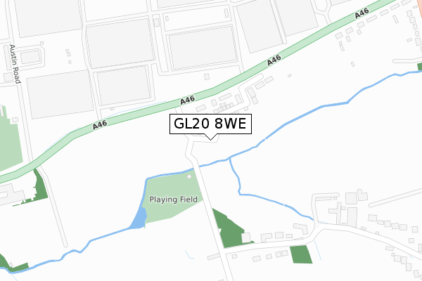
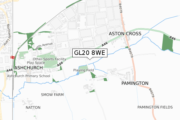
GL20 8WE is located in the Isbourne electoral ward, within the local authority district of Tewkesbury and the English Parliamentary constituency of Tewkesbury. The Sub Integrated Care Board (ICB) Location is NHS Gloucestershire ICB - 11M and the police force is Gloucestershire. This postcode has been in use since June 2019.


GetTheData
Source: OS Open Zoomstack (Ordnance Survey)
Licence: Open Government Licence (requires attribution)
Attribution: Contains OS data © Crown copyright and database right 2025
Source: Open Postcode Geo
Licence: Open Government Licence (requires attribution)
Attribution: Contains OS data © Crown copyright and database right 2025; Contains Royal Mail data © Royal Mail copyright and database right 2025; Source: Office for National Statistics licensed under the Open Government Licence v.3.0
| Easting | 393776 |
| Northing | 233417 |
| Latitude | 51.999169 |
| Longitude | -2.092061 |
GetTheData
Source: Open Postcode Geo
Licence: Open Government Licence
| Country | England |
| Postcode District | GL20 |
➜ See where GL20 is on a map ➜ Where is Ashchurch? | |
GetTheData
Source: Land Registry Price Paid Data
Licence: Open Government Licence
| Ward | Isbourne |
| Constituency | Tewkesbury |
GetTheData
Source: ONS Postcode Database
Licence: Open Government Licence
11, TIRLE BROOK ROAD, PAMINGTON, TEWKESBURY, GL20 8WE 2021 29 OCT £425,000 |
7, TIRLE BROOK ROAD, PAMINGTON, TEWKESBURY, GL20 8WE 2021 30 SEP £425,000 |
5, TIRLE BROOK ROAD, PAMINGTON, TEWKESBURY, GL20 8WE 2021 30 SEP £430,000 |
9, TIRLE BROOK ROAD, PAMINGTON, TEWKESBURY, GL20 8WE 2021 24 SEP £425,000 |
13, TIRLE BROOK ROAD, PAMINGTON, TEWKESBURY, GL20 8WE 2021 30 JUL £419,995 |
17, TIRLE BROOK ROAD, PAMINGTON, TEWKESBURY, GL20 8WE 2021 30 JUN £419,995 |
15, TIRLE BROOK ROAD, PAMINGTON, TEWKESBURY, GL20 8WE 2021 30 JUN £417,500 |
3, TIRLE BROOK ROAD, PAMINGTON, TEWKESBURY, GL20 8WE 2019 31 OCT £410,000 |
1, TIRLE BROOK ROAD, PAMINGTON, TEWKESBURY, GL20 8WE 2019 28 JUN £410,000 |
GetTheData
Source: HM Land Registry Price Paid Data
Licence: Contains HM Land Registry data © Crown copyright and database right 2025. This data is licensed under the Open Government Licence v3.0.
| Pamington Turn (Tewkesbury Road A46) | Ashchurch | 173m |
| Pamington Turn (Tewkesbury Road A46) | Ashchurch | 178m |
| Tewkesbury Road (A46) | Aston Cross | 253m |
| Pamington Farm (Main Street) | Pamington | 333m |
| Tewkesbury Road | Aston Cross | 335m |
| Ashchurch for Tewkesbury Station | 1.1km |
GetTheData
Source: NaPTAN
Licence: Open Government Licence
| Percentage of properties with Next Generation Access | 22.2% |
| Percentage of properties with Superfast Broadband | 22.2% |
| Percentage of properties with Ultrafast Broadband | 22.2% |
| Percentage of properties with Full Fibre Broadband | 22.2% |
Superfast Broadband is between 30Mbps and 300Mbps
Ultrafast Broadband is > 300Mbps
| Percentage of properties unable to receive 2Mbps | 0.0% |
| Percentage of properties unable to receive 5Mbps | 77.8% |
| Percentage of properties unable to receive 10Mbps | 77.8% |
| Percentage of properties unable to receive 30Mbps | 77.8% |
GetTheData
Source: Ofcom
Licence: Ofcom Terms of Use (requires attribution)
GetTheData
Source: ONS Postcode Database
Licence: Open Government Licence


➜ Get more ratings from the Food Standards Agency
GetTheData
Source: Food Standards Agency
Licence: FSA terms & conditions
| Last Collection | |||
|---|---|---|---|
| Location | Mon-Fri | Sat | Distance |
| Aston Cross | 16:50 | 08:00 | 357m |
| The Camp Ashchurch | 16:00 | 10:00 | 795m |
| Aston On Carrant | 16:10 | 07:00 | 1,190m |
GetTheData
Source: Dracos
Licence: Creative Commons Attribution-ShareAlike
The below table lists the International Territorial Level (ITL) codes (formerly Nomenclature of Territorial Units for Statistics (NUTS) codes) and Local Administrative Units (LAU) codes for GL20 8WE:
| ITL 1 Code | Name |
|---|---|
| TLK | South West (England) |
| ITL 2 Code | Name |
| TLK1 | Gloucestershire, Wiltshire and Bath/Bristol area |
| ITL 3 Code | Name |
| TLK13 | Gloucestershire CC |
| LAU 1 Code | Name |
| E07000083 | Tewkesbury |
GetTheData
Source: ONS Postcode Directory
Licence: Open Government Licence
The below table lists the Census Output Area (OA), Lower Layer Super Output Area (LSOA), and Middle Layer Super Output Area (MSOA) for GL20 8WE:
| Code | Name | |
|---|---|---|
| OA | E00113970 | |
| LSOA | E01032938 | Tewkesbury 001F |
| MSOA | E02004666 | Tewkesbury 001 |
GetTheData
Source: ONS Postcode Directory
Licence: Open Government Licence
| GL20 8LX | 385m | |
| GL20 8LN | Thirlebrook Cottages | 429m |
| GL20 8LR | 468m | |
| GL20 8LW | 530m | |
| GL20 8LU | Ellendene Drive | 544m |
| GL20 8LP | 553m | |
| GL20 8LS | 592m | |
| GL20 8LT | 638m | |
| GL20 8UE | Tirlebrook Grange | 653m |
| GL20 8HX | 669m |
GetTheData
Source: Open Postcode Geo; Land Registry Price Paid Data
Licence: Open Government Licence