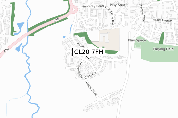
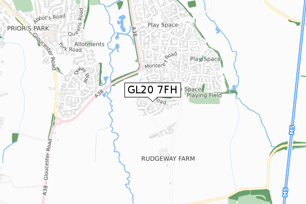
GL20 7FH is located in the Tewkesbury East electoral ward, within the local authority district of Tewkesbury and the English Parliamentary constituency of Tewkesbury. The Sub Integrated Care Board (ICB) Location is NHS Gloucestershire ICB - 11M and the police force is Gloucestershire. This postcode has been in use since December 2018.


GetTheData
Source: OS Open Zoomstack (Ordnance Survey)
Licence: Open Government Licence (requires attribution)
Attribution: Contains OS data © Crown copyright and database right 2025
Source: Open Postcode Geo
Licence: Open Government Licence (requires attribution)
Attribution: Contains OS data © Crown copyright and database right 2025; Contains Royal Mail data © Royal Mail copyright and database right 2025; Source: Office for National Statistics licensed under the Open Government Licence v.3.0
| Easting | 390252 |
| Northing | 231041 |
| Latitude | 51.977755 |
| Longitude | -2.143323 |
GetTheData
Source: Open Postcode Geo
Licence: Open Government Licence
| Country | England |
| Postcode District | GL20 |
➜ See where GL20 is on a map ➜ Where is Tewkesbury? | |
GetTheData
Source: Land Registry Price Paid Data
Licence: Open Government Licence
| Ward | Tewkesbury East |
| Constituency | Tewkesbury |
GetTheData
Source: ONS Postcode Database
Licence: Open Government Licence
18, CHAMOMILE WAY, WALTON CARDIFF, TEWKESBURY, GL20 7FH 2018 18 DEC £312,500 |
20, CHAMOMILE WAY, WALTON CARDIFF, TEWKESBURY, GL20 7FH 2018 18 DEC £385,000 |
GetTheData
Source: HM Land Registry Price Paid Data
Licence: Contains HM Land Registry data © Crown copyright and database right 2025. This data is licensed under the Open Government Licence v3.0.
| Jubilee Way (A38) | Walton Cardiff | 347m |
| River Swilgate (A38) | Tewkesbury | 422m |
| Monterey Road Roundabout (Monterey Road) | Walton Cardiff | 459m |
| Vine Way Path (A38) | Tewkesbury | 470m |
| Mowbray Avenue Path (A38) | Tewkesbury | 538m |
| Ashchurch for Tewkesbury Station | 3.3km |
GetTheData
Source: NaPTAN
Licence: Open Government Licence
| Percentage of properties with Next Generation Access | 100.0% |
| Percentage of properties with Superfast Broadband | 100.0% |
| Percentage of properties with Ultrafast Broadband | 100.0% |
| Percentage of properties with Full Fibre Broadband | 100.0% |
Superfast Broadband is between 30Mbps and 300Mbps
Ultrafast Broadband is > 300Mbps
| Percentage of properties unable to receive 2Mbps | 0.0% |
| Percentage of properties unable to receive 5Mbps | 0.0% |
| Percentage of properties unable to receive 10Mbps | 0.0% |
| Percentage of properties unable to receive 30Mbps | 0.0% |
GetTheData
Source: Ofcom
Licence: Ofcom Terms of Use (requires attribution)
GetTheData
Source: ONS Postcode Database
Licence: Open Government Licence


➜ Get more ratings from the Food Standards Agency
GetTheData
Source: Food Standards Agency
Licence: FSA terms & conditions
| Last Collection | |||
|---|---|---|---|
| Location | Mon-Fri | Sat | Distance |
| Monterey Close Walton Cardiff | 17:00 | 10:00 | 342m |
| Priors Park P.o. | 17:15 | 11:10 | 1,055m |
| Abbots Road | 17:25 | 11:10 | 1,207m |
GetTheData
Source: Dracos
Licence: Creative Commons Attribution-ShareAlike
The below table lists the International Territorial Level (ITL) codes (formerly Nomenclature of Territorial Units for Statistics (NUTS) codes) and Local Administrative Units (LAU) codes for GL20 7FH:
| ITL 1 Code | Name |
|---|---|
| TLK | South West (England) |
| ITL 2 Code | Name |
| TLK1 | Gloucestershire, Wiltshire and Bath/Bristol area |
| ITL 3 Code | Name |
| TLK13 | Gloucestershire CC |
| LAU 1 Code | Name |
| E07000083 | Tewkesbury |
GetTheData
Source: ONS Postcode Directory
Licence: Open Government Licence
The below table lists the Census Output Area (OA), Lower Layer Super Output Area (LSOA), and Middle Layer Super Output Area (MSOA) for GL20 7FH:
| Code | Name | |
|---|---|---|
| OA | E00113969 | |
| LSOA | E01032938 | Tewkesbury 001F |
| MSOA | E02004666 | Tewkesbury 001 |
GetTheData
Source: ONS Postcode Directory
Licence: Open Government Licence
| GL20 7DT | Half Acre Court | 238m |
| GL20 7SP | Columbine Road | 265m |
| GL20 7SL | Thatcham Road | 267m |
| GL20 7SN | Richmond Road | 278m |
| GL20 7ST | Bristow Road | 352m |
| GL20 7SW | Bristow Cottages | 361m |
| GL20 7TS | Bluebell Grove | 362m |
| GL20 7RA | Monterey Road | 363m |
| GL20 7TW | Nightingale Way | 380m |
| GL20 7SU | Redwing Walk | 396m |
GetTheData
Source: Open Postcode Geo; Land Registry Price Paid Data
Licence: Open Government Licence