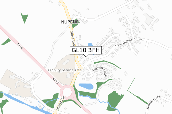
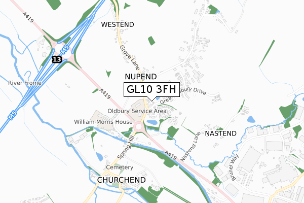
GL10 3FH is located in the Severn electoral ward, within the local authority district of Stroud and the English Parliamentary constituency of Stroud. The Sub Integrated Care Board (ICB) Location is NHS Gloucestershire ICB - 11M and the police force is Gloucestershire. This postcode has been in use since April 2020.


GetTheData
Source: OS Open Zoomstack (Ordnance Survey)
Licence: Open Government Licence (requires attribution)
Attribution: Contains OS data © Crown copyright and database right 2025
Source: Open Postcode Geo
Licence: Open Government Licence (requires attribution)
Attribution: Contains OS data © Crown copyright and database right 2025; Contains Royal Mail data © Royal Mail copyright and database right 2025; Source: Office for National Statistics licensed under the Open Government Licence v.3.0
| Easting | 378531 |
| Northing | 206471 |
| Latitude | 51.756516 |
| Longitude | -2.312435 |
GetTheData
Source: Open Postcode Geo
Licence: Open Government Licence
| Country | England |
| Postcode District | GL10 |
➜ See where GL10 is on a map ➜ Where is Stonehouse? | |
GetTheData
Source: Land Registry Price Paid Data
Licence: Open Government Licence
| Ward | Severn |
| Constituency | Stroud |
GetTheData
Source: ONS Postcode Database
Licence: Open Government Licence
5, CHARLES ALMOND CLOSE, GREAT OLDBURY, STONEHOUSE, GL10 3FH 2022 23 MAY £375,000 |
33, CHARLES ALMOND CLOSE, GREAT OLDBURY, STONEHOUSE, GL10 3FH 2021 17 DEC £380,000 |
34, CHARLES ALMOND CLOSE, GREAT OLDBURY, STONEHOUSE, GL10 3FH 2021 17 DEC £460,000 |
5, CHARLES ALMOND CLOSE, GREAT OLDBURY, STONEHOUSE, GL10 3FH 2021 7 MAY £325,000 |
14, CHARLES ALMOND CLOSE, GREAT OLDBURY, STONEHOUSE, GL10 3FH 2020 27 NOV £340,000 |
4, CHARLES ALMOND CLOSE, GREAT OLDBURY, STONEHOUSE, GL10 3FH 2020 30 OCT £325,000 |
3, CHARLES ALMOND CLOSE, GREAT OLDBURY, STONEHOUSE, GL10 3FH 2020 24 SEP £315,000 |
21, CHARLES ALMOND CLOSE, GREAT OLDBURY, STONEHOUSE, GL10 3FH 2020 10 AUG £340,000 |
20, CHARLES ALMOND CLOSE, GREAT OLDBURY, STONEHOUSE, GL10 3FH 2020 7 AUG £325,000 |
1, CHARLES ALMOND CLOSE, GREAT OLDBURY, STONEHOUSE, GL10 3FH 2020 30 JUN £333,000 |
GetTheData
Source: HM Land Registry Price Paid Data
Licence: Contains HM Land Registry data © Crown copyright and database right 2025. This data is licensed under the Open Government Licence v3.0.
| Nupend Turn | Westend | 177m |
| Nupend Turn | Westend | 184m |
| Pike Bridge (Spring Hill) | Eastington | 459m |
| Pike Bridge (Spring Hill) | Eastington | 479m |
| Farm | Westend | 558m |
| Stonehouse Station | 2.6km |
| Cam & Dursley Station | 5.4km |
GetTheData
Source: NaPTAN
Licence: Open Government Licence
GetTheData
Source: ONS Postcode Database
Licence: Open Government Licence


➜ Get more ratings from the Food Standards Agency
GetTheData
Source: Food Standards Agency
Licence: FSA terms & conditions
| Last Collection | |||
|---|---|---|---|
| Location | Mon-Fri | Sat | Distance |
| Nastnd | 17:00 | 08:00 | 594m |
| Churchend | 16:50 | 08:30 | 722m |
| Eastington Bridge | 16:50 | 09:50 | 1,147m |
GetTheData
Source: Dracos
Licence: Creative Commons Attribution-ShareAlike
The below table lists the International Territorial Level (ITL) codes (formerly Nomenclature of Territorial Units for Statistics (NUTS) codes) and Local Administrative Units (LAU) codes for GL10 3FH:
| ITL 1 Code | Name |
|---|---|
| TLK | South West (England) |
| ITL 2 Code | Name |
| TLK1 | Gloucestershire, Wiltshire and Bath/Bristol area |
| ITL 3 Code | Name |
| TLK13 | Gloucestershire CC |
| LAU 1 Code | Name |
| E07000082 | Stroud |
GetTheData
Source: ONS Postcode Directory
Licence: Open Government Licence
The below table lists the Census Output Area (OA), Lower Layer Super Output Area (LSOA), and Middle Layer Super Output Area (MSOA) for GL10 3FH:
| Code | Name | |
|---|---|---|
| OA | E00113745 | |
| LSOA | E01022376 | Stroud 003A |
| MSOA | E02004653 | Stroud 003 |
GetTheData
Source: ONS Postcode Directory
Licence: Open Government Licence
| GL10 3SJ | 287m | |
| GL10 3SQ | Chipmans Platt | 328m |
| GL10 3SN | Cressington Cottages | 484m |
| GL10 3SP | 489m | |
| GL10 3SL | 562m | |
| GL10 3RP | 581m | |
| GL10 3RR | 607m | |
| GL10 3SR | Dotloe Farm Cottages | 637m |
| GL10 3RX | Churchend | 655m |
| GL10 3SS | Post Office Row | 686m |
GetTheData
Source: Open Postcode Geo; Land Registry Price Paid Data
Licence: Open Government Licence