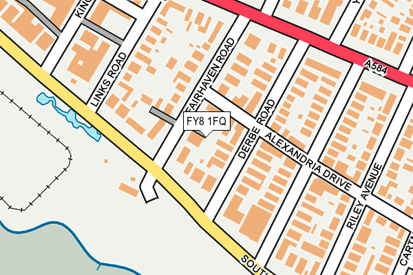
FY8 1FQ is located in the Carnegie electoral ward, within the local authority district of Fylde and the English Parliamentary constituency of Fylde. The Sub Integrated Care Board (ICB) Location is NHS Lancashire and South Cumbria ICB - 02M and the police force is Lancashire. This postcode has been in use since July 2017.


GetTheData
Source: OS OpenMap – Local (Ordnance Survey)
Source: OS VectorMap District (Ordnance Survey)
Licence: Open Government Licence (requires attribution)
| Easting | 332514 |
| Northing | 428144 |
| Latitude | 53.745298 |
| Longitude | -3.024767 |
GetTheData
Source: Open Postcode Geo
Licence: Open Government Licence
| Country | England |
| Postcode District | FY8 |
➜ See where FY8 is on a map ➜ Where is Lytham St Anne's? | |
GetTheData
Source: Land Registry Price Paid Data
Licence: Open Government Licence
| Ward | Carnegie |
| Constituency | Fylde |
GetTheData
Source: ONS Postcode Database
Licence: Open Government Licence
| Beach Terrace Cafe (South Promenade) | St Annes | 80m |
| Beach Terrace (South Promenade) | St Annes | 95m |
| Grand Hotel (South Promenade) | St Annes | 206m |
| St Thomas Church (Clifton Drive) | St Annes | 208m |
| York Road (Clifton Drive) | St Annes | 214m |
| St Annes-on-the-Sea Station | 0.9km |
| Ansdell & Fairhaven Station | 2.1km |
| Squires Gate Station | 3.9km |
GetTheData
Source: NaPTAN
Licence: Open Government Licence
| Median download speed | 20.0Mbps |
| Average download speed | 27.6Mbps |
| Maximum download speed | 39.99Mbps |
| Median upload speed | 1.2Mbps |
| Average upload speed | 4.8Mbps |
| Maximum upload speed | 10.00Mbps |
GetTheData
Source: Ofcom
Licence: Ofcom Terms of Use (requires attribution)
GetTheData
Source: ONS Postcode Database
Licence: Open Government Licence


➜ Get more ratings from the Food Standards Agency
GetTheData
Source: Food Standards Agency
Licence: FSA terms & conditions
| Last Collection | |||
|---|---|---|---|
| Location | Mon-Fri | Sat | Distance |
| 7 Alexandria Drive, St Annes | 17:00 | 12:45 | 58m |
| Osborne Road | 17:00 | 12:45 | 387m |
| St Andrews Road South | 17:00 | 11:45 | 434m |
GetTheData
Source: Dracos
Licence: Creative Commons Attribution-ShareAlike
The below table lists the International Territorial Level (ITL) codes (formerly Nomenclature of Territorial Units for Statistics (NUTS) codes) and Local Administrative Units (LAU) codes for FY8 1FQ:
| ITL 1 Code | Name |
|---|---|
| TLD | North West (England) |
| ITL 2 Code | Name |
| TLD4 | Lancashire |
| ITL 3 Code | Name |
| TLD45 | Mid Lancashire |
| LAU 1 Code | Name |
| E07000119 | Fylde |
GetTheData
Source: ONS Postcode Directory
Licence: Open Government Licence
The below table lists the Census Output Area (OA), Lower Layer Super Output Area (LSOA), and Middle Layer Super Output Area (MSOA) for FY8 1FQ:
| Code | Name | |
|---|---|---|
| OA | E00126862 | |
| LSOA | E01024996 | Fylde 006G |
| MSOA | E02005208 | Fylde 006 |
GetTheData
Source: ONS Postcode Directory
Licence: Open Government Licence
| FY8 1NL | Alexandria Drive | 50m |
| FY8 1NJ | Derbe Road | 51m |
| FY8 1WB | South Promenade | 60m |
| FY8 1NW | South Promenade | 67m |
| FY8 1WA | South Promenade | 70m |
| FY8 1NN | Fairhaven Road | 90m |
| FY8 1PD | Fairhaven Lane | 96m |
| FY8 1WD | South Promenade | 115m |
| FY8 1NQ | Links Road | 131m |
| FY8 1JF | Alexandria Drive | 132m |
GetTheData
Source: Open Postcode Geo; Land Registry Price Paid Data
Licence: Open Government Licence