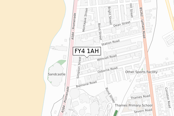
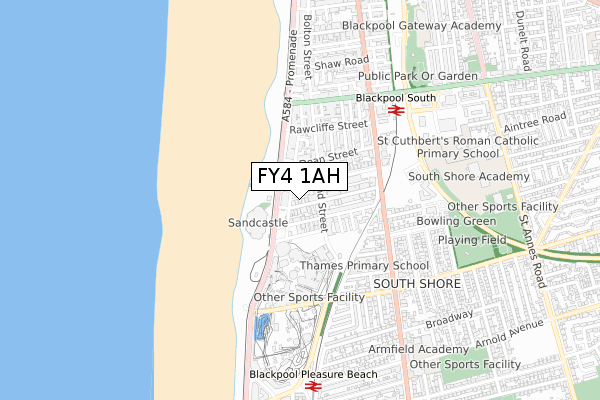
FY4 1AH is located in the Waterloo electoral ward, within the unitary authority of Blackpool and the English Parliamentary constituency of Blackpool South. The Sub Integrated Care Board (ICB) Location is NHS Lancashire and South Cumbria ICB - 00R and the police force is Lancashire. This postcode has been in use since June 2019.


GetTheData
Source: OS Open Zoomstack (Ordnance Survey)
Licence: Open Government Licence (requires attribution)
Attribution: Contains OS data © Crown copyright and database right 2025
Source: Open Postcode Geo
Licence: Open Government Licence (requires attribution)
Attribution: Contains OS data © Crown copyright and database right 2025; Contains Royal Mail data © Royal Mail copyright and database right 2025; Source: Office for National Statistics licensed under the Open Government Licence v.3.0
| Easting | 330609 |
| Northing | 433693 |
| Latitude | 53.794913 |
| Longitude | -3.054897 |
GetTheData
Source: Open Postcode Geo
Licence: Open Government Licence
| Country | England |
| Postcode District | FY4 |
➜ See where FY4 is on a map ➜ Where is Blackpool? | |
GetTheData
Source: Land Registry Price Paid Data
Licence: Open Government Licence
| Ward | Waterloo |
| Constituency | Blackpool South |
GetTheData
Source: ONS Postcode Database
Licence: Open Government Licence
| Pleasure Beach (Station Road) | Pleasure Beach | 49m |
| Withnell Road (Bond Street) | Pleasure Beach | 84m |
| South Pier (Station Road) | Pleasure Beach | 85m |
| South Pier (Promenade) | Pleasure Beach | 89m |
| Station Road (Bond Street) | Pleasure Beach | 135m |
| South Pier (Blackpool Tramway) (Promenade) | South Shore | 144m |
| Pleasure Beach (Blackpool Tramway) (Promenade) | South Shore | 207m |
| Waterloo Road (Blackpool Tramway) (Waterloo Road) | Bloomfield | 466m |
| St Chad's (Blackpool Tramway) (St Chads Road) | Bloomfield | 839m |
| Burlington Road West (Blackpool Tramway) (Burlington Road West) | South Shore | 880m |
| Blackpool South Station | 0.6km |
| Blackpool Pleasure Beach Station | 0.8km |
| Squires Gate Station | 2km |
GetTheData
Source: NaPTAN
Licence: Open Government Licence
| Percentage of properties with Next Generation Access | 100.0% |
| Percentage of properties with Superfast Broadband | 100.0% |
| Percentage of properties with Ultrafast Broadband | 0.0% |
| Percentage of properties with Full Fibre Broadband | 0.0% |
Superfast Broadband is between 30Mbps and 300Mbps
Ultrafast Broadband is > 300Mbps
| Percentage of properties unable to receive 2Mbps | 0.0% |
| Percentage of properties unable to receive 5Mbps | 0.0% |
| Percentage of properties unable to receive 10Mbps | 0.0% |
| Percentage of properties unable to receive 30Mbps | 0.0% |
GetTheData
Source: Ofcom
Licence: Ofcom Terms of Use (requires attribution)
GetTheData
Source: ONS Postcode Database
Licence: Open Government Licence


➜ Get more ratings from the Food Standards Agency
GetTheData
Source: Food Standards Agency
Licence: FSA terms & conditions
| Last Collection | |||
|---|---|---|---|
| Location | Mon-Fri | Sat | Distance |
| Withnell Road | 17:00 | 12:45 | 87m |
| Dean Street | 16:00 | 12:15 | 150m |
| Station Terrace | 16:00 | 12:45 | 341m |
GetTheData
Source: Dracos
Licence: Creative Commons Attribution-ShareAlike
The below table lists the International Territorial Level (ITL) codes (formerly Nomenclature of Territorial Units for Statistics (NUTS) codes) and Local Administrative Units (LAU) codes for FY4 1AH:
| ITL 1 Code | Name |
|---|---|
| TLD | North West (England) |
| ITL 2 Code | Name |
| TLD4 | Lancashire |
| ITL 3 Code | Name |
| TLD42 | Blackpool |
| LAU 1 Code | Name |
| E06000009 | Blackpool |
GetTheData
Source: ONS Postcode Directory
Licence: Open Government Licence
The below table lists the Census Output Area (OA), Lower Layer Super Output Area (LSOA), and Middle Layer Super Output Area (MSOA) for FY4 1AH:
| Code | Name | |
|---|---|---|
| OA | E00064314 | |
| LSOA | E01012751 | Blackpool 013D |
| MSOA | E02002645 | Blackpool 013 |
GetTheData
Source: ONS Postcode Directory
Licence: Open Government Licence
| FY4 1HF | Withnell Road | 9m |
| FY4 1HS | Simpson Street | 26m |
| FY4 1BA | Promenade | 50m |
| FY4 1HJ | Osborne Road | 73m |
| FY4 1BE | Station Road | 75m |
| FY4 1HG | Bond Street | 81m |
| FY4 1EY | Bond Street | 110m |
| FY4 1AZ | Promenade | 121m |
| FY4 1AU | Dean Street | 122m |
| FY4 1HR | Balmoral Road | 123m |
GetTheData
Source: Open Postcode Geo; Land Registry Price Paid Data
Licence: Open Government Licence