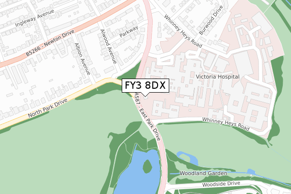
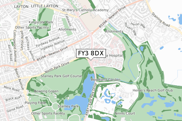
FY3 8DX is located in the Layton electoral ward, within the unitary authority of Blackpool and the English Parliamentary constituency of Blackpool North and Cleveleys. The Sub Integrated Care Board (ICB) Location is NHS Lancashire and South Cumbria ICB - 00R and the police force is Lancashire. This postcode has been in use since November 2017.


GetTheData
Source: OS Open Zoomstack (Ordnance Survey)
Licence: Open Government Licence (requires attribution)
Attribution: Contains OS data © Crown copyright and database right 2025
Source: Open Postcode Geo
Licence: Open Government Licence (requires attribution)
Attribution: Contains OS data © Crown copyright and database right 2025; Contains Royal Mail data © Royal Mail copyright and database right 2025; Source: Office for National Statistics licensed under the Open Government Licence v.3.0
| Easting | 333110 |
| Northing | 436448 |
| Latitude | 53.819999 |
| Longitude | -3.017534 |
GetTheData
Source: Open Postcode Geo
Licence: Open Government Licence
| Country | England |
| Postcode District | FY3 |
➜ See where FY3 is on a map ➜ Where is Blackpool? | |
GetTheData
Source: Land Registry Price Paid Data
Licence: Open Government Licence
| Ward | Layton |
| Constituency | Blackpool North And Cleveleys |
GetTheData
Source: ONS Postcode Database
Licence: Open Government Licence
| Victoria Hospital (To Blackpool) (Victoria Hospital) | Victoria Hospital | 150m |
| Victoria Hospital (To Poulton) (Victoria Hospital) | Victoria Hospital | 164m |
| Cardiac Centre (Whinney Heys Road) | Victoria Hospital | 169m |
| Cardiac Centre (Whinney Heys Lane) | Victoria Hospital | 249m |
| Regency Lodge (Whinney Heys Road) | St Walburgas | 322m |
| Layton (Lancs) Station | 1.9km |
| Blackpool North Station | 2.1km |
| Blackpool South Station | 3.1km |
GetTheData
Source: NaPTAN
Licence: Open Government Licence
| Percentage of properties with Next Generation Access | 100.0% |
| Percentage of properties with Superfast Broadband | 100.0% |
| Percentage of properties with Ultrafast Broadband | 0.0% |
| Percentage of properties with Full Fibre Broadband | 0.0% |
Superfast Broadband is between 30Mbps and 300Mbps
Ultrafast Broadband is > 300Mbps
| Percentage of properties unable to receive 2Mbps | 0.0% |
| Percentage of properties unable to receive 5Mbps | 0.0% |
| Percentage of properties unable to receive 10Mbps | 0.0% |
| Percentage of properties unable to receive 30Mbps | 0.0% |
GetTheData
Source: Ofcom
Licence: Ofcom Terms of Use (requires attribution)
GetTheData
Source: ONS Postcode Database
Licence: Open Government Licence


➜ Get more ratings from the Food Standards Agency
GetTheData
Source: Food Standards Agency
Licence: FSA terms & conditions
| Last Collection | |||
|---|---|---|---|
| Location | Mon-Fri | Sat | Distance |
| Lakeway | 17:00 | 11:45 | 320m |
| 35 Torsway Avenue | 17:30 | 11:30 | 599m |
| Milton Avenue | 16:45 | 13:00 | 648m |
GetTheData
Source: Dracos
Licence: Creative Commons Attribution-ShareAlike
The below table lists the International Territorial Level (ITL) codes (formerly Nomenclature of Territorial Units for Statistics (NUTS) codes) and Local Administrative Units (LAU) codes for FY3 8DX:
| ITL 1 Code | Name |
|---|---|
| TLD | North West (England) |
| ITL 2 Code | Name |
| TLD4 | Lancashire |
| ITL 3 Code | Name |
| TLD42 | Blackpool |
| LAU 1 Code | Name |
| E06000009 | Blackpool |
GetTheData
Source: ONS Postcode Directory
Licence: Open Government Licence
The below table lists the Census Output Area (OA), Lower Layer Super Output Area (LSOA), and Middle Layer Super Output Area (MSOA) for FY3 8DX:
| Code | Name | |
|---|---|---|
| OA | E00064146 | |
| LSOA | E01012722 | Blackpool 009F |
| MSOA | E02002641 | Blackpool 009 |
GetTheData
Source: ONS Postcode Directory
Licence: Open Government Licence
| FY3 8NE | North Park Drive | 194m |
| FY3 8NQ | North Park Drive | 215m |
| FY3 8NG | Alwood Avenue | 227m |
| FY3 8NF | Parkway | 244m |
| FY3 8NA | Albion Avenue | 251m |
| FY3 8NP | Whinney Heys Road | 279m |
| FY3 8ND | Newton Drive | 295m |
| FY3 8NH | North Park Drive | 333m |
| FY3 8NB | Newton Drive | 350m |
| FY3 8SB | Cottesmore Place | 354m |
GetTheData
Source: Open Postcode Geo; Land Registry Price Paid Data
Licence: Open Government Licence