Property/Postcode Data Search:
EX36 4FP maps, stats, and open data
EX36 4FP is located in the South Molton electoral ward, within the local authority district of North Devon and the English Parliamentary constituency of North Devon. The Sub Integrated Care Board (ICB) Location is NHS Devon ICB - 15N and the police force is Devon & Cornwall. This postcode has been in use since December 2019.
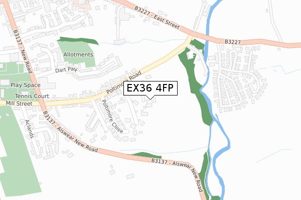
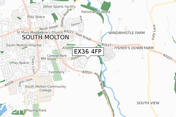
EX36 4FP maps


Source: OS Open Zoomstack (Ordnance Survey)
Licence: Open Government Licence (requires attribution)
Attribution: Contains OS data © Crown copyright and database right 2025
Source: Open Postcode Geo
Licence: Open Government Licence (requires attribution)
Attribution: Contains OS data © Crown copyright and database right 2025; Contains Royal Mail data © Royal Mail copyright and database right 2025; Source: Office for National Statistics licensed under the Open Government Licence v.3.0
Licence: Open Government Licence (requires attribution)
Attribution: Contains OS data © Crown copyright and database right 2025
Source: Open Postcode Geo
Licence: Open Government Licence (requires attribution)
Attribution: Contains OS data © Crown copyright and database right 2025; Contains Royal Mail data © Royal Mail copyright and database right 2025; Source: Office for National Statistics licensed under the Open Government Licence v.3.0
EX36 4FP geodata
| Easting | 272073 |
| Northing | 125599 |
| Latitude | 51.015493 |
| Longitude | -3.825124 |
Where is EX36 4FP?
| Country | England |
| Postcode District | EX36 |
Politics
| Ward | South Molton |
|---|---|
| Constituency | North Devon |
House Prices
Sales of detached houses in EX36 4FP
4, DUCKS FIELD, SOUTH MOLTON, EX36 4FP 2020 31 JAN £474,500 |
2019 23 DEC £485,000 |
3, DUCKS FIELD, SOUTH MOLTON, EX36 4FP 2019 23 DEC £470,000 |
Source: HM Land Registry Price Paid Data
Licence: Contains HM Land Registry data © Crown copyright and database right 2025. This data is licensed under the Open Government Licence v3.0.
Licence: Contains HM Land Registry data © Crown copyright and database right 2025. This data is licensed under the Open Government Licence v3.0.
Transport
Nearest bus stops to EX36 4FP
| Mill On The Mole (Poltimore Road) | South Molton | 171m |
| Mill On The Mole (East Street) | South Molton | 236m |
| Mill On The Mole (East Street) | South Molton | 242m |
| Sainsburys (New Road) | South Molton | 399m |
| Sainsburys (New Road) | South Molton | 399m |
Deprivation
68.4% of English postcodes are less deprived than EX36 4FP:Food Standards Agency
Three nearest food hygiene ratings to EX36 4FP (metres)
Baker George

Cattle Market
245m
Sainsbury's

Sainsburys
354m
Eastleigh Care Home

90-91 East Street
451m
➜ Get more ratings from the Food Standards Agency
Nearest post box to EX36 4FP
| Last Collection | |||
|---|---|---|---|
| Location | Mon-Fri | Sat | Distance |
| Poltimore Road | 17:30 | 12:15 | 371m |
| Exeter Road | 17:30 | 12:30 | 806m |
| Bishops Nympton Post Office | 16:00 | 10:00 | 4,195m |
EX36 4FP ITL and EX36 4FP LAU
The below table lists the International Territorial Level (ITL) codes (formerly Nomenclature of Territorial Units for Statistics (NUTS) codes) and Local Administrative Units (LAU) codes for EX36 4FP:
| ITL 1 Code | Name |
|---|---|
| TLK | South West (England) |
| ITL 2 Code | Name |
| TLK4 | Devon |
| ITL 3 Code | Name |
| TLK43 | Devon CC |
| LAU 1 Code | Name |
| E07000043 | North Devon |
EX36 4FP census areas
The below table lists the Census Output Area (OA), Lower Layer Super Output Area (LSOA), and Middle Layer Super Output Area (MSOA) for EX36 4FP:
| Code | Name | |
|---|---|---|
| OA | E00101968 | |
| LSOA | E01020135 | North Devon 013C |
| MSOA | E02004187 | North Devon 013 |
Nearest postcodes to EX36 4FP
| EX36 4DA | Poltimore Road | 136m |
| EX36 4DD | Poltimore Close | 138m |
| EX36 4SE | Spearfield Close | 151m |
| EX36 4DE | Poltimore Close | 168m |
| EX36 4DB | Oakhays | 211m |
| EX36 4BJ | Dart Park | 240m |
| EX36 4BB | New Road | 246m |
| EX36 4BA | Gwythers | 292m |
| EX36 4AZ | Gwythers | 304m |
| EX36 4AY | Fir Terrace | 310m |