Property/Postcode Data Search:
EX36 4FG maps, stats, and open data
EX36 4FG is located in the South Molton electoral ward, within the local authority district of North Devon and the English Parliamentary constituency of North Devon. The Sub Integrated Care Board (ICB) Location is NHS Devon ICB - 15N and the police force is Devon & Cornwall. This postcode has been in use since January 2018.
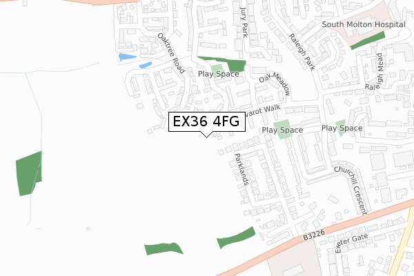
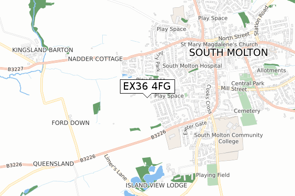
EX36 4FG maps


Source: OS Open Zoomstack (Ordnance Survey)
Licence: Open Government Licence (requires attribution)
Attribution: Contains OS data © Crown copyright and database right 2025
Source: Open Postcode Geo
Licence: Open Government Licence (requires attribution)
Attribution: Contains OS data © Crown copyright and database right 2025; Contains Royal Mail data © Royal Mail copyright and database right 2025; Source: Office for National Statistics licensed under the Open Government Licence v.3.0
Licence: Open Government Licence (requires attribution)
Attribution: Contains OS data © Crown copyright and database right 2025
Source: Open Postcode Geo
Licence: Open Government Licence (requires attribution)
Attribution: Contains OS data © Crown copyright and database right 2025; Contains Royal Mail data © Royal Mail copyright and database right 2025; Source: Office for National Statistics licensed under the Open Government Licence v.3.0
EX36 4FG geodata
| Easting | 270752 |
| Northing | 125486 |
| Latitude | 51.014182 |
| Longitude | -3.843905 |
Where is EX36 4FG?
| Country | England |
| Postcode District | EX36 |
Politics
| Ward | South Molton |
|---|---|
| Constituency | North Devon |
House Prices
Sales of detached houses in EX36 4FG
3, MOLFORD COURT, SOUTH MOLTON, EX36 4FG 2021 23 JUL £272,950 |
1, MOLFORD COURT, SOUTH MOLTON, EX36 4FG 2021 9 JUL £316,950 |
4, MOLFORD COURT, SOUTH MOLTON, EX36 4FG 2021 25 JUN £287,950 |
2, MOLFORD COURT, SOUTH MOLTON, EX36 4FG 2021 25 JUN £316,950 |
Source: HM Land Registry Price Paid Data
Licence: Contains HM Land Registry data © Crown copyright and database right 2025. This data is licensed under the Open Government Licence v3.0.
Licence: Contains HM Land Registry data © Crown copyright and database right 2025. This data is licensed under the Open Government Licence v3.0.
Transport
Nearest bus stops to EX36 4FG
| Parklands | South Molton | 249m |
| Churchill Crescent | South Molton | 318m |
| Churchill Crescent | South Molton | 328m |
| Raleigh Close (Raleigh Park) | South Molton | 334m |
| Raleigh Close | South Molton | 343m |
Deprivation
38% of English postcodes are less deprived than EX36 4FG:Food Standards Agency
Three nearest food hygiene ratings to EX36 4FG (metres)
Storm Promotions

8 Raleigh Close
382m
South Molton United Church Of England Primary School

Exeter Road
395m
Eastleigh Care Homes

Raleigh Mead
446m
➜ Get more ratings from the Food Standards Agency
Nearest post box to EX36 4FG
| Last Collection | |||
|---|---|---|---|
| Location | Mon-Fri | Sat | Distance |
| Exeter Road | 17:30 | 12:30 | 561m |
| Poltimore Road | 17:30 | 12:15 | 955m |
| Old Filliegh Post Office | 16:00 | 12:45 | 4,958m |
EX36 4FG ITL and EX36 4FG LAU
The below table lists the International Territorial Level (ITL) codes (formerly Nomenclature of Territorial Units for Statistics (NUTS) codes) and Local Administrative Units (LAU) codes for EX36 4FG:
| ITL 1 Code | Name |
|---|---|
| TLK | South West (England) |
| ITL 2 Code | Name |
| TLK4 | Devon |
| ITL 3 Code | Name |
| TLK43 | Devon CC |
| LAU 1 Code | Name |
| E07000043 | North Devon |
EX36 4FG census areas
The below table lists the Census Output Area (OA), Lower Layer Super Output Area (LSOA), and Middle Layer Super Output Area (MSOA) for EX36 4FG:
| Code | Name | |
|---|---|---|
| OA | E00101972 | |
| LSOA | E01020136 | North Devon 013D |
| MSOA | E02004187 | North Devon 013 |
Nearest postcodes to EX36 4FG
| EX36 4BS | Nadder Meadow | 144m |
| EX36 4EW | Parklands | 204m |
| EX36 4EF | Livarot Walk | 208m |
| EX36 4BR | Nadder Meadow | 240m |
| EX36 4EU | Parklands Close | 277m |
| EX36 4EL | Churchill Crescent | 317m |
| EX36 4DR | Raleigh Park | 324m |
| EX36 4DW | Jury Park | 327m |
| EX36 4ET | Churchill Crescent | 335m |
| EX36 4DT | Raleigh Park | 357m |