EX36 3FE maps, stats, and open data
EX36 3FE is located in the South Molton electoral ward, within the local authority district of North Devon and the English Parliamentary constituency of North Devon. The Sub Integrated Care Board (ICB) Location is NHS Devon ICB - 15N and the police force is Devon & Cornwall. This postcode has been in use since November 2018.
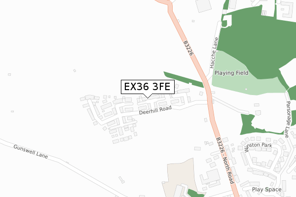
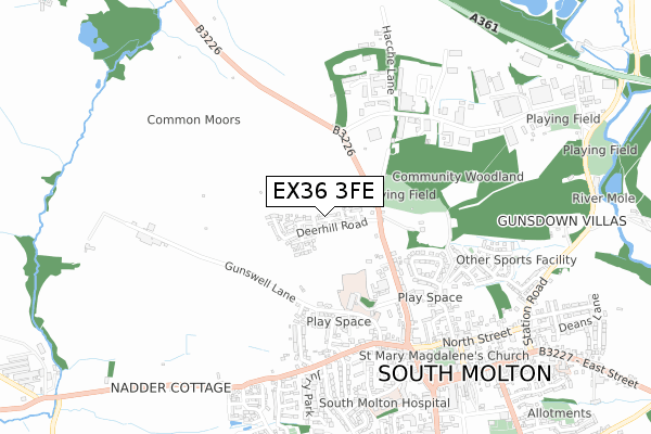
EX36 3FE maps


Licence: Open Government Licence (requires attribution)
Attribution: Contains OS data © Crown copyright and database right 2025
Source: Open Postcode Geo
Licence: Open Government Licence (requires attribution)
Attribution: Contains OS data © Crown copyright and database right 2025; Contains Royal Mail data © Royal Mail copyright and database right 2025; Source: Office for National Statistics licensed under the Open Government Licence v.3.0
EX36 3FE geodata
| Easting | 270935 |
| Northing | 126483 |
| Latitude | 51.023184 |
| Longitude | -3.841653 |
Where is EX36 3FE?
| Country | England |
| Postcode District | EX36 |
Politics
| Ward | South Molton |
|---|---|
| Constituency | North Devon |
House Prices
Sales of detached houses in EX36 3FE
2023 22 AUG £390,000 |
7, OBSERVER CLOSE, SOUTH MOLTON, EX36 3FE 2019 25 JAN £349,950 |
2019 11 JAN £309,950 |
1, OBSERVER CLOSE, SOUTH MOLTON, EX36 3FE 2018 19 DEC £349,950 |
3, OBSERVER CLOSE, SOUTH MOLTON, EX36 3FE 2018 14 DEC £299,950 |
4, OBSERVER CLOSE, SOUTH MOLTON, EX36 3FE 2018 10 DEC £349,950 |
5, OBSERVER CLOSE, SOUTH MOLTON, EX36 3FE 2018 19 NOV £359,950 |
6, OBSERVER CLOSE, SOUTH MOLTON, EX36 3FE 2018 16 NOV £349,950 |
Licence: Contains HM Land Registry data © Crown copyright and database right 2025. This data is licensed under the Open Government Licence v3.0.
Transport
Nearest bus stops to EX36 3FE
| Hacche Lane (North Road) | South Molton | 203m |
| Hacche Lane (North Road) | South Molton | 208m |
| Pathfields (B3226) | South Molton | 287m |
| Pathfields (B3226) | South Molton | 287m |
| Quince Honey Farm (North Road) | South Molton | 408m |
Broadband
Broadband access in EX36 3FE (2020 data)
| Percentage of properties with Next Generation Access | 100.0% |
| Percentage of properties with Superfast Broadband | 100.0% |
| Percentage of properties with Ultrafast Broadband | 100.0% |
| Percentage of properties with Full Fibre Broadband | 100.0% |
Superfast Broadband is between 30Mbps and 300Mbps
Ultrafast Broadband is > 300Mbps
Broadband limitations in EX36 3FE (2020 data)
| Percentage of properties unable to receive 2Mbps | 0.0% |
| Percentage of properties unable to receive 5Mbps | 0.0% |
| Percentage of properties unable to receive 10Mbps | 0.0% |
| Percentage of properties unable to receive 30Mbps | 0.0% |
Deprivation
38% of English postcodes are less deprived than EX36 3FE:Food Standards Agency
Three nearest food hygiene ratings to EX36 3FE (metres)


➜ Get more ratings from the Food Standards Agency
Nearest post box to EX36 3FE
| Last Collection | |||
|---|---|---|---|
| Location | Mon-Fri | Sat | Distance |
| Exeter Road | 17:30 | 12:30 | 1,173m |
| Poltimore Road | 17:30 | 12:15 | 1,189m |
| Old Filliegh Post Office | 16:00 | 12:45 | 4,708m |
EX36 3FE ITL and EX36 3FE LAU
The below table lists the International Territorial Level (ITL) codes (formerly Nomenclature of Territorial Units for Statistics (NUTS) codes) and Local Administrative Units (LAU) codes for EX36 3FE:
| ITL 1 Code | Name |
|---|---|
| TLK | South West (England) |
| ITL 2 Code | Name |
| TLK4 | Devon |
| ITL 3 Code | Name |
| TLK43 | Devon CC |
| LAU 1 Code | Name |
| E07000043 | North Devon |
EX36 3FE census areas
The below table lists the Census Output Area (OA), Lower Layer Super Output Area (LSOA), and Middle Layer Super Output Area (MSOA) for EX36 3FE:
| Code | Name | |
|---|---|---|
| OA | E00101962 | |
| LSOA | E01020136 | North Devon 013D |
| MSOA | E02004187 | North Devon 013 |
Nearest postcodes to EX36 3FE
| EX36 4DU | Gunswell Lane | 377m |
| EX36 3RA | North Road | 381m |
| EX36 4DH | Gunswell Lane | 410m |
| EX36 3AZ | North Road | 428m |
| EX36 3BG | Mole Ridge Way | 439m |
| EX36 3AY | Winston Park | 450m |
| EX36 4GJ | Kingdon Avenue | 459m |
| EX36 4HJ | West Park | 481m |
| EX36 3BE | Mole Ridge Way | 496m |
| EX36 4DQ | West Street | 507m |