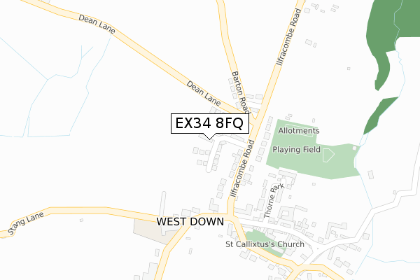
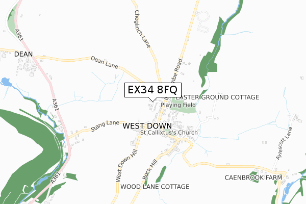
EX34 8FQ is located in the Mortehoe electoral ward, within the local authority district of North Devon and the English Parliamentary constituency of North Devon. The Sub Integrated Care Board (ICB) Location is NHS Devon ICB - 15N and the police force is Devon & Cornwall. This postcode has been in use since August 2019.


GetTheData
Source: OS Open Zoomstack (Ordnance Survey)
Licence: Open Government Licence (requires attribution)
Attribution: Contains OS data © Crown copyright and database right 2025
Source: Open Postcode Geo
Licence: Open Government Licence (requires attribution)
Attribution: Contains OS data © Crown copyright and database right 2025; Contains Royal Mail data © Royal Mail copyright and database right 2025; Source: Office for National Statistics licensed under the Open Government Licence v.3.0
| Easting | 251480 |
| Northing | 142257 |
| Latitude | 51.160231 |
| Longitude | -4.125355 |
GetTheData
Source: Open Postcode Geo
Licence: Open Government Licence
| Country | England |
| Postcode District | EX34 |
➜ See where EX34 is on a map ➜ Where is West Down? | |
GetTheData
Source: Land Registry Price Paid Data
Licence: Open Government Licence
| Ward | Mortehoe |
| Constituency | North Devon |
GetTheData
Source: ONS Postcode Database
Licence: Open Government Licence
11, LOWER BROAD PARK, WEST DOWN, ILFRACOMBE, EX34 8FQ 2024 19 NOV £485,000 |
18, LOWER BROAD PARK, WEST DOWN, ILFRACOMBE, EX34 8FQ 2021 12 MAR £299,950 |
11, LOWER BROAD PARK, WEST DOWN, ILFRACOMBE, EX34 8FQ 2021 22 JAN £425,000 |
12, LOWER BROAD PARK, WEST DOWN, ILFRACOMBE, EX34 8FQ 2020 11 DEC £415,000 |
9, LOWER BROAD PARK, WEST DOWN, ILFRACOMBE, EX34 8FQ 2020 30 OCT £465,000 |
2, LOWER BROAD PARK, WEST DOWN, ILFRACOMBE, EX34 8FQ 2020 19 OCT £430,000 |
8, LOWER BROAD PARK, WEST DOWN, ILFRACOMBE, EX34 8FQ 2020 15 OCT £450,000 |
10, LOWER BROAD PARK, WEST DOWN, ILFRACOMBE, EX34 8FQ 2020 1 SEP £375,000 |
3, LOWER BROAD PARK, WEST DOWN, ILFRACOMBE, EX34 8FQ 2020 19 AUG £450,000 |
2019 18 OCT £480,000 |
GetTheData
Source: HM Land Registry Price Paid Data
Licence: Contains HM Land Registry data © Crown copyright and database right 2025. This data is licensed under the Open Government Licence v3.0.
| The Square | West Down | 159m |
| The Square | West Down | 164m |
| Fox Hunters Inn (A361) | West Down | 744m |
| Fox Hunters Inn (A361) | West Down | 760m |
| Dean Lane (A361) | Dean Cross | 1,048m |
GetTheData
Source: NaPTAN
Licence: Open Government Licence
GetTheData
Source: ONS Postcode Database
Licence: Open Government Licence


➜ Get more ratings from the Food Standards Agency
GetTheData
Source: Food Standards Agency
Licence: FSA terms & conditions
| Last Collection | |||
|---|---|---|---|
| Location | Mon-Fri | Sat | Distance |
| Higher Slade | 16:45 | 11:00 | 3,478m |
| Tescos Store | 17:45 | 12:30 | 4,476m |
| Sterridge Valley | 15:45 | 09:30 | 5,304m |
GetTheData
Source: Dracos
Licence: Creative Commons Attribution-ShareAlike
The below table lists the International Territorial Level (ITL) codes (formerly Nomenclature of Territorial Units for Statistics (NUTS) codes) and Local Administrative Units (LAU) codes for EX34 8FQ:
| ITL 1 Code | Name |
|---|---|
| TLK | South West (England) |
| ITL 2 Code | Name |
| TLK4 | Devon |
| ITL 3 Code | Name |
| TLK43 | Devon CC |
| LAU 1 Code | Name |
| E07000043 | North Devon |
GetTheData
Source: ONS Postcode Directory
Licence: Open Government Licence
The below table lists the Census Output Area (OA), Lower Layer Super Output Area (LSOA), and Middle Layer Super Output Area (MSOA) for EX34 8FQ:
| Code | Name | |
|---|---|---|
| OA | E00101835 | |
| LSOA | E01020108 | North Devon 004B |
| MSOA | E02004178 | North Devon 004 |
GetTheData
Source: ONS Postcode Directory
Licence: Open Government Licence
| EX34 8NL | 98m | |
| EX34 8NF | 145m | |
| EX34 8NN | Barton Road | 150m |
| EX34 8LZ | West Down Hill | 151m |
| EX34 8NG | Thorne Park | 197m |
| EX34 8NQ | 231m | |
| EX34 8NH | 361m | |
| EX34 8NW | 1070m | |
| EX34 8NT | 1129m | |
| EX34 8NJ | 1243m |
GetTheData
Source: Open Postcode Geo; Land Registry Price Paid Data
Licence: Open Government Licence