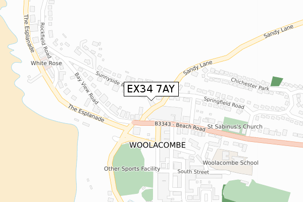
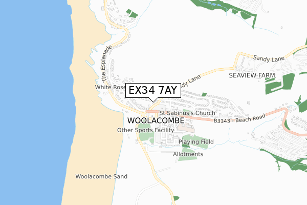
EX34 7AY is located in the Mortehoe electoral ward, within the local authority district of North Devon and the English Parliamentary constituency of North Devon. The Sub Integrated Care Board (ICB) Location is NHS Devon ICB - 15N and the police force is Devon & Cornwall. This postcode has been in use since November 2017.


GetTheData
Source: OS Open Zoomstack (Ordnance Survey)
Licence: Open Government Licence (requires attribution)
Attribution: Contains OS data © Crown copyright and database right 2025
Source: Open Postcode Geo
Licence: Open Government Licence (requires attribution)
Attribution: Contains OS data © Crown copyright and database right 2025; Contains Royal Mail data © Royal Mail copyright and database right 2025; Source: Office for National Statistics licensed under the Open Government Licence v.3.0
| Easting | 245862 |
| Northing | 143903 |
| Latitude | 51.173534 |
| Longitude | -4.206342 |
GetTheData
Source: Open Postcode Geo
Licence: Open Government Licence
| Country | England |
| Postcode District | EX34 |
➜ See where EX34 is on a map ➜ Where is Woolacombe? | |
GetTheData
Source: Land Registry Price Paid Data
Licence: Open Government Licence
| Ward | Mortehoe |
| Constituency | North Devon |
GetTheData
Source: ONS Postcode Database
Licence: Open Government Licence
| Sands (Barton Road) | Woolacombe | 138m |
| End Of Promenade (The Esplanade) | Woolacombe | 144m |
| Parish Church (Beach Road) | Woolacombe | 275m |
| Parish Church (Beach Road) | Woolacombe | 277m |
| Chichester House (The Esplanade) | Woolacombe | 523m |
GetTheData
Source: NaPTAN
Licence: Open Government Licence
| Percentage of properties with Next Generation Access | 100.0% |
| Percentage of properties with Superfast Broadband | 100.0% |
| Percentage of properties with Ultrafast Broadband | 0.0% |
| Percentage of properties with Full Fibre Broadband | 0.0% |
Superfast Broadband is between 30Mbps and 300Mbps
Ultrafast Broadband is > 300Mbps
| Median download speed | 23.5Mbps |
| Average download speed | 26.4Mbps |
| Maximum download speed | 40.00Mbps |
| Median upload speed | 1.3Mbps |
| Average upload speed | 3.0Mbps |
| Maximum upload speed | 10.00Mbps |
| Percentage of properties unable to receive 2Mbps | 0.0% |
| Percentage of properties unable to receive 5Mbps | 0.0% |
| Percentage of properties unable to receive 10Mbps | 0.0% |
| Percentage of properties unable to receive 30Mbps | 0.0% |
GetTheData
Source: Ofcom
Licence: Ofcom Terms of Use (requires attribution)
GetTheData
Source: ONS Postcode Database
Licence: Open Government Licence


➜ Get more ratings from the Food Standards Agency
GetTheData
Source: Food Standards Agency
Licence: FSA terms & conditions
| Last Collection | |||
|---|---|---|---|
| Location | Mon-Fri | Sat | Distance |
| Parade | 16:15 | 10:15 | 288m |
| Combesgate | 16:15 | 10:00 | 658m |
| Mortehoe Hotel | 16:15 | 10:00 | 973m |
GetTheData
Source: Dracos
Licence: Creative Commons Attribution-ShareAlike
The below table lists the International Territorial Level (ITL) codes (formerly Nomenclature of Territorial Units for Statistics (NUTS) codes) and Local Administrative Units (LAU) codes for EX34 7AY:
| ITL 1 Code | Name |
|---|---|
| TLK | South West (England) |
| ITL 2 Code | Name |
| TLK4 | Devon |
| ITL 3 Code | Name |
| TLK43 | Devon CC |
| LAU 1 Code | Name |
| E07000043 | North Devon |
GetTheData
Source: ONS Postcode Directory
Licence: Open Government Licence
The below table lists the Census Output Area (OA), Lower Layer Super Output Area (LSOA), and Middle Layer Super Output Area (MSOA) for EX34 7AY:
| Code | Name | |
|---|---|---|
| OA | E00101832 | |
| LSOA | E01020108 | North Devon 004B |
| MSOA | E02004178 | North Devon 004 |
GetTheData
Source: ONS Postcode Directory
Licence: Open Government Licence
| EX34 7BS | Beach Road | 84m |
| EX34 7BP | Beach Road | 109m |
| EX34 7DG | Sunnyside Road | 138m |
| EX34 7DQ | Bay View Road | 147m |
| EX34 7BW | West Road | 162m |
| EX34 7BA | Barton Road | 173m |
| EX34 7BX | Springfield Road | 179m |
| EX34 7BT | Beach Road | 209m |
| EX34 7BB | South Street | 253m |
| EX34 7BJ | Rosalie Terrace | 282m |
GetTheData
Source: Open Postcode Geo; Land Registry Price Paid Data
Licence: Open Government Licence