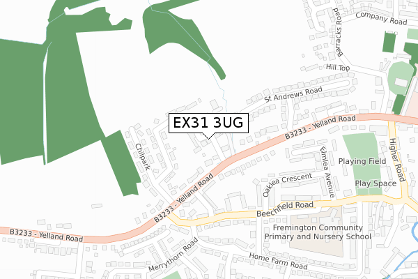
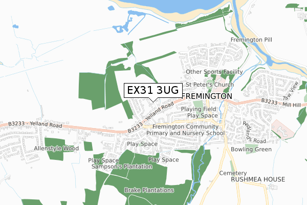
EX31 3UG is located in the Fremington electoral ward, within the local authority district of North Devon and the English Parliamentary constituency of North Devon. The Sub Integrated Care Board (ICB) Location is NHS Devon ICB - 15N and the police force is Devon & Cornwall. This postcode has been in use since August 2019.


GetTheData
Source: OS Open Zoomstack (Ordnance Survey)
Licence: Open Government Licence (requires attribution)
Attribution: Contains OS data © Crown copyright and database right 2025
Source: Open Postcode Geo
Licence: Open Government Licence (requires attribution)
Attribution: Contains OS data © Crown copyright and database right 2025; Contains Royal Mail data © Royal Mail copyright and database right 2025; Source: Office for National Statistics licensed under the Open Government Licence v.3.0
| Easting | 250728 |
| Northing | 132423 |
| Latitude | 51.071666 |
| Longitude | -4.132029 |
GetTheData
Source: Open Postcode Geo
Licence: Open Government Licence
| Country | England |
| Postcode District | EX31 |
➜ See where EX31 is on a map ➜ Where is Fremington? | |
GetTheData
Source: Land Registry Price Paid Data
Licence: Open Government Licence
| Ward | Fremington |
| Constituency | North Devon |
GetTheData
Source: ONS Postcode Database
Licence: Open Government Licence
2023 11 SEP £450,000 |
2023 29 MAR £415,000 |
2021 20 AUG £340,000 |
6, HORSESHOE CLOSE, FREMINGTON, BARNSTAPLE, EX31 3UG 2020 3 JUN £315,000 |
8, HORSESHOE CLOSE, FREMINGTON, BARNSTAPLE, EX31 3UG 2019 17 DEC £335,000 |
2019 8 NOV £312,000 |
2019 18 OCT £330,000 |
10, HORSESHOE CLOSE, FREMINGTON, BARNSTAPLE, EX31 3UG 2019 4 OCT £340,000 |
7, HORSESHOE CLOSE, FREMINGTON, BARNSTAPLE, EX31 3UG 2019 2 OCT £320,000 |
1, HORSESHOE CLOSE, FREMINGTON, BARNSTAPLE, EX31 3UG 2019 1 OCT £335,000 |
GetTheData
Source: HM Land Registry Price Paid Data
Licence: Contains HM Land Registry data © Crown copyright and database right 2025. This data is licensed under the Open Government Licence v3.0.
| Beechfield (B3233) | Fremington | 159m |
| Beechfield (B3233) | Fremington | 179m |
| Beechfield Road (Yelland Road) | Fremington | 207m |
| Beechfield Road (Yelland Road) | Fremington | 216m |
| Shops (Beechfield Road) | Fremington | 356m |
| Barnstaple Station | 4.8km |
GetTheData
Source: NaPTAN
Licence: Open Government Licence
GetTheData
Source: ONS Postcode Database
Licence: Open Government Licence


➜ Get more ratings from the Food Standards Agency
GetTheData
Source: Food Standards Agency
Licence: FSA terms & conditions
| Last Collection | |||
|---|---|---|---|
| Location | Mon-Fri | Sat | Distance |
| Taw View | 16:45 | 12:45 | 873m |
| Brynsworthy Park | 18:00 | 12:30 | 3,129m |
| Ashford Meadowside | 17:15 | 13:00 | 3,163m |
GetTheData
Source: Dracos
Licence: Creative Commons Attribution-ShareAlike
The below table lists the International Territorial Level (ITL) codes (formerly Nomenclature of Territorial Units for Statistics (NUTS) codes) and Local Administrative Units (LAU) codes for EX31 3UG:
| ITL 1 Code | Name |
|---|---|
| TLK | South West (England) |
| ITL 2 Code | Name |
| TLK4 | Devon |
| ITL 3 Code | Name |
| TLK43 | Devon CC |
| LAU 1 Code | Name |
| E07000043 | North Devon |
GetTheData
Source: ONS Postcode Directory
Licence: Open Government Licence
The below table lists the Census Output Area (OA), Lower Layer Super Output Area (LSOA), and Middle Layer Super Output Area (MSOA) for EX31 3UG:
| Code | Name | |
|---|---|---|
| OA | E00101812 | |
| LSOA | E01020105 | North Devon 011A |
| MSOA | E02004185 | North Devon 011 |
GetTheData
Source: ONS Postcode Directory
Licence: Open Government Licence
| EX31 3BU | Yelland Road | 44m |
| EX31 3BZ | Chilpark | 95m |
| EX31 3BR | The Green | 98m |
| EX31 3BX | Yelland Road | 130m |
| EX31 3DA | Thornlea Avenue | 132m |
| EX31 3DB | Beechfield Road | 171m |
| EX31 3BY | Chilpark | 177m |
| EX31 3BP | St Peters Road | 188m |
| EX31 3DE | Oaklea Crescent | 211m |
| EX31 3BS | St Andrews Road | 248m |
GetTheData
Source: Open Postcode Geo; Land Registry Price Paid Data
Licence: Open Government Licence