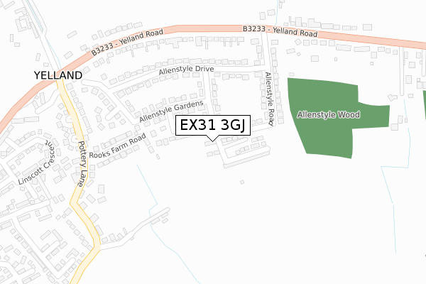
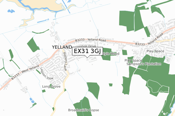
EX31 3GJ is located in the Fremington electoral ward, within the local authority district of North Devon and the English Parliamentary constituency of North Devon. The Sub Integrated Care Board (ICB) Location is NHS Devon ICB - 15N and the police force is Devon & Cornwall. This postcode has been in use since November 2017.


GetTheData
Source: OS Open Zoomstack (Ordnance Survey)
Licence: Open Government Licence (requires attribution)
Attribution: Contains OS data © Crown copyright and database right 2025
Source: Open Postcode Geo
Licence: Open Government Licence (requires attribution)
Attribution: Contains OS data © Crown copyright and database right 2025; Contains Royal Mail data © Royal Mail copyright and database right 2025; Source: Office for National Statistics licensed under the Open Government Licence v.3.0
| Easting | 249665 |
| Northing | 131987 |
| Latitude | 51.067471 |
| Longitude | -4.147009 |
GetTheData
Source: Open Postcode Geo
Licence: Open Government Licence
| Country | England |
| Postcode District | EX31 |
➜ See where EX31 is on a map ➜ Where is Yelland? | |
GetTheData
Source: Land Registry Price Paid Data
Licence: Open Government Licence
| Ward | Fremington |
| Constituency | North Devon |
GetTheData
Source: ONS Postcode Database
Licence: Open Government Licence
6, WALTER WAY, YELLAND, BARNSTAPLE, EX31 3GJ 2024 28 MAR £529,950 |
2022 5 JAN £302,500 |
2, WALTER WAY, YELLAND, BARNSTAPLE, EX31 3GJ 2020 7 JAN £290,000 |
12, WALTER WAY, YELLAND, BARNSTAPLE, EX31 3GJ 2019 22 NOV £313,750 |
2019 30 APR £299,000 |
13, WALTER WAY, YELLAND, BARNSTAPLE, EX31 3GJ 2017 12 DEC £330,000 |
GetTheData
Source: HM Land Registry Price Paid Data
Licence: Contains HM Land Registry data © Crown copyright and database right 2025. This data is licensed under the Open Government Licence v3.0.
| Post Office (Yelland Road) | Yelland | 287m |
| Post Office (Yelland Road) | Yelland | 288m |
| Allenstyle (B3233) | Yelland | 324m |
| Allenstyle (B3233) | Yelland | 334m |
| Pottery Lane (B3233) | Lower Yelland | 430m |
GetTheData
Source: NaPTAN
Licence: Open Government Licence
| Percentage of properties with Next Generation Access | 100.0% |
| Percentage of properties with Superfast Broadband | 100.0% |
| Percentage of properties with Ultrafast Broadband | 0.0% |
| Percentage of properties with Full Fibre Broadband | 0.0% |
Superfast Broadband is between 30Mbps and 300Mbps
Ultrafast Broadband is > 300Mbps
| Percentage of properties unable to receive 2Mbps | 0.0% |
| Percentage of properties unable to receive 5Mbps | 0.0% |
| Percentage of properties unable to receive 10Mbps | 0.0% |
| Percentage of properties unable to receive 30Mbps | 0.0% |
GetTheData
Source: Ofcom
Licence: Ofcom Terms of Use (requires attribution)
GetTheData
Source: ONS Postcode Database
Licence: Open Government Licence


➜ Get more ratings from the Food Standards Agency
GetTheData
Source: Food Standards Agency
Licence: FSA terms & conditions
| Last Collection | |||
|---|---|---|---|
| Location | Mon-Fri | Sat | Distance |
| Taw View | 16:45 | 12:45 | 2,021m |
| South Street | 17:15 | 10:00 | 4,035m |
| Brynsworthy Park | 18:00 | 12:30 | 4,184m |
GetTheData
Source: Dracos
Licence: Creative Commons Attribution-ShareAlike
The below table lists the International Territorial Level (ITL) codes (formerly Nomenclature of Territorial Units for Statistics (NUTS) codes) and Local Administrative Units (LAU) codes for EX31 3GJ:
| ITL 1 Code | Name |
|---|---|
| TLK | South West (England) |
| ITL 2 Code | Name |
| TLK4 | Devon |
| ITL 3 Code | Name |
| TLK43 | Devon CC |
| LAU 1 Code | Name |
| E07000043 | North Devon |
GetTheData
Source: ONS Postcode Directory
Licence: Open Government Licence
The below table lists the Census Output Area (OA), Lower Layer Super Output Area (LSOA), and Middle Layer Super Output Area (MSOA) for EX31 3GJ:
| Code | Name | |
|---|---|---|
| OA | E00101818 | |
| LSOA | E01020106 | North Devon 011B |
| MSOA | E02004185 | North Devon 011 |
GetTheData
Source: ONS Postcode Directory
Licence: Open Government Licence
| EX31 3EB | Allenstyle Close | 83m |
| EX31 3ED | Allenstyle Way | 95m |
| EX31 3EA | Allenstyle Gardens | 127m |
| EX31 3DY | Allenstyle Drive | 169m |
| EX31 3DX | Allenstyle Road | 172m |
| EX31 3EJ | Pottery Lane | 205m |
| EX31 3DZ | Allenstyle Drive | 207m |
| EX31 3EQ | Rooks Farm Road | 213m |
| EX31 3EE | Yelland Road | 263m |
| EX31 3DW | Allenstyle View | 270m |
GetTheData
Source: Open Postcode Geo; Land Registry Price Paid Data
Licence: Open Government Licence