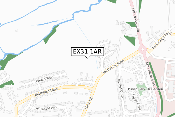
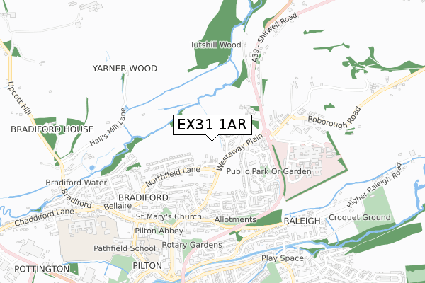
EX31 1AR is located in the Barnstaple with Pilton electoral ward, within the local authority district of North Devon and the English Parliamentary constituency of North Devon. The Sub Integrated Care Board (ICB) Location is NHS Devon ICB - 15N and the police force is Devon & Cornwall. This postcode has been in use since June 2019.


GetTheData
Source: OS Open Zoomstack (Ordnance Survey)
Licence: Open Government Licence (requires attribution)
Attribution: Contains OS data © Crown copyright and database right 2025
Source: Open Postcode Geo
Licence: Open Government Licence (requires attribution)
Attribution: Contains OS data © Crown copyright and database right 2025; Contains Royal Mail data © Royal Mail copyright and database right 2025; Source: Office for National Statistics licensed under the Open Government Licence v.3.0
| Easting | 255921 |
| Northing | 134624 |
| Latitude | 51.092774 |
| Longitude | -4.058836 |
GetTheData
Source: Open Postcode Geo
Licence: Open Government Licence
| Country | England |
| Postcode District | EX31 |
➜ See where EX31 is on a map ➜ Where is Barnstaple? | |
GetTheData
Source: Land Registry Price Paid Data
Licence: Open Government Licence
| Ward | Barnstaple With Pilton |
| Constituency | North Devon |
GetTheData
Source: ONS Postcode Database
Licence: Open Government Licence
2, RAMSOMS COURT, BARNSTAPLE, EX31 1AR 2021 17 DEC £525,000 |
3, RAMSOMS COURT, BARNSTAPLE, EX31 1AR 2021 16 DEC £475,000 |
1, RAMSOMS COURT, BARNSTAPLE, EX31 1AR 2021 21 OCT £410,000 |
5, RAMSOMS COURT, BARNSTAPLE, EX31 1AR 2021 14 OCT £385,000 |
4, RAMSOMS COURT, BARNSTAPLE, EX31 1AR 2021 23 SEP £390,000 |
GetTheData
Source: HM Land Registry Price Paid Data
Licence: Contains HM Land Registry data © Crown copyright and database right 2025. This data is licensed under the Open Government Licence v3.0.
| Youings Drive | Bradiford | 331m |
| Littabourne (Mear Top) | Bradiford | 345m |
| Northfield Park | Bradiford | 376m |
| Youings Drive Roundabout | Bradiford | 407m |
| North Devon District Hospital (North Road) | Barnstaple | 411m |
| Barnstaple Station | 2.1km |
GetTheData
Source: NaPTAN
Licence: Open Government Licence
GetTheData
Source: ONS Postcode Database
Licence: Open Government Licence


➜ Get more ratings from the Food Standards Agency
GetTheData
Source: Food Standards Agency
Licence: FSA terms & conditions
| Last Collection | |||
|---|---|---|---|
| Location | Mon-Fri | Sat | Distance |
| Barnstaple Hospital | 17:30 | 13:30 | 375m |
| Bellaire | 17:30 | 12:30 | 629m |
| Pilton Street Post Office | 17:30 | 12:30 | 686m |
GetTheData
Source: Dracos
Licence: Creative Commons Attribution-ShareAlike
The below table lists the International Territorial Level (ITL) codes (formerly Nomenclature of Territorial Units for Statistics (NUTS) codes) and Local Administrative Units (LAU) codes for EX31 1AR:
| ITL 1 Code | Name |
|---|---|
| TLK | South West (England) |
| ITL 2 Code | Name |
| TLK4 | Devon |
| ITL 3 Code | Name |
| TLK43 | Devon CC |
| LAU 1 Code | Name |
| E07000043 | North Devon |
GetTheData
Source: ONS Postcode Directory
Licence: Open Government Licence
The below table lists the Census Output Area (OA), Lower Layer Super Output Area (LSOA), and Middle Layer Super Output Area (MSOA) for EX31 1AR:
| Code | Name | |
|---|---|---|
| OA | E00101954 | |
| LSOA | E01020133 | North Devon 007B |
| MSOA | E02004181 | North Devon 007 |
GetTheData
Source: ONS Postcode Directory
Licence: Open Government Licence
| EX31 1QE | Northfield Lane | 213m |
| EX31 1QL | Youings Drive | 267m |
| EX31 1QG | Lynbro Road | 285m |
| EX31 1PX | Littabourne | 309m |
| EX31 1NY | Westaway Heights | 312m |
| EX31 1QF | Mannings Way | 315m |
| EX31 1PZ | Beech Grove | 344m |
| EX31 1QQ | Wordsworth Avenue | 345m |
| EX31 1NR | Westaway Heights | 354m |
| EX31 1TR | Barlow Road | 378m |
GetTheData
Source: Open Postcode Geo; Land Registry Price Paid Data
Licence: Open Government Licence