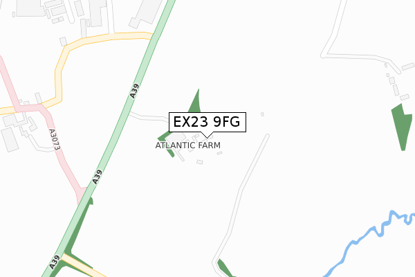
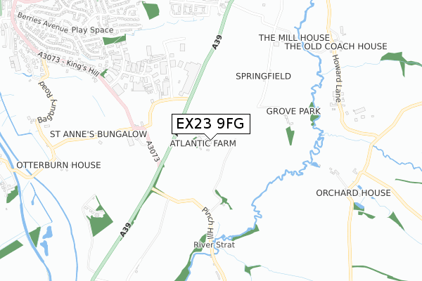
EX23 9FG is located in the Poundstock electoral ward, within the unitary authority of Cornwall and the English Parliamentary constituency of North Cornwall. The Sub Integrated Care Board (ICB) Location is NHS Cornwall and the Isles of Scilly ICB - 11N and the police force is Devon & Cornwall. This postcode has been in use since June 2018.


GetTheData
Source: OS Open Zoomstack (Ordnance Survey)
Licence: Open Government Licence (requires attribution)
Attribution: Contains OS data © Crown copyright and database right 2025
Source: Open Postcode Geo
Licence: Open Government Licence (requires attribution)
Attribution: Contains OS data © Crown copyright and database right 2025; Contains Royal Mail data © Royal Mail copyright and database right 2025; Source: Office for National Statistics licensed under the Open Government Licence v.3.0
| Easting | 222272 |
| Northing | 104991 |
| Latitude | 50.817117 |
| Longitude | -4.524421 |
GetTheData
Source: Open Postcode Geo
Licence: Open Government Licence
| Country | England |
| Postcode District | EX23 |
➜ See where EX23 is on a map | |
GetTheData
Source: Land Registry Price Paid Data
Licence: Open Government Licence
| Ward | Poundstock |
| Constituency | North Cornwall |
GetTheData
Source: ONS Postcode Database
Licence: Open Government Licence
| Stratton Business Park | Bude | 445m |
| Kings Hill Industrial Estate | Bude | 637m |
| Kings Hill Industrial Estate (Kings Hill) | Bude | 648m |
| Kings Hill (King's Hill) | Bude | 938m |
| Kings Hill | Bude | 943m |
GetTheData
Source: NaPTAN
Licence: Open Government Licence
| Percentage of properties with Next Generation Access | 100.0% |
| Percentage of properties with Superfast Broadband | 0.0% |
| Percentage of properties with Ultrafast Broadband | 0.0% |
| Percentage of properties with Full Fibre Broadband | 0.0% |
Superfast Broadband is between 30Mbps and 300Mbps
Ultrafast Broadband is > 300Mbps
| Percentage of properties unable to receive 2Mbps | 0.0% |
| Percentage of properties unable to receive 5Mbps | 0.0% |
| Percentage of properties unable to receive 10Mbps | 0.0% |
| Percentage of properties unable to receive 30Mbps | 100.0% |
GetTheData
Source: Ofcom
Licence: Ofcom Terms of Use (requires attribution)
GetTheData
Source: ONS Postcode Database
Licence: Open Government Licence


➜ Get more ratings from the Food Standards Agency
GetTheData
Source: Food Standards Agency
Licence: FSA terms & conditions
| Last Collection | |||
|---|---|---|---|
| Location | Mon-Fri | Sat | Distance |
| Berries Avenue | 16:15 | 12:00 | 1,176m |
| Marhamchurch Post Office | 15:45 | 11:15 | 1,314m |
| Hele Bridge | 12:45 | 12:45 | 1,510m |
GetTheData
Source: Dracos
Licence: Creative Commons Attribution-ShareAlike
The below table lists the International Territorial Level (ITL) codes (formerly Nomenclature of Territorial Units for Statistics (NUTS) codes) and Local Administrative Units (LAU) codes for EX23 9FG:
| ITL 1 Code | Name |
|---|---|
| TLK | South West (England) |
| ITL 2 Code | Name |
| TLK3 | Cornwall and Isles of Scilly |
| ITL 3 Code | Name |
| TLK30 | Cornwall and Isles of Scilly |
| LAU 1 Code | Name |
| E06000052 | Cornwall |
GetTheData
Source: ONS Postcode Directory
Licence: Open Government Licence
The below table lists the Census Output Area (OA), Lower Layer Super Output Area (LSOA), and Middle Layer Super Output Area (MSOA) for EX23 9FG:
| Code | Name | |
|---|---|---|
| OA | E00095744 | |
| LSOA | E01018960 | Cornwall 001E |
| MSOA | E02003931 | Cornwall 001 |
GetTheData
Source: ONS Postcode Directory
Licence: Open Government Licence
| EX23 9TG | 495m | |
| EX23 9TE | Howard Lane | 813m |
| EX23 0LT | St Annes Hill | 877m |
| EX23 8TS | Stapleton Road | 882m |
| EX23 8SB | Agnes Close | 890m |
| EX23 8FJ | Cormorant Close | 894m |
| EX23 9TD | 900m | |
| EX23 8EE | Shearwater Drive | 902m |
| EX23 8SA | Treleven Road | 914m |
| EX23 8DZ | Shorelark Way | 919m |
GetTheData
Source: Open Postcode Geo; Land Registry Price Paid Data
Licence: Open Government Licence